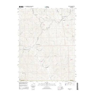
2015 Map of Briceland
USGS Topo · Published 2015About this map
Briceland serves as a central hub in this corner of southern Humboldt County, where the Mattole River begins its winding course toward the Pacific. The landscape is defined by the steep rises of Telegraph Ridge and Tank Ridge, illustrating the challenging geography that shaped early ranching and timber access. Moving south toward the county line at the Humboldt Co Mendocino Co border, the settlement of Whitethorn sits along the upper reaches of the river, connected to Thorn Junction by a network of winding mountain roads. Researchers can identify many family-named landmarks and historical property boundaries, such as Johnson Flat and Rose Peak, which reflect the localized history of land use in the Coast Range. Small drainages like Buck Gulch and Baker Creek carve deep into the terrain, while the Briceland Cemetery remains a significant site for genealogists tracing the legacy of these isolated communities.
Find a feature on this map
69 named features on this map. Tap any name to fly to it.
Don’t see what you’re looking for? This feature index may not catch every label — zoom into the map to look around manually.
Map Details
Editions of this 2015 Briceland Map
This is the sole edition of this map. No revisions or reprints were ever made.
Other maps of this area

1920 · Pt. Delagda
USGS Topo · 1:62,500

1921 · Briceland
USGS Topo · 1:62,500

1949 · Eureka
USGS Topo · 1:250,000

1949 · Point Delgada
USGS Topo · 1:62,500

1949 · Garberville
USGS Topo · 1:62,500

1950 · Piercy
USGS Topo · 1:62,500

1951 · Garberville
USGS Topo · 1:62,500

1951 · Point Delgada
USGS Topo · 1:62,500

1957 · Ukiah
USGS Topo · 1:250,000

1958 · Redding
USGS Topo · 1:250,000