
1958 Map of Redding
USGS Topo · Published 1958About this map
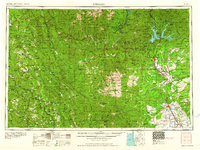
Redding and the upper Sacramento River valley serve as the focal point of this mid-century survey, a time of significant transition for Northern California water and power infrastructure. The map documents the recently completed Shasta Reservoir and Keswick Reservoir, alongside the newly formed Whiskeytown Reservoir and Lewiston Lake, which fundamentally altered the hydrologic landscape of the Trinity River and its tributaries. To the south, Red Bluff marks the transition from the fertile Central Valley floor to the surrounding highlands.
Find a feature on this map
194 named features on this map. Tap any name to fly to it.
Don’t see what you’re looking for? This feature index may not catch every label — zoom into the map to look around manually.
Map Details
Editions of this 1958 Redding Map
5 editions found
Other maps of this area

1886 · Lassen Peak
USGS Topo · 1:250,000

1886 · Modoc Lava Bed
USGS Topo · 1:250,000

1886 · Shasta
USGS Topo · 1:250,000

1890 · Red Bluff
USGS Topo · 1:250,000

1891 · Chico
USGS Topo · 1:125,000

1892 · Modoc Lava-Bed
USGS Topo · 1:250,000

1892 · Lassen Peak
USGS Topo · 1:250,000

1893 · Chico
USGS Topo · 1:125,000

1894 · Lassen Peak
USGS Topo · 1:250,000

1894 · Red Bluff
USGS Topo · 1:250,000