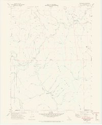
1969 Map of Briceland
USGS Topo · Published 1974About this map
The Mattole River headwaters and the rugged interior of southern Humboldt County define this late-1960s landscape. Small settlements like Briceland and Whitethorn anchor a terrain dominated by significant ridges and deep creek valleys. The presence of the Whitethorn Sch and the Thorn Fire Control Station suggests a remote but managed wilderness, while a single Gas Well near Briceland points to localized resource extraction. To the west, the boundary of the King Range National Conservation Area marks the edge of the coastal wilderness, separated from the interior by the high elevations of Telegraph Ridge. The map captures a moment when travel through these hills relied on routes like Shelter Cove Road and Briceland Rd, connecting isolated flats and junctions such as Johnson Flat and Thorn Junction.
Find a feature on this map
47 named features on this map. Tap any name to fly to it.
Don’t see what you’re looking for? This feature index may not catch every label — zoom into the map to look around manually.
Map Details
Editions of this 1969 Briceland Map
4 editions found
Other maps of this area

1920 · Pt. Delagda
USGS Topo · 1:62,500

1921 · Briceland
USGS Topo · 1:62,500

1949 · Eureka
USGS Topo · 1:250,000

1949 · Point Delgada
USGS Topo · 1:62,500

1949 · Garberville
USGS Topo · 1:62,500

1950 · Piercy
USGS Topo · 1:62,500

1951 · Garberville
USGS Topo · 1:62,500

1951 · Point Delgada
USGS Topo · 1:62,500

1957 · Ukiah
USGS Topo · 1:250,000

1958 · Redding
USGS Topo · 1:250,000