Old Maps of Big Pine, California for Hiking & Exploration
Hike through history with 14 historic maps of Big Pine. Explore old trails, ghost towns, and forgotten backroads — perfect for outdoor adventurers and local explorers.
- Rediscover forgotten places: Map out old mining camps, roads, and footpaths that no longer exist on modern maps.
- Layer with modern tools: Combine with LiDAR or satellite views to plan hikes through historical terrain.
- Made for exploration: Popular among hikers, overlanders, and local history lovers.
Use these maps to find adventure and explore the hidden past of Big Pine.
Big Pine, CA maps
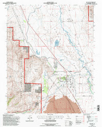
(14)- 1913 Map of Bishop
 1913 Bishop1913 Print · USGSThe Owens Valley was a landscape of high-altitude industry and burgeoning towns in the years before massive water diversions. Trace the path of the Southern Pacific Railroad through Laws and Big Pine, or locate family sites like Roberts Ranch and the Riverside School.8 unique versions available
 - 1947 Map of Mariposa, 1948 Print
 1947 Mariposa1948 Print · USGSThe High Sierra and Owens Valley transition is captured here in the late 1940s, just as the region’s hydroelectric and tourism infrastructure was maturing. Genealogists and historians can trace old ranger stations, the Casa Diablo Mine, and rail stops along the Southern Pacific like Benton Station and Zurich.2 unique versions available
 - 1948 Map of Mariposa, 1951 Print
 1948 Mariposa1951 Print · USGSThe High Sierra and Mariposa foothills are shown here in the late 1940s as the post-war tourism and water infrastructure expanded. Genealogists and historians can locate vanished waypoints like Mormon Bar, the Glacier Point Hotel, and the granite quarries of Knowles.
 - 1950 Map of Big Pine, 1952 Print
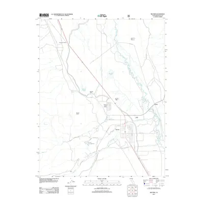
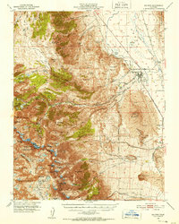 1950 Big Pine1952 Print · USGSBig Pine and the Owens Valley are captured here in the early fifties, showing the vital intersection of the Southern Pacific railroad and local irrigation. Researchers can trace the legacy of the Big Pine Rancheria, the County Farm, and the high-altitude route of the John Muir Trail.5 unique versions available
 - 1957 Map of Mariposa, 1966 Print
 1957 Mariposa1966 Print · USGSThe High Sierra and Owens Valley appear in the mid-fifties, showing the intersection of conservation, hydroelectric power, and mountain industry. Genealogists and researchers can trace local landmarks like Yosemite Cemetery, the remote Kinsley Station, and the Pine Creek Mine.4 unique versions available
 - 1958 Map of Big Pine, 1969 Print
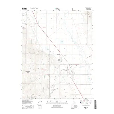
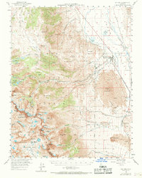 1958 Big Pine1969 Print · USGSBig Pine and the Owens Valley are shown here in the late fifties, where the railroad and river define the valley floor below the Sierra Nevada. Genealogists and historians can trace local landmarks like Zurich, the Owens Valley Ranch, and the early mountain retreat at Glacier Lodge.
 - 1963 Map of Mariposa
 1963 Mariposa1963 Print · USGSThe High Sierra and Owens Valley meet in the early sixties, showing a landscape defined by gold-rush history and massive post-war water projects. Genealogists and researchers can trace old mining routes near Mariposa, locate the Glacier Point Hotel, and find small settlements like Coarse Gold or Knowles Junction.
 - 1978 Map of Bishop, 1994 Print
 1978 Bishop1994 Print · USGSThe Owens Valley and Eastern Sierra come alive in this late seventies study, documenting a landscape shaped by mining and high-altitude water storage. Local researchers can trace family names and industry at Pine Creek Mine, Scheelite, and Lucky Strike Mine.2 unique versions available
 - 1984 Map of Big Pine
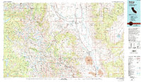
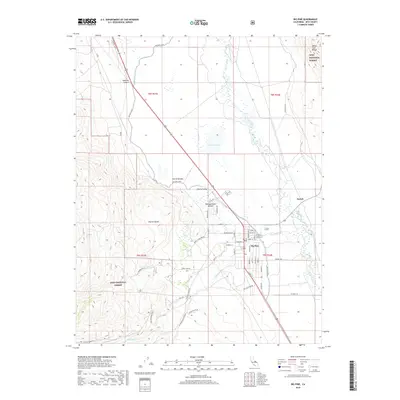
 1984 Big Pine1984 Print · USGSBig Pine and the surrounding Owens Valley appear in high detail during the early 1980s, showcasing a mix of scientific research and deep-rooted local infrastructure. Genealogists and historians can trace the layout of the Big Pine Indian Res, locate the local Cem, or identify the Owens Valley Radio Observatory Radio Telescopes.2 unique versions available
 - 1994 Map of Big Pine, 1997 Print
 1994 Big Pine1997 Print · USGSBig Pine and the surrounding Owens Valley appear in high detail during the 1990s as a hub of scientific research and Sierra Nevada gateway. Genealogists and historians can trace the bounds of the Big Pine Indian Reservation or locate family sites near Zurich and the Inyo Heights High Sch.
 - 2012 Map of Big Pine, 2012 Print
 2012 Big Pine2012 Print · USGSCovers Big Pine, including Inyo County, United States, and other nearby areas
 - 2015 Map of Big Pine, 2015 Print
 2015 Big Pine2015 Print · USGSCovers Big Pine, including Inyo County, United States, and other nearby areas
 - 2018 Map of Big Pine, 2018 Print
 2018 Big Pine2018 Print · USGSCovers Big Pine, including Inyo County, United States, and other nearby areas
 - 2021 Map of Big Pine, 2021 Print
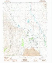
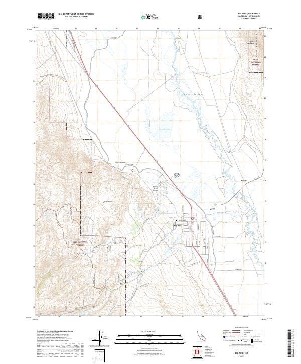 2021 Big Pine2021 Print · USGSThe Eastern Sierra settlement of Big Pine is documented here alongside the vital water infrastructure of the Owens Valley. Researchers can trace local history through Big Pine Cem, the small site of Zurich, and the complex network of the Big Pine Canal.
End of results
Showing maps 1-14 of 14
Top cities near Big Pine
- Bishop historical maps
- Dixon Lane–Meadow Creek historical maps
- West Bishop historical maps
- Wilkerson historical maps
Frequently asked questions
- What are the different types of historical maps available for Big Pine?
- What is the oldest map of Big Pine?
- Where can I purchase historical maps of Big Pine for my home or office?
- Where can I download high-res historical maps of Big Pine?
- Are there historical topographic maps available for Big Pine?
- Is there historical aerial imagery available for Big Pine?
- Where are historical maps of Big Pine sourced from?