1990s Maps of Lone Pine, California
Explore 2 historic maps of Lone Pine from the 1990s. These maps offer a rare glimpse into what life looked like during the 1990s — showing old roads, neighborhoods, homes, and landmarks that have changed or disappeared over time.
Whether you're researching your family's past, planning a metal detecting trip, or studying how Lone Pine's landscape evolved across the 1990s, these high-resolution maps are a powerful tool for exploring the history of this region.
- Focus on a specific era: All maps on this page are from the 1990s, giving you a focused view of this time period.
- See what’s changed: Compare century-old streets, trails, and buildings to today's modern landscape using overlays and satellite layers.
- Research with precision: Use these maps for genealogy, historical research, land use analysis, or educational projects.
- View, download, or print: Maps are fully viewable online in high resolution, and can be downloaded or printed for your own records.
Start exploring Lone Pine's history through authentic maps from the 1990s. This is your window into the past.
Lone Pine, CA maps
(2)- 1993 Map of Union Wash, 1995 Print
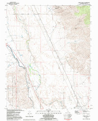 1993 Union Wash1995 Print · USGSThe Owens Valley in the early 1990s reflects a landscape defined by water engineering and mining history. Trace the Los Angeles Aqueduct and the Old Railroad Grade past Owenyo and the Reward Mine.
 - 1994 Map of Lone Pine, 1997 Print
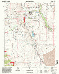 1994 Lone Pine1997 Print · USGSLone Pine in the mid-1990s stands at the intersection of Sierra Nevada recreation and the complex water history of the Owens Valley. Trace the lineage of the town through the Old Lone Pine Cem, the Lone Pine Indian Reservation, and the path of the Los Angeles Aqueduct.
End of results
Showing maps 1-2 of 2
Top cities near Lone Pine
Top neighborhoods of Lone Pine
Frequently asked questions
- What are the different types of historical maps available for Lone Pine?
- What is the oldest map of Lone Pine?
- Where can I purchase historical maps of Lone Pine for my home or office?
- Where can I download high-res historical maps of Lone Pine?
- Are there historical topographic maps available for Lone Pine?
- Is there historical aerial imagery available for Lone Pine?
- Where are historical maps of Lone Pine sourced from?