Old Maps of Shafter, California for Academic Research
Study the evolution of Shafter with 50 high-resolution historic maps. Whether you're teaching, researching, or modeling changes in land use, these maps provide essential visual documentation of urban, environmental, and geographic change.
- Analyze long-term change: Track patterns in development, transportation, and natural features.
- Ideal for environmental or urban studies: Support academic projects with primary historical map data.
- Use in the classroom or lab: Educators and researchers rely on these maps to bring historical context to life.
These maps are a powerful tool for teaching, research, and visualizing how Shafter has changed over the decades.
Shafter, CA maps
(50)- 1906 Map of Bakersfield
 1906 Bakersfield1906 Print · USGSIn the early 1900s, Bakersfield was the heart of a booming oil and rail network just as the landscape was being transformed. Genealogists and historians can trace early settlements like Oil Center and Jewetta or the industrial workings of the Fullers Earth Mine.5 unique versions available
 - 1910 Map of Buena Vista Lake, 1912 Print
 1910 Buena Vista Lake1912 Print · USGSThe southern San Joaquin Valley comes to life in the years before the great lakes were drained for agriculture. Genealogists and historians can trace early rail stops like Bowerbank and Hazelton or locate rural landmarks such as the Palm School and Moron Taft P O.
 - 1912 Map of Buena Vista Lake, 1921 Print
 1912 Buena Vista Lake1921 Print · USGSThe San Joaquin Valley at the height of its irrigation and oil boom is captured here, from the streets of Bakersfield to the shores of Buena Vista Lake. Genealogists and local historians can trace early schools like Old River School and the rail stops of the Sunset RR.4 unique versions available
 - 1930 Map of Wasco
 1930 Wasco1930 Print · USGSKern County farming and rail commerce are in full swing in the late 1920s. Genealogists can trace family footprints near Wasco, Shafter, and Hoover Ranch, or locate local landmarks like Maple Sch and the Seventh Day Adventist Ch.3 unique versions available
 - 1930 Map of Famoso
 1930 Famoso1930 Print · USGSThe San Joaquin Valley's agricultural heartland emerges here in the late Prohibition era, organized around vital irrigation and rail corridors. Researchers can trace the early paths of the Lerdo Canal and find small rail-side settlements like Famoso and Kimberlina.2 unique versions available
 - 1930 Map of Rosedale
 1930 Rosedale1930 Print · USGSRosedale and the surrounding Kern County landscape appear here in the early thirties as a thriving agricultural and rail-oriented community. Researchers can locate the White Church, Palm Sch, and transit points like Rosedale Sta or Una Siding.
 - 1930 Map of Oildale
 1930 Oildale1930 Print · USGSThe northern reaches of the Central Valley come alive in the early 1930s as petroleum and aviation take root. Researchers can trace the early layout of Oildale alongside the Kern County Airplane Landing Field and rural schools like Beardsley Sch.
 - 1931 Map of Rio Bravo
 1931 Rio Bravo1931 Print · USGSKern County was undergoing a period of significant growth in the early 1930s as irrigation and oil transformed the landscape. Researchers can trace the development of rural education and commerce at Rio Bravo Sch and the Rio Bravo Store, or follow the path of the Southern Pacific railroad.3 unique versions available
 - 1933 Map of Rosedale
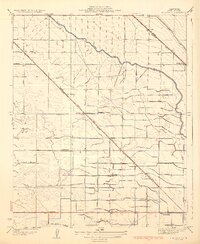 1933 Rosedale1933 Print · USGSKern County's irrigation and rail networks are in full view in this early 1930s survey of the Rosedale area. Genealogists can locate family-named landmarks and essential rural institutions like Palm Sch, the White Ch, and the stop at Una Siding.3 unique versions available
 - 1935 Map of Oildale
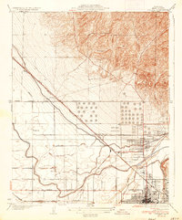 1935 Oildale1935 Print · USGSThe San Joaquin Valley landscape north of Bakersfield comes alive in this mid-1930s survey of oil fields and irrigation. Genealogists and historians can trace local life through Standard Sch, the growing streets of Oildale, and the early Kern County Landing Field.3 unique versions available
 - 1942 Map of Slater
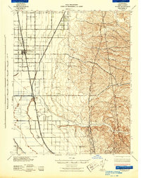 1942 Slater1942 Print · USGSKern County during the early war years shows an landscape of evolving rail towns and major irrigation works. Genealogists and historians can trace the early footprints of McFarland and Famoso, alongside family holdings like the Doyle Ranch and Kimberlina Ranch.
 - 1942 Map of Buttonwillow
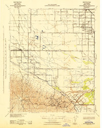 1942 Buttonwillow1942 Print · USGSKern County's agricultural and energy heartland is meticulously detailed in this wartime survey of the San Joaquin Valley. Researchers can trace family ranch boundaries like Woolner Ranch, locate the Rio Bravo Oil Field, and follow the Southern Pacific McKittrick Branch rail line.
 - 1942 Map of Bakersfield West, 1944 Print
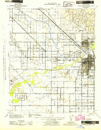 1942 Bakersfield West1944 Print · USGSBakersfield and the surrounding oil fields are shown here during the early war years, revealing a landscape defined by petroleum and irrigation. Genealogists can locate family holdings near Rosedale, Pumpkin Center, or early schoolhouses like Greeley Sch.
 - 1943 Map of Wasco
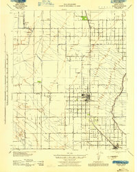 1943 Wasco1943 Print · USGSAgricultural and oil interests converge in 1940s Kern County as the irrigation network expands. Genealogists can trace family holdings like Goose Lake Ranch or local landmarks including Pondham Sch and the Wasco Oil Field.
 - 1948 Map of Bakersfield
 1948 Bakersfield1948 Print · USGSBakersfield and the southern San Joaquin Valley appear in the late 1940s, showing a landscape of burgeoning oil towns, rail junctions, and early irrigation canals. Genealogists and historians can trace the foundations of local industry through Gardner Field, the Sunset Railway, and the shores of Buena Vista Lake.2 unique versions available
 - 1950 Map of Rosedale
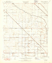 1950 Rosedale1950 Print · USGSThe Rosedale area of Kern County is shown during a period of significant agricultural expansion and rail development. Researchers can trace early irrigation networks like the Calloway Canal and locate vanished local landmarks such as Una Siding and Palm Sch.
 - 1950 Map of Famoso
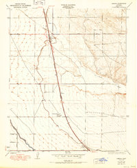 1950 Famoso1950 Print · USGSMid-century Kern County comes alive in this survey of the agricultural corridor north of Bakersfield. Researchers can trace the rail-and-road economy through stops like Famoso and Kimberlina or follow the vital irrigation paths of the Lerdo Canal.
 - 1953 Map of Famoso
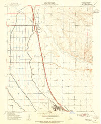 1953 Famoso1953 Print · USGSKern County agricultural and transit networks come into focus in the early fifties as irrigation canals and rail lines transformed the valley. Researchers can trace family-named landmarks like Doyle Ranch and early aviation sites including Famoso Airfield and Shafter Airport.3 unique versions available
 - 1953 Map of Wasco, 1954 Print
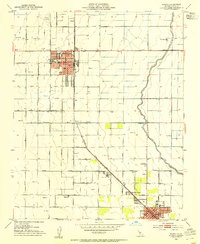 1953 Wasco1954 Print · USGSThe agricultural heart of Kern County comes into focus in the early fifties as Wasco and Shafter expand along the rail lines. Trace family roots and local history at Union High School, Myricks Corner, and the U S Agricultural Experiment Sta.3 unique versions available
 - 1954 Map of Rosedale, 1955 Print
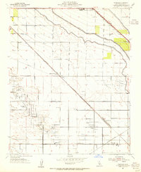 1954 Rosedale1955 Print · USGSKern County's oil and agricultural heartland is captured here in the mid-1950s during a period of industrial intensification. Researchers can trace the development of the Rosedale Oil Field alongside local landmarks like Shafter Cemetery and Greeley Sch.3 unique versions available
 - 1954 Map of Oildale, 1956 Print
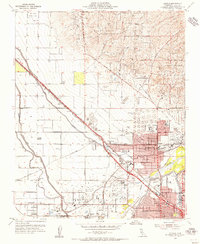 1954 Oildale1956 Print · USGSIn the mid-1950s, the landscape north of Bakersfield was a hive of industrial activity driven by the petroleum and rail sectors. Genealogists and local historians can trace the growth of Oildale and Fruitvale, finding specific landmarks like Norris School, Oil Junction, and the Kern River Oil Field.4 unique versions available
 - 1954 Map of Rio Bravo, 1957 Print
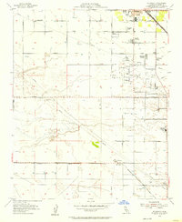 1954 Rio Bravo1957 Print · USGSCentral California's oil and agricultural landscape comes into focus in the mid-fifties, centered on the southern San Joaquin Valley. Trace early community sites like Mexican Colony and the Rio Bravo Oil Field alongside the Southern Pacific rail line.5 unique versions available
 - 1955 Map of Bakersfield
 1955 Bakersfield1955 Print · USGSThe southern San Joaquin Valley in the mid-fifties shows an era of massive oil production and industrial irrigation. Trace family roots in Allensworth, the oil fields of Oildale, or the shorelines of Tulare Lake and Buena Vista Lake.
 - 1956 Map of Bakersfield
 1956 Bakersfield1956 Print · USGSThe southern San Joaquin Valley and High Sierra come alive in the mid-fifties, showing the region's complex agricultural and rail networks. Genealogists and historians can trace family roots in towns like Bakersfield, Taft, and Delano, or locate early infrastructure along the Sunset Railway.
 - 1960 Map of Bakersfield
 1960 Bakersfield1960 Print · USGSThe Southern San Joaquin Valley at mid-century reveals a complex landscape of petroleum development and massive irrigation projects. Researchers can trace the rail lines of the Southern Pacific, explore oil-era landmarks like Oil City, and locate early settlements including Allensworth and Pixley.2 unique versions available
Showing maps 1-25 of 50
Top cities near Shafter
- Bakersfield historical maps
- Wasco historical maps
- McFarland historical maps
- Buttonwillow historical maps
Top neighborhoods of Shafter
- Minter Village historical maps
- Hights Corner historical maps
- North Shafter historical maps
- Myricks Corner historical maps
Frequently asked questions
- What are the different types of historical maps available for Shafter?
- What is the oldest map of Shafter?
- Where can I purchase historical maps of Shafter for my home or office?
- Where can I download high-res historical maps of Shafter?
- Are there historical topographic maps available for Shafter?
- Is there historical aerial imagery available for Shafter?
- Where are historical maps of Shafter sourced from?