2020s Maps of Stallion Springs, California
Explore 3 historic maps of Stallion Springs from the 2020s. These maps offer a rare glimpse into what life looked like during the 2020s — showing old roads, neighborhoods, homes, and landmarks that have changed or disappeared over time.
Whether you're researching your family's past, planning a metal detecting trip, or studying how Stallion Springs's landscape evolved across the 2020s, these high-resolution maps are a powerful tool for exploring the history of this region.
- Focus on a specific era: All maps on this page are from the 2020s, giving you a focused view of this time period.
- See what’s changed: Compare century-old streets, trails, and buildings to today's modern landscape using overlays and satellite layers.
- Research with precision: Use these maps for genealogy, historical research, land use analysis, or educational projects.
- View, download, or print: Maps are fully viewable online in high resolution, and can be downloaded or printed for your own records.
Start exploring Stallion Springs's history through authentic maps from the 2020s. This is your window into the past.
Stallion Springs, CA maps
(3)- 2021 Map of Tejon Ranch, 2021 Print
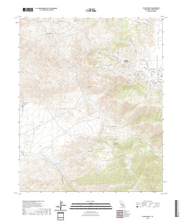 2021 Tejon Ranch2021 Print · USGSThe foothills of the Tehachapi Mountains meet the Cummings Valley in this 2021 study of the modern ranch landscape. Researchers can trace the development of Stallion Springs and find vital water sources like Havali Spring or Rosemarr Spring.
 - 2021 Map of Bear Mountain, 2021 Print
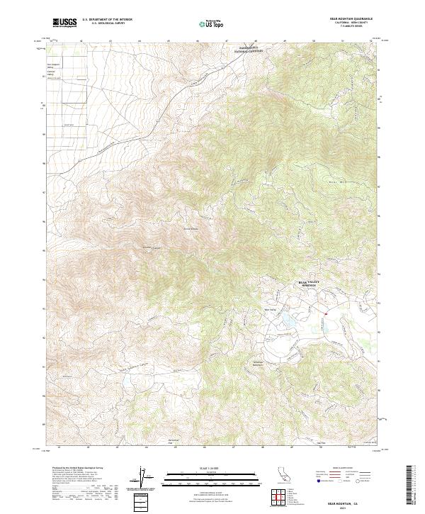 2021 Bear Mountain2021 Print · USGSKern County in the early twenty-first century reveals a striking transition from valley floors to high mountain basins. Trace the modern development of Bear Valley Springs alongside local landmarks like Bear Mtn and Horsethief Flat.
 - 2021 Map of Cummings Mountain, 2021 Print
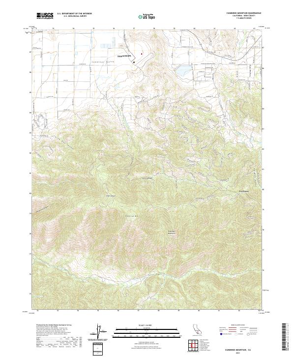 2021 Cummings Mountain2021 Print · USGSThe Tehachapi Mountains and the southern residential fringes of Tehachapi are captured here during a period of modern expansion into the foothills. Researchers can trace the path of Tejon Creek and Brite Creek or locate landmarks like Stag Spring and Cummings Mountain.
End of results
Showing maps 1-3 of 3
Top cities near Stallion Springs
- Bakersfield historical maps
- Arvin historical maps
- Tehachapi historical maps
- Golden Hills historical maps
- Keene historical maps
Frequently asked questions
- What are the different types of historical maps available for Stallion Springs?
- What is the oldest map of Stallion Springs?
- Where can I purchase historical maps of Stallion Springs for my home or office?
- Where can I download high-res historical maps of Stallion Springs?
- Are there historical topographic maps available for Stallion Springs?
- Is there historical aerial imagery available for Stallion Springs?
- Where are historical maps of Stallion Springs sourced from?