1930s Maps of Andrade Corner, California
Explore 2 historic maps of Andrade Corner from the 1930s. These maps offer a rare glimpse into what life looked like during the 1930s — showing old roads, neighborhoods, homes, and landmarks that have changed or disappeared over time.
Whether you're researching your family's past, planning a metal detecting trip, or studying how Andrade Corner's landscape evolved across the 1930s, these high-resolution maps are a powerful tool for exploring the history of this region.
- Focus on a specific era: All maps on this page are from the 1930s, giving you a focused view of this time period.
- See what’s changed: Compare century-old streets, trails, and buildings to today's modern landscape using overlays and satellite layers.
- Research with precision: Use these maps for genealogy, historical research, land use analysis, or educational projects.
- View, download, or print: Maps are fully viewable online in high resolution, and can be downloaded or printed for your own records.
Start exploring Andrade Corner's history through authentic maps from the 1930s. This is your window into the past.
Andrade Corner, CA maps
(2)- 1932 Map of Lake
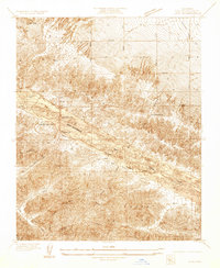 1932 Lake1932 Print · USGSHigh-desert ranching and mountain canyons meet along the San Andreas fault line in the early 1930s. Researchers can trace the geological footprint of the San Andreas Rift Zone and locate rural landmarks like Elizabeth Lake Sch, Talamantes, and Sheas Lodge.
 - 1937 Map of Lake
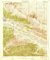 1937 Lake1937 Print · USGSLos Angeles County's High Desert and the San Andreas Fault area appear here in the early thirties as a landscape of isolated ranches and mountain passes. Researchers can trace historic routes and homesteads like Elizabeth Lake Ranch, Talamantes, and the early Elizabeth Lake Sch.3 unique versions available
End of results
Showing maps 1-2 of 2
Top cities near Andrade Corner
- Santa Clarita historical maps
- Palmdale historical maps
- Lancaster historical maps
- Rosamond historical maps
- Antelope Acres historical maps
Frequently asked questions
- What are the different types of historical maps available for Andrade Corner?
- What is the oldest map of Andrade Corner?
- Where can I purchase historical maps of Andrade Corner for my home or office?
- Where can I download high-res historical maps of Andrade Corner?
- Are there historical topographic maps available for Andrade Corner?
- Is there historical aerial imagery available for Andrade Corner?
- Where are historical maps of Andrade Corner sourced from?