2020s Maps of Castaic, California
Explore 4 historic maps of Castaic from the 2020s. These maps offer a rare glimpse into what life looked like during the 2020s — showing old roads, neighborhoods, homes, and landmarks that have changed or disappeared over time.
Whether you're researching your family's past, planning a metal detecting trip, or studying how Castaic's landscape evolved across the 2020s, these high-resolution maps are a powerful tool for exploring the history of this region.
- Focus on a specific era: All maps on this page are from the 2020s, giving you a focused view of this time period.
- See what’s changed: Compare century-old streets, trails, and buildings to today's modern landscape using overlays and satellite layers.
- Research with precision: Use these maps for genealogy, historical research, land use analysis, or educational projects.
- View, download, or print: Maps are fully viewable online in high resolution, and can be downloaded or printed for your own records.
Start exploring Castaic's history through authentic maps from the 2020s. This is your window into the past.
Castaic, CA maps
(4)- 2021 Map of Val Verde, 2021 Print
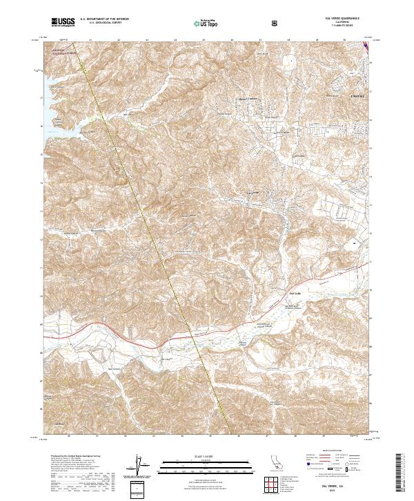 2021 Val Verde2021 Print · USGSThe canyonlands of the Los Angeles-Ventura border are captured here in a moment of modern residential expansion into the hills. Researchers can trace the interface between the Angeles National Forest and settlements like Val Verde, Del Valle, and Castaic.
 - 2022 Map of Newhall, 2022 Print
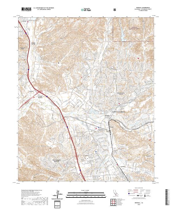 2022 Newhall2022 Print · USGSSanta Clarita and the Santa Clara River valley appear in this recent survey during a period of significant suburban development. Researchers can trace the modern layout of Stevenson Ranch and Valencia or locate landmarks like the California Institute of the Arts.
 - 2022 Map of Whitaker Peak, 2022 Print
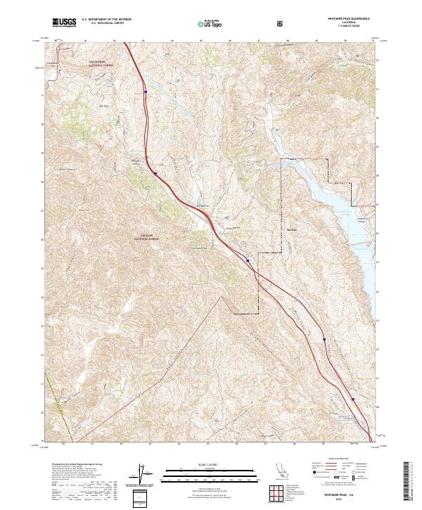 2022 Whitaker Peak2022 Print · USGSThe northern Los Angeles County mountains are shown here at the start of the 2020s, dominated by the massive infrastructure of the California Aqueduct. Genealogists and hikers can trace the historic Ridge Route Rd and remote sites like Oak Flats or the Gillette Mine Trl.
 - 2022 Map of Warm Springs Mountain, 2022 Print
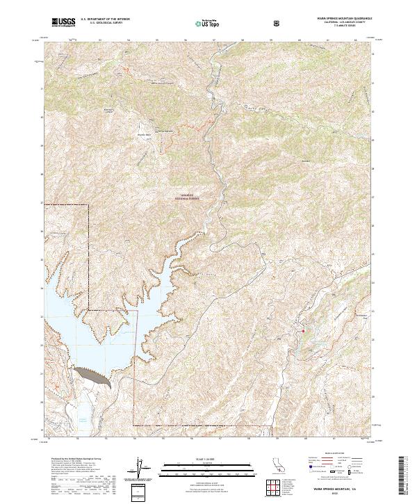 2022 Warm Springs Mountain2022 Print · USGSThe Angeles National Forest and the northern reaches of Castaic Lake are shown here in the 2020s. Trace water infrastructure and remote trails like the Los Angeles Aqueduct, Warm Springs Mtn, and Drinkwater Flat.
End of results
Showing maps 1-4 of 4
Top cities near Castaic
- Los Angeles historical maps
- Santa Clarita historical maps
- Simi Valley historical maps
- Moorpark historical maps
- San Fernando historical maps
- Val Verde historical maps
Top neighborhoods of Castaic
Frequently asked questions
- What are the different types of historical maps available for Castaic?
- What is the oldest map of Castaic?
- Where can I purchase historical maps of Castaic for my home or office?
- Where can I download high-res historical maps of Castaic?
- Are there historical topographic maps available for Castaic?
- Is there historical aerial imagery available for Castaic?
- Where are historical maps of Castaic sourced from?