Old Maps of Cedar Springs, California
Explore 21 old maps of Cedar Springs, spanning from 1901 to today. These high-resolution historic maps reveal how streets, neighborhoods, landmarks, and natural features evolved over time — perfect for genealogy, metal detecting, research, and local history exploration.
What you can do with these maps:
- See how Cedar Springs changed over time: Compare historical maps to modern-day views to trace roads, homesites, rail lines & more.
- View detailed metadata: Each map includes creators, publishers, year, scale, and archive source.
- Overlay maps with satellite & LiDAR: Visualize the past alongside modern tools to explore terrain & human change.
- Trusted historical sources: Maps sourced from the USGS, Library of Congress, and other archives.
- Access maps your way: View online, download high-res files, or order prints for personal or research use.
Start exploring old maps of Cedar Springs to uncover forgotten places, hidden landmarks, and the deep history beneath your feet.
Cedar Springs, CA maps
(21)- 1901 Map of Southern California Sheet No. 1
 1901 Southern California Sheet No. 11901 Print · USGSGreater Los Angeles at the dawn of the twentieth century is a landscape of growing citrus towns and a burgeoning rail network. Genealogists and historians can trace the early gridded streets of Hollywood and Pasadena or locate landmarks like Bear Lake and the Cahuilla Indian Reservation.6 unique versions available
 - 1903 Map of Rock Creek
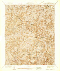
 1903 Rock Creek1903 Print · USGSThe high San Gabriel peaks and the edge of the Mojave come alive in this turn-of-the-century survey. Researchers can trace early mountain resorts and outposts like Squirrel Inn and Big Rock Villa or the geological wonder of the Devils Punchbowl.6 unique versions available
 - 1904 Map of Southern California Sheet No. 1, 1905 Print
 1904 Southern California Sheet No. 11905 Print · USGSSouthern California at the dawn of the twentieth century shows a landscape of citrus groves and coastal towns connected by rail. Genealogists and historians can trace early settlements like San Juan Capistrano, find remote sites like the Rose Mine, and study the original water systems of the Santa Ana River.2 unique versions available
 - 1936 Map of Crystal Lake
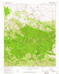
 1936 Crystal Lake1936 Print · USGSThe San Gabriel Mountains come into focus in the mid-1930s, showing the early recreational developments of Los Angeles County. Researchers can trace historic mountain sites like Wawona Lodge, the YMCA Hut, and the Crystal Lake Guard Station near the shoreline of Crystal Lake.
 - 1940 Map of Rock Creek, 1955 Print
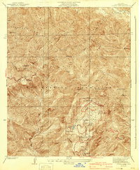
 1940 Rock Creek1955 Print · USGSHigh desert settlements and steep mountain peaks meet in this mid-century look at the eastern San Gabriel range. Researchers can trace the path of the Andreas Rift Zone and locate early ranch sites like Saunders Ranch and the community of Valyermo.
 - 1941 Map of Crystal Lake
 1941 Crystal Lake1941 Print · USGSThe high San Gabriel Mountains are captured here in the early 1940s, just as mountain recreation was becoming formalized in the national forest. Researchers can trace early resort and camp footprints at Wawona Lodge and the Crystal Lake Camp Area, or locate remote landmarks like the YMCA Hut.4 unique versions available
 - 1953 Map of San Bernardino
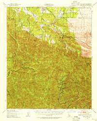
 1953 San Bernardino1953 Print · USGSSouthern California underwent massive post-war growth as suburban sprawl reached the foothills of the San Bernardino Mountains. Genealogists and historians can trace the rail-and-road roots of the Inland Empire through the Union Pacific RR and Lake Arrowhead resorts.2 unique versions available
 - 1956 Map of San Bernardino
 1956 San Bernardino1956 Print · USGSSouthern California's Inland Empire and High Desert come into focus in the mid-fifties as agriculture gives way to suburban and military growth. Trace early rail lines like the Pacific Electric or find remote landmarks like Camp Rock Mine and George AFB.
 - 1957 Map of San Bernardino
 1957 San Bernardino1957 Print · USGSSouthern California's Inland Empire and High Desert met during the postwar expansion of the late fifties. Genealogists and historians can trace the growth of San Bernardino and Redlands alongside remote landmarks like Edwards AFB and the Camp Rock Mine.
 - 1958 Map of San Bernardino, 1975 Print
 1958 San Bernardino1975 Print · USGSSouthern California’s Inland Empire and High Desert come into focus during the mid-century boom, showing the rise of suburbs and massive military installations. Researchers can trace the rail networks of the Union Pacific RR or locate landmarks like Norton AFB and Big Bear Lake.
 - 1959 Map of San Bernardino
 1959 San Bernardino1959 Print · USGSSouthern California underwent a massive transformation in the late fifties as suburban growth and military power reshaped the desert and valley. Researchers can trace the legacy of the Union Pacific Railroad and locate early footprints of Joshua Tree National Monument and Edwards Air Force Base.
 - 1959 Map of Waterman Mtn, 1960 Print
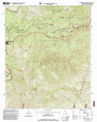
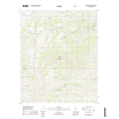
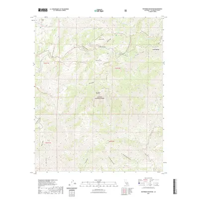
 1959 Waterman Mtn1960 Print · USGSThe San Gabriel Mountains in the late 1950s were a hub for high-altitude recreation and summer camps. Genealogists and hikers can trace the footprints of Pasadena Camp, the Buckhorn Guard Sta, and the historic Burkhart Trail before the region's further modernization.4 unique versions available
 - 1959 Map of Valyermo, 1961 Print
 1959 Valyermo1961 Print · USGSThe northern slopes of the San Gabriel Mountains meet the desert's edge during a period of expanding mountain recreation in the late fifties. Researchers can trace historic ranch boundaries at McFarland Ranch, locate high-country retreats like Louies Cabin, and explore the development of the Juniper Hills community.2 unique versions available
 - 1966 Map of San Bernardino
 1966 San Bernardino1966 Print · USGSThe San Bernardino Valley and Mojave Desert met during a period of massive military and suburban growth in the mid-sixties. Genealogists and historians can trace the development of Edwards Air Force Base, old desert mines like the Bagdad Chase Mine, and mountain communities near Big Bear Lake.
 - 1982 Map of San Bernardino, 1983 Print
 1982 San Bernardino1983 Print · USGSThe Inland Empire and San Gabriel Valley met at a peak of suburban and industrial expansion in the early eighties. Researchers can trace the massive rail infrastructure through Cajon Pass and locate landmarks like Norton Air Force Base or the Fontana International Raceway.
 - 1995 Map of Waterman Mountain, 1999 Print
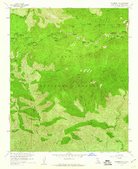
 1995 Waterman Mountain1999 Print · USGSThe high San Gabriel Mountains in the 1990s are revealed here through a network of alpine trails and seasonal camps. Genealogists and hikers can trace the Pacific Crest National Scenic Trail and locate recreation sites like Camp Valcrest or the Mt Waterman Ski Area.
 - 2012 Map of Waterman Mountain, 2012 Print
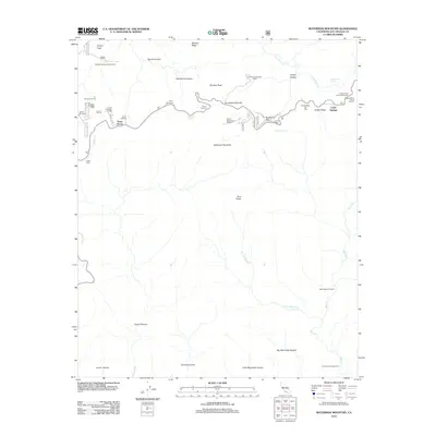 2012 Waterman Mountain2012 Print · USGSCovers Cedar Springs, including Los Angeles County, United States, and other nearby areas
 - 2015 Map of Waterman Mountain, 2015 Print
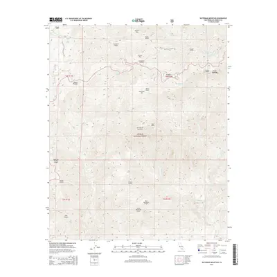 2015 Waterman Mountain2015 Print · USGSCovers Cedar Springs, including Los Angeles County, United States, and other nearby areas
 - 2018 Map of Waterman Mountain, 2018 Print
 2018 Waterman Mountain2018 Print · USGSCovers Cedar Springs, including Los Angeles County, United States, and other nearby areas
 - 2021 Map of Waterman Mountain, 2021 Print
 2021 Waterman Mountain2021 Print · USGSCovers Cedar Springs, including Los Angeles County, United States, and other nearby areas
 - 2023 Map of Waterman Mountain, 2023 Print
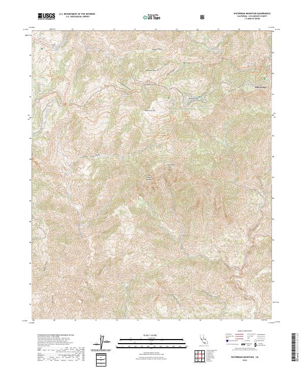 2023 Waterman Mountain2023 Print · USGSThe high San Gabriel Mountains are documented here in 2023, showcasing a landscape of protected wilderness and significant trail networks. Hikers and historians can trace the paths of the Pacific Crest National Scenic Trl past landmarks like Winston Peak and Buckhorn Flat.
End of results
Showing maps 1-21 of 21
Top cities near Cedar Springs
- Palmdale historical maps
- Pasadena historical maps
- Upland historical maps
- Arcadia historical maps
- Glendora historical maps
- Azusa historical maps
See more
Frequently asked questions
- What are the different types of historical maps available for Cedar Springs?
- What is the oldest map of Cedar Springs?
- Where can I purchase historical maps of Cedar Springs for my home or office?
- Where can I download high-res historical maps of Cedar Springs?
- Are there historical topographic maps available for Cedar Springs?
- Is there historical aerial imagery available for Cedar Springs?
- Where are historical maps of Cedar Springs sourced from?