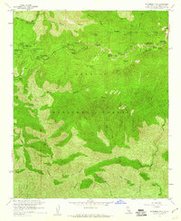
1959 Map of Waterman Mtn
USGS Topo · Published 1960About this map
The high peaks and deep canyons of the Angeles National Forest are captured here in the late 1950s, centered on the prominent Waterman Mtn and Twin Peaks. This era was characterized by a dense network of organized youth and recreational camps situated along the Angeles Crest Highway, including Camp Valcrest, Pasadena Camp, and Camp Christian. The map illustrates a landscape managed for both public leisure and mountain safety, evidenced by features like the Buckhorn Guard Sta and the Conservation Camp 37 near Kratka Ridge.
Find a feature on this map
50 named features on this map. Tap any name to fly to it.
Don’t see what you’re looking for? This feature index may not catch every label — zoom into the map to look around manually.
Map Details
Editions of this 1959 Waterman Mtn Map
4 editions found
Other maps of this area

1894 · Los Angeles
USGS Topo · 1:62,500

1894 · Pomona
USGS Topo · 1:62,500

1896 · Pasadena
USGS Topo · 1:62,500

1897 · Pomona
USGS Topo · 1:62,500

1898 · Pomona
USGS Topo · 1:62,500

1900 · Pasadena
USGS Topo · 1:62,500

1900 · Tujunga
USGS Topo · 1:62,500

1900 · Los Angeles
USGS Topo · 1:62,500

1901 · Southern California Sheet No. 1
USGS Topo · 1:250,000

1903 · Rock Creek
USGS Topo · 1:62,500