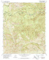
1959 Map of Waterman Mtn
USGS Topo · Published 1987About this map
Angeles Crest Highway winds through this high-elevation landscape, serving as the primary corridor for a dense concentration of recreational and youth camps established by the late 1950s. The map reveals a specialized alpine community including Camp Pasadena, Camp Singing Pines, and Camp Valcrest, many of which were built near the road's crest for summer retreat and winter access. To the south, the terrain falls away into the deep drainage of Devils Canyon and the headwaters of the West Fork San Gabriel River, showcasing a landscape defined by dramatic elevation changes between Waterman Mtn and the isolated Louies Cabin. Resource management infrastructure is evident through the Buckhorn Guard Sta and Conservation Camp 37, highlighting the Forest Service's active oversight of the Angeles National Forest during this era of mid-century expansion.
Find a feature on this map
48 named features on this map. Tap any name to fly to it.
Don’t see what you’re looking for? This feature index may not catch every label — zoom into the map to look around manually.
Map Details
Editions of this 1959 Waterman Mtn Map
4 editions found
Other maps of this area

1894 · Los Angeles
USGS Topo · 1:62,500

1894 · Pomona
USGS Topo · 1:62,500

1896 · Pasadena
USGS Topo · 1:62,500

1897 · Pomona
USGS Topo · 1:62,500

1898 · Pomona
USGS Topo · 1:62,500

1900 · Pasadena
USGS Topo · 1:62,500

1900 · Tujunga
USGS Topo · 1:62,500

1900 · Los Angeles
USGS Topo · 1:62,500

1901 · Southern California Sheet No. 1
USGS Topo · 1:250,000

1903 · Rock Creek
USGS Topo · 1:62,500