1930s Maps of Juniper Hills, California
Explore 3 historic maps of Juniper Hills from the 1930s. These maps offer a rare glimpse into what life looked like during the 1930s — showing old roads, neighborhoods, homes, and landmarks that have changed or disappeared over time.
Whether you're researching your family's past, planning a metal detecting trip, or studying how Juniper Hills's landscape evolved across the 1930s, these high-resolution maps are a powerful tool for exploring the history of this region.
- Focus on a specific era: All maps on this page are from the 1930s, giving you a focused view of this time period.
- See what’s changed: Compare century-old streets, trails, and buildings to today's modern landscape using overlays and satellite layers.
- Research with precision: Use these maps for genealogy, historical research, land use analysis, or educational projects.
- View, download, or print: Maps are fully viewable online in high resolution, and can be downloaded or printed for your own records.
Start exploring Juniper Hills's history through authentic maps from the 1930s. This is your window into the past.
Juniper Hills, CA maps
(3)- 1934 Map of Cima Mesa
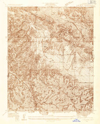 1934 Cima Mesa1934 Print · USGSLos Angeles County's high desert terrain is captured here in the mid-1930s, showing the early infrastructure of the Antelope Valley foothills. Researchers can trace the path of the San Andreas Fault Zone and early transit routes like Fort Tejon Road.
 - 1938 Map of Cima Mesa
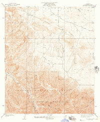 1938 Cima Mesa1938 Print · USGSHigh-desert ranching meets the San Andreas Fault in the late 1930s, documenting a landscape of water wells and mountain ridges. Trace early property at Saunders Ranch and the historical route of the Fort Tejon Road near Cima Mesa.
 - 1939 Map of Cima Mesa
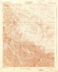 1939 Cima Mesa1939 Print · USGSThe northern edge of the San Gabriel Mountains meets the Antelope Valley in the mid-1930s. Genealogists and historians can locate family landmarks like Saunders Ranch and Stanton Ranch or trace the path of the San Andreas Rift Zone.2 unique versions available
End of results
Showing maps 1-3 of 3
Top cities near Juniper Hills
- Los Angeles historical maps
- Palmdale historical maps
- Lancaster historical maps
- Pasadena historical maps
Frequently asked questions
- What are the different types of historical maps available for Juniper Hills?
- What is the oldest map of Juniper Hills?
- Where can I purchase historical maps of Juniper Hills for my home or office?
- Where can I download high-res historical maps of Juniper Hills?
- Are there historical topographic maps available for Juniper Hills?
- Is there historical aerial imagery available for Juniper Hills?
- Where are historical maps of Juniper Hills sourced from?