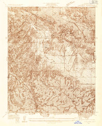
1934 Map of Cima Mesa
USGS Topo · Published 1934About this map
The San Andreas Fault Zone cuts dramatically across the northern landscape of this 1934 topographic survey, revealing the striking geologic foundations of the High Desert. This advance sheet, produced under County Surveyor Alfred Jones, captures the high-elevation terrain of Cima Mesa before modern development altered the rural character of northern Los Angeles County. The drainage patterns of Pallett Creek and Little Rock Creek dominate the southern half of the sheet, while early transportation routes like Fort Tejon Road and Pallett Creek Road provide evidence of the area's connectivity during the mid-1930s. Isolated infrastructure, including several scattered wells and springs, points to the critical importance of water management in this arid environment.
Find a feature on this map
8 named features on this map. Tap any name to fly to it.
Don’t see what you’re looking for? This feature index may not catch every label — zoom into the map to look around manually.
Map Details
Editions of this 1934 Cima Mesa Map
This is the sole edition of this map. No revisions or reprints were ever made.
Other maps of this area

1900 · Tujunga
USGS Topo · 1:62,500

1901 · Southern California Sheet No. 1
USGS Topo · 1:250,000

1903 · Rock Creek
USGS Topo · 1:62,500

1904 · Southern California Sheet No. 1
USGS Topo · 1:250,000

1915 · Elizabeth Lake
USGS Topo · 1:125,000

1917 · Elizabeth Lake
USGS Topo · 1:125,000

1930 · Little Rock
USGS Topo · 1:24,000

1930 · Llano
USGS Topo · 1:24,000

1930 · Pearland
USGS Topo · 1:24,000

1934 · Pearland
USGS Topo · 1:24,000