Old Maps of Lancaster, California for Academic Research
Study the evolution of Lancaster with 74 high-resolution historic maps. Whether you're teaching, researching, or modeling changes in land use, these maps provide essential visual documentation of urban, environmental, and geographic change.
- Analyze long-term change: Track patterns in development, transportation, and natural features.
- Ideal for environmental or urban studies: Support academic projects with primary historical map data.
- Use in the classroom or lab: Educators and researchers rely on these maps to bring historical context to life.
These maps are a powerful tool for teaching, research, and visualizing how Lancaster has changed over the decades.
Lancaster, CA maps
(74)- 1915 Map of Elizabeth Lake
 1915 Elizabeth Lake1915 Print · USGSAntelope Valley and the northern reaches of the San Gabriel mountains were transforming in the early twentieth century as major water and rail projects arrived. Genealogists can trace family homesteads such as St Anthony Ranch, old desert outposts like Willow Springs, and early mining sites including the Gray Eagle Mine.2 unique versions available
 - 1917 Map of Elizabeth Lake
 1917 Elizabeth Lake1917 Print · USGSThe western Antelope Valley and Sierra Pelona appear here during a period of rapid hydraulic and rail expansion. Researchers can trace the original path of the Los Angeles Aqueduct and locate early landmarks like Willow Springs and the Antelope Valley Pumping Sta.6 unique versions available
 - 1930 Map of Oban
 1930 Oban1930 Print · USGSAntelope Valley was a landscape of remote rail sidings and scattered wells during the early 1930s. Genealogists and local historians can trace the early layout of Lancaster, the location of the Lancaster Airport, and the Southern Pacific rail corridor.
 - 1930 Map of Roosevelt School
 1930 Roosevelt School1930 Print · USGSAntelope Valley was a landscape of emerging rural homesteads and early water development during the 1930s. Genealogists and historians can trace family-named landmarks like Peavey Road and Hahn Road or locate the community center at Roosevelt School.
 - 1930 Map of Lancaster
 1930 Lancaster1930 Print · USGSAntelope Valley during the early 1930s shows the emerging township of Lancaster as it grew along the railroad. Researchers can trace early infrastructure like the Lancaster Tubercular Rest Home and the rural footprint of Antelope Valley High Sch.
 - 1930 Map of West Alpine Butte
 1930 West Alpine Butte1930 Print · USGSHigh Desert settlement takes shape in northern Los Angeles County during the early thirties, defined by a rigid township grid. Trace early desert infrastructure along Wilsona Road and Sheldon Road, and locate vital water sources marked as Well near the base of Alpine Butte.
 - 1930 Map of Tierra Bonita, 1933 Print
 1930 Tierra Bonita1933 Print · USGSThe high desert of northern Los Angeles County appears here in the early 1930s, just as the rural Antelope Valley began its modern transition. Genealogists and desert historians can trace early homesteads and landmarks like the Tierra Bonita Sch, Twin Joshua Rancho, and Little Rock Wash.
 - 1931 Map of Little Buttes
 1931 Little Buttes1931 Print · USGSAntelope Valley ranching life and early high-desert infrastructure are captured here in the early thirties. Genealogists and local historians can trace the Eric Munz Ranch, the (Esperanza School), and the path of the Old Willow Springs Road.
 - 1931 Map of Del Sur
 1931 Del Sur1931 Print · USGSLos Angeles County's northern valleys appear here during the early 1930s as a developing rural grid between the mountains and the desert. Researchers can trace early school districts at Del Sur Sch and Leona Sch or locate water sources like the Spring.
 - 1931 Map of Esperanza School
 1931 Esperanza School1931 Print · USGSAntelope Valley in the early 1930s is a landscape of surveyed grids and scattered desert wells. Researchers can trace the early community at the Esperanza Sch, find the Japanese Ch, and locate the small settlement of Rogers near the county line.
 - 1932 Map of Lake
 1932 Lake1932 Print · USGSHigh-desert ranching and mountain canyons meet along the San Andreas fault line in the early 1930s. Researchers can trace the geological footprint of the San Andreas Rift Zone and locate rural landmarks like Elizabeth Lake Sch, Talamantes, and Sheas Lodge.
 - 1933 Map of Lancaster
 1933 Lancaster1933 Print · USGSThe Antelope Valley desert is shown here in the early 1930s, long before its post-war suburban boom. You can trace the early rail-side growth of Lancaster and locate the Lancaster Tubercular Rest Home and the settlement at Quartz Hill.3 unique versions available
 - 1933 Map of Roosevelt School
 1933 Roosevelt School1933 Print · USGSThe Antelope Valley high desert is captured in the early 1930s, showing a transition from open ranching land to a structured rural grid. Genealogists and desert historians can trace early homestead infrastructure, including the Roosevelt School, Rock Creek, and a vast network of isolated wells.3 unique versions available
 - 1933 Map of Tierra Bonita
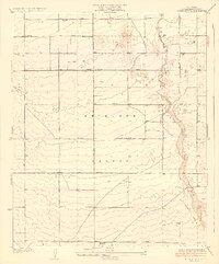 1933 Tierra Bonita1933 Print · USGSAntelope Valley was a landscape of pioneering ranching tracts and desert homesteads during the early 1930s. Genealogists and local historians can trace early community sites like Tierra Bonita Sch, the Twin Joshua Rancho, and the riparian corridor of Little Rock Wash.3 unique versions available
 - 1933 Map of West Alpine Butte
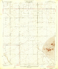 1933 West Alpine Butte1933 Print · USGSAntelope Valley in the early 1930s was a landscape of high desert plains and dry washes before the era of intensive development. Trace early road grids like Avenue M and find landmarks such as Alpine Butte and the seasonal Rock Creek.3 unique versions available
 - 1933 Map of Oban
 1933 Oban1933 Print · USGSThe northern reaches of Los Angeles County appear here in the early 1930s as a developing desert grid along the Southern Pacific line. Genealogists and local historians can trace early land use through features like the Glendale Rod and Gun Club, the Moore Club, and the railroad stop at Oban.3 unique versions available
 - 1934 Map of Little Buttes
 1934 Little Buttes1934 Print · USGSAntelope Valley was a landscape of remote ranching outposts and rugged peaks in the early thirties. Genealogists and historians can trace family landholdings like the Eric Munz Ranch and find the site of the Esperanza School near the Antelope Buttes.2 unique versions available
 - 1934 Map of Esperanza School
 1934 Esperanza School1934 Print · USGSAntelope Valley's high desert landscape comes into focus during the early 1930s as a developing agricultural and social hub. Genealogists can trace early local landmarks like the Japanese Ch, Rogers Sch, and Esperanza Sch.3 unique versions available
 - 1936 Map of Del Sur
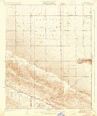 1936 Del Sur1936 Print · USGSAntelope Valley was a landscape of remote schools and mountain passes in the mid-1930s before modern expansion. Genealogists and local historians can trace family locations near Del Sur, Belleview Sch, and the distinct San Andreas Rift Zone.4 unique versions available
 - 1937 Map of Lake
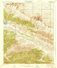 1937 Lake1937 Print · USGSLos Angeles County's High Desert and the San Andreas Fault area appear here in the early thirties as a landscape of isolated ranches and mountain passes. Researchers can trace historic routes and homesteads like Elizabeth Lake Ranch, Talamantes, and the early Elizabeth Lake Sch.3 unique versions available
 - 1943 Map of Rosamond
 1943 Rosamond1943 Print · USGSThe Mojave Desert comes alive in the early 1940s as a center of mining and rail transit. Researchers can trace the industrial footprint of the Golden Queen Mine, locate the Kern County Union School, and see the early layout of Rosamond.2 unique versions available
 - 1943 Map of Willow Springs
 1943 Willow Springs1943 Print · USGSThe northern Antelope Valley and Mojave Desert come alive in this wartime survey of the Kern and Los Angeles county line. Researchers can trace historic family holdings like Wagon Wheel Ranch and C Z Ranch or locate the site of the Cactus Mine.3 unique versions available
 - 1945 Map of Alpine Butte
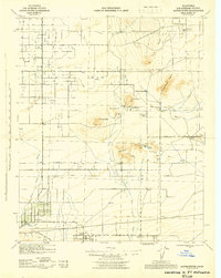 1945 Alpine Butte1945 Print · USGSAntelope Valley in the mid-forties reveals a landscape of isolated desert buttes and early ranching settlements. Genealogists and historians can trace family-named sites like Wilsona Ranch and Morrison Ranch or locate the Wilsona Sch and Antelope Valley Indian Museum.
 - 1947 Map of Alpine Butte
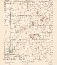 1947 Alpine Butte1947 Print · USGSPost-war ranching and desert life emerge in the Antelope Valley during the late 1940s. Researchers can trace family-named landmarks like Wilsona Ranch and Morrison Ranch or locate the Antelope Valley Indian Museum and Wilsona Sch 1.
 - 1947 Map of Rosamond
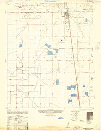 1947 Rosamond1947 Print · USGSThe high desert community of Rosamond is captured here just after the war, at the edge of the western Mojave Desert. Researchers can trace the early layout of the Southern Pacific rail corridor and find landmarks like the Liberty Flying School and A Andrews Ranch.3 unique versions available
Showing maps 1-25 of 74
Top cities near Lancaster
Frequently asked questions
- What are the different types of historical maps available for Lancaster?
- What is the oldest map of Lancaster?
- Where can I purchase historical maps of Lancaster for my home or office?
- Where can I download high-res historical maps of Lancaster?
- Are there historical topographic maps available for Lancaster?
- Is there historical aerial imagery available for Lancaster?
- Where are historical maps of Lancaster sourced from?