
1934 Map of Little Buttes
USGS Topo · Published 1934About this map
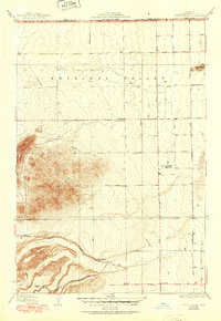
Antelope Valley dominates this 1930s survey, characterized by a sparse ranching landscape where individual homesteads and isolated schoolhouses serve as the primary social markers. The rugged Antelope Buttes rise sharply in the west, providing a stark topographical contrast to the surveyed grid of the desert floor. This map captures the region's early 20th-century development, where family operations like the Eric Munz Ranch and Half Circle G Ranch established footholds along seasonal watercourses and early road networks. The layout of Neenach Avenue and Old Willow Springs Road illustrates the transition from traditional trail-based travel to a more formal regional infrastructure. Educational needs of these remote ranching families were met by institutions such as the Esperanza School, while a prominent Transmission Line cutting across the terrain signals the arrival of large-scale utility expansion through the valley.
Find a feature on this map
11 named features on this map. Tap any name to fly to it.
Don’t see what you’re looking for? This feature index may not catch every label — zoom into the map to look around manually.
Map Details
Editions of this 1934 Little Buttes Map
2 editions found
Other maps of this area

1915 · Elizabeth Lake
USGS Topo · 1:125,000

1917 · Elizabeth Lake
USGS Topo · 1:125,000

1931 · Little Buttes
USGS Topo · 1:24,000

1931 · Del Sur
USGS Topo · 1:24,000

1931 · Esperanza School
USGS Topo · 1:24,000

1932 · Lake
USGS Topo · 1:24,000

1932 · Hughes Lake
USGS Topo · 1:24,000

1932 · Fairmont
USGS Topo · 1:24,000

1934 · Esperanza School
USGS Topo · 1:24,000
1936 · Del Sur
USGS Topo · 1:24,000