
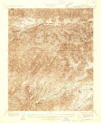
1931 Map of Del Sur
USGS Topo · Published 1931About this map
Antelope Valley and Leona Valley dominate this 1931 survey, revealing a landscape defined by an emerging grid of rural roads and scattered educational hubs. This area of Los Angeles County shows a transition from the level terrain of the northern valley floor to the steep, complex relief to the south. Local education is centered around three key facilities: Del Sur Sch in the northwest, Belleview Sch to the east, and Leona Sch tucked into the southern hills. Water access, critical for settlement in this arid region, is marked by numerous wells and a spring, while industrial activity is represented by a single Quarry near the eastern margin. The systematic layout of alphabetic avenues, such as J Avenue and P Avenue, suggests the early stages of formal land division and community organization during the early 1930s.
Find a feature on this map
39 named features on this map. Tap any name to fly to it.
Don’t see what you’re looking for? This feature index may not catch every label — zoom into the map to look around manually.
Map Details
Editions of this 1931 Del Sur Map
This is the sole edition of this map. No revisions or reprints were ever made.
Other maps of this area

1915 · Elizabeth Lake
USGS Topo · 1:125,000

1917 · Elizabeth Lake
USGS Topo · 1:125,000

1930 · Oban
USGS Topo · 1:24,000

1930 · Lancaster
USGS Topo · 1:24,000

1931 · Little Buttes
USGS Topo · 1:24,000

1931 · Esperanza School
USGS Topo · 1:24,000

1932 · Red Rover
USGS Topo · 1:24,000

1932 · Lake
USGS Topo · 1:24,000
1932 · Mint Canyon
USGS Topo · 1:24,000

1932 · Palmdale
USGS Topo · 1:24,000