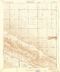
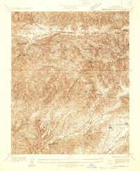
1936 Map of Del Sur
USGS Topo · Published 1936About this map
The San Andreas Rift Zone carves a striking path through this high-desert landscape, defining the geologic character of the region during the mid-1930s. Settled pockets like Del Sur and Quartz Hill sit at the intersection of the flat Antelope Valley and the rising elevations of Portal Ridge. The map reveals a community-centered infrastructure with Belleview Sch and Leona Sch serving the local families who lived along the grid of avenues and winding mountain routes. Water management in this arid environment is clearly marked by numerous wells and intermittent drainage systems such as Amargosa Creek and Rogers Creek. The presence of Bouquet Canyon Road and Elizabeth Lake Road highlights the established transportation network connecting these mountain passes to the valley floor during this era of Los Angeles County's development.
Find a feature on this map
26 named features on this map. Tap any name to fly to it.
Don’t see what you’re looking for? This feature index may not catch every label — zoom into the map to look around manually.
Map Details
Editions of this 1936 Del Sur Map
4 editions found
Other maps of this area

1915 · Elizabeth Lake
USGS Topo · 1:125,000

1917 · Elizabeth Lake
USGS Topo · 1:125,000

1930 · Oban
USGS Topo · 1:24,000

1930 · Lancaster
USGS Topo · 1:24,000

1931 · Little Buttes
USGS Topo · 1:24,000

1931 · Del Sur
USGS Topo · 1:24,000

1931 · Esperanza School
USGS Topo · 1:24,000

1932 · Red Rover
USGS Topo · 1:24,000

1932 · Lake
USGS Topo · 1:24,000
1932 · Mint Canyon
USGS Topo · 1:24,000