Old Maps of Malibu, California for Academic Research
Study the evolution of Malibu with 57 high-resolution historic maps. Whether you're teaching, researching, or modeling changes in land use, these maps provide essential visual documentation of urban, environmental, and geographic change.
- Analyze long-term change: Track patterns in development, transportation, and natural features.
- Ideal for environmental or urban studies: Support academic projects with primary historical map data.
- Use in the classroom or lab: Educators and researchers rely on these maps to bring historical context to life.
These maps are a powerful tool for teaching, research, and visualizing how Malibu has changed over the decades.
Malibu, CA maps
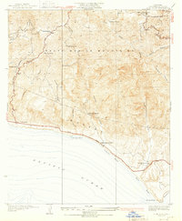
(57)- 1900 Map of Triunfo Pass
 1900 Triunfo Pass1900 Print · USGSIn the final year of the nineteenth century, the coast between Ventura and Los Angeles remained a series of massive ranchos and canyons. Genealogists and historians can trace early settlements like Newbury Park and Vejor, or follow the ancient Boundary Line across the Santa Monica Mountains.2 unique versions available
 - 1903 Map of Calabasas
 1903 Calabasas1903 Print · USGSThe northern reaches of the Santa Monica Mountains and the western San Fernando Valley are shown here at the turn of the century. Genealogists and historians can trace early ranch boundaries like Encino and Las Virgenes, or locate the original sites of Grape Arbor and the Chatsworth Park Branch railroad.8 unique versions available
 - 1903 Map of Camulos
 1903 Camulos1903 Print · USGSSouthern California at the dawn of the twentieth century shows a landscape of ranchos and early rail towns. Trace the old routes through Simi and Camulos, or locate vanished stops like Ternez Siding and the coastal piers at Port Los Angeles.5 unique versions available
 - 1921 Map of Triunfo Pass
 1921 Triunfo Pass1921 Print · USGSThe coastal canyons and mountain passes of Ventura and Los Angeles counties are captured here at the turn of the century. Genealogists and historians can trace early settlements at Newbury Park and Triunfo, or follow the rugged drainage of Dume Canyon to the sea.3 unique versions available
 - 1928 Map of Topanga Canyon
 1928 Topanga Canyon1928 Print · USGSAlong the Los Angeles coast in the late twenties, the shoreline was a string of ranch lands and early social colonies. Trace the development of Pacific Palisades and Castellammare or find early landmarks like Trippet Ranch and the Pacific Palisades Auto Camp.3 unique versions available
 - 1929 Map of Dume Point
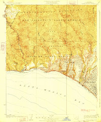
 1929 Dume Point1929 Print · USGSThe Malibu coast and Santa Monica Mountains appear here in the late twenties, before the arrival of modern density. Genealogists and historians can trace early family holdings like Filbert Ranch, locate the Decker Sch, and find the Madley Trading Post.
 - 1929 Map of Solstice Canyon
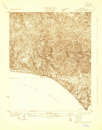
 1929 Solstice Canyon1929 Print · USGSThe Santa Monica coastline appears in its early stages of development during the late twenties. Researchers can trace the original State Highway Route No 60 and find early settlements like Malibu Vista and El Nido.
 - 1932 Map of Las Flores
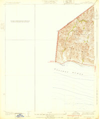
 1932 Las Flores1932 Print · USGSCoastal Los Angeles County appears at the dawn of the 1930s as a series of isolated canyon outposts and emerging beach colonies. Historians and researchers can trace the early layouts of Malibu Beach, Stunts Ranch, and Topanga while exploring the original path of the State Highway.2 unique versions available
 - 1932 Map of Dume Point
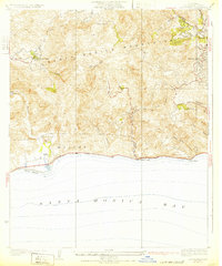
 1932 Dume Point1932 Print · USGSCoastal Malibu was a realm of private ranches and narrow mountain roads in the years before the Pacific Coast Highway’s modern expansion. Genealogists and local historians can trace family-named landmarks like Rindge Ranch, the remote Decker Sch, and the Malibu Trading Sta near the shore.2 unique versions available
 - 1932 Map of Arroyo Sequit
 1932 Arroyo Sequit1932 Print · USGSCoastal Los Angeles County is captured here in the early thirties, showing the rugged intersection of the mountains and the sea. Trace early transit routes along the State Highway and follow the natural paths of Arroyo Sequit Creek and Nicholas Canyon.3 unique versions available
 - 1932 Map of Solstice Canyon
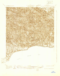
 1932 Solstice Canyon1932 Print · USGSThe Santa Monica Mountains meet the Pacific in the early 1930s, documenting a era of coastal ranches and new canyon communities. Researchers can trace the original footprints of The Crags Country Club, Perret Ranch, and El Nido before mid-century growth.2 unique versions available
 - 1943 Map of Triunfo Pass
 1943 Triunfo Pass1943 Print · USGSThe Conejo Valley and Santa Monica Mountains are shown here during the early war years, when ranching and small coastal outposts defined the region. Local researchers can locate family landholdings like Fillmore Ranch or trace the early development of the Thousand Oaks Community and Newbury Park.
 - 1944 Map of Calabasas
 1944 Calabasas1944 Print · USGSMid-century Los Angeles County unfolds here, showing the grid of the San Fernando Valley meeting the Santa Monica Mountains. Trace old ranch boundaries at Platt Ranch or locate early landmarks like the Will Rogers Memorial and Topanga Lookout.
 - 1949 Map of Los Angeles
 1949 Los Angeles1949 Print · USGSSouthern California and the South Coast appear at the onset of the post-war boom, from the Channel Islands to the Mojave Desert. Trace early aviation sites like Lockheed Air Terminal and mining history at the Redrock Quicksilver Mine and Redrover Mine.2 unique versions available
 - 1949 Map of Long Beach
 1949 Long Beach1949 Print · USGSSouthern California at the start of the post-war boom shows the rapid development of the Los Angeles basin and the South Bay. Genealogists and historians can trace the evolution of early suburbs like Gardena and Lynwood or the coastal defenses at Ft MacArthur Lower Reservation.2 unique versions available
 - 1949 Map of Triunfo Pass, 1958 Print
 1949 Triunfo Pass1958 Print · USGSThe coastal Santa Monica Mountains meet the Pacific in the late 1940s, showing a landscape of deep canyons and early highway development. Genealogists and historians can locate rural landmarks like Yerba Buena Sch, the Triunfo Lookout, and the seaside Solromar.3 unique versions available
 - 1950 Map of Triunfo Pass
 1950 Triunfo Pass1950 Print · USGSThe coastal Santa Monica Mountains come into focus just after the war as new highways begin to carve through the canyons. Genealogists and hikers can trace the original locations of Yerba Buena Sch, Solromar, and the Triunfo Lookout.2 unique versions available
 - 1950 Map of Malibu Beach, 1955 Print
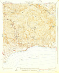
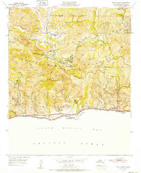
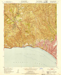
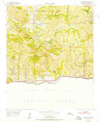 1950 Malibu Beach1955 Print · USGSCoastal Los Angeles County at mid-century reveals a landscape of private ranches and mountain retreats tucked into the canyons. Researchers can trace early property lines and landmarks like Century Ranch, the Salvation Army Camp, and Las Flores.7 unique versions available
 - 1950 Map of Point Dume, 1956 Print
 1950 Point Dume1956 Print · USGSThe coastal canyons and peaks of western Los Angeles County appear here in the early fifties, before the surge of modern residential expansion. Researchers can trace early ranch sites like Kincaid Ranch, visit Seminole Hot Springs, or locate the Castro Pk Lookout.6 unique versions available
 - 1951 Map of Malibu Beach
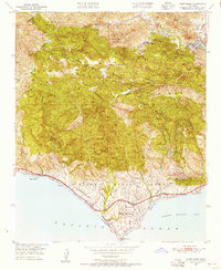
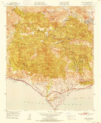
 1951 Malibu Beach1951 Print · USGSThe Malibu coast and interior canyons come alive in the early 1950s, showing a landscape of remote ranches and seaside retreats. Researchers can trace early mountain landmarks like Century Ranch, find the Las Virgenes Sch, or locate coastal features like Serra Retreat.
 - 1951 Map of Point Dume
 1951 Point Dume1951 Print · USGSThe coastal mountains of Malibu and the Santa Monica range appear here in the early fifties, before the arrival of modern suburban sprawl. Researchers can trace historic landmarks like Seminole Hot Springs, the Kincaid Ranch, and the early layout of Malibu Riviera.
 - 1952 Map of Topanga, 1953 Print
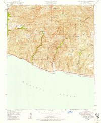
 1952 Topanga1953 Print · USGSCoastal Los Angeles and the adjacent canyon country appear in the early fifties as the region began its mid-century transformation. Researchers can trace the development of Pacific Palisades, the grounds of Will Rogers State Park, and rural landmarks like Trippet Ranch.8 unique versions available
 - 1955 Map of Los Angeles
 1955 Los Angeles1955 Print · USGSThe mid-century transformation of Southern California comes into focus as the urban sprawl of Los Angeles meets the wilderness of the Santa Monica Mountains. Researchers can trace the development of post-war suburbs alongside historic landmarks like the Santa Barbara Lighthouse and early industrial sites such as the Good Luck Mine.
 - 1957 Map of Long Beach
 1957 Long Beach1957 Print · USGSThe Los Angeles coast and the Channel Islands appear here during the mid-fifties era of rapid suburbanization and naval expansion. Genealogists and researchers can locate early industrial neighborhoods like South Gate and trace military boundaries at Ft MacArthur Upper Reservation or the remote San Nicolas Island.4 unique versions available
 - 1958 Map of Long Beach
 1958 Long Beach1958 Print · USGSCoastal Southern California is shown during a mid-century period of intense suburbanization and military readiness. Genealogists and historians can trace the growth of Long Beach, identify early neighborhoods in Lakewood Village, or locate the bounds of Ft MacArthur Lower Reservation.
Showing maps 1-25 of 57
Top cities near Malibu
- Los Angeles historical maps
- Thousand Oaks historical maps
- Simi Valley historical maps
- Santa Monica historical maps
- Camarillo historical maps
- Calabasas historical maps
See more
Top neighborhoods of Malibu
- Malibu Beach historical maps
- Trancas historical maps
- Malibu West historical maps
- Las Flores historical maps
- Malibu Country Estates historical maps
- Malibu Riviera historical maps
Frequently asked questions
- What are the different types of historical maps available for Malibu?
- What is the oldest map of Malibu?
- Where can I purchase historical maps of Malibu for my home or office?
- Where can I download high-res historical maps of Malibu?
- Are there historical topographic maps available for Malibu?
- Is there historical aerial imagery available for Malibu?
- Where are historical maps of Malibu sourced from?