1950s Maps of Palmdale, California
Explore 17 historic maps of Palmdale from the 1950s. These maps offer a rare glimpse into what life looked like during the 1950s — showing old roads, neighborhoods, homes, and landmarks that have changed or disappeared over time.
Whether you're researching your family's past, planning a metal detecting trip, or studying how Palmdale's landscape evolved across the 1950s, these high-resolution maps are a powerful tool for exploring the history of this region.
- Focus on a specific era: All maps on this page are from the 1950s, giving you a focused view of this time period.
- See what’s changed: Compare century-old streets, trails, and buildings to today's modern landscape using overlays and satellite layers.
- Research with precision: Use these maps for genealogy, historical research, land use analysis, or educational projects.
- View, download, or print: Maps are fully viewable online in high resolution, and can be downloaded or printed for your own records.
Start exploring Palmdale's history through authentic maps from the 1950s. This is your window into the past.
Palmdale, CA maps
(17)- 1953 Map of San Bernardino
 1953 San Bernardino1953 Print · USGSSouthern California underwent massive post-war growth as suburban sprawl reached the foothills of the San Bernardino Mountains. Genealogists and historians can trace the rail-and-road roots of the Inland Empire through the Union Pacific RR and Lake Arrowhead resorts.2 unique versions available
 - 1955 Map of Los Angeles
 1955 Los Angeles1955 Print · USGSThe mid-century transformation of Southern California comes into focus as the urban sprawl of Los Angeles meets the wilderness of the Santa Monica Mountains. Researchers can trace the development of post-war suburbs alongside historic landmarks like the Santa Barbara Lighthouse and early industrial sites such as the Good Luck Mine.
 - 1956 Map of San Bernardino
 1956 San Bernardino1956 Print · USGSSouthern California's Inland Empire and High Desert come into focus in the mid-fifties as agriculture gives way to suburban and military growth. Trace early rail lines like the Pacific Electric or find remote landmarks like Camp Rock Mine and George AFB.
 - 1957 Map of San Bernardino
 1957 San Bernardino1957 Print · USGSSouthern California's Inland Empire and High Desert met during the postwar expansion of the late fifties. Genealogists and historians can trace the growth of San Bernardino and Redlands alongside remote landmarks like Edwards AFB and the Camp Rock Mine.
 - 1957 Map of Alpine Butte, 1958 Print
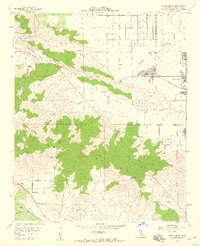
 1957 Alpine Butte1958 Print · USGSAntelope Valley aviation and desert topography are captured here in the late fifties. Trace early flight history at the Antelope Valley Pilots Club Landing Field or locate landmarks like Alpine Butte and Rock Creek.4 unique versions available
 - 1957 Map of Littlerock, 1958 Print
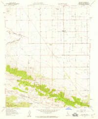
 1957 Littlerock1958 Print · USGSThe high desert communities of the Antelope Valley are captured here in the late fifties as agriculture and early infrastructure began to shape the region. You can trace irrigation patterns along the Little Rock Ditch and locate early settlements like Antelope Center and Pearblossom.4 unique versions available
 - 1958 Map of Lancaster East, 1959 Print
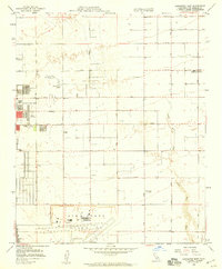 1958 Lancaster East1959 Print · USGSMid-century Lancaster and the surrounding High Desert come into focus during a period of rapid Cold War aerospace expansion. Genealogists and historians can trace the early footprints of Air Force Plant 42, Antelope Valley College, and the rural community of Roosevelt.3 unique versions available
 - 1958 Map of Palmdale, 1959 Print
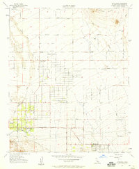
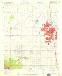
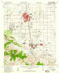
 1958 Palmdale1959 Print · USGSPalmdale was transforming into an aerospace hub during the late fifties as residential blocks expanded toward the High Desert foothills. Trace the development of local neighborhoods, schools, and landmarks like Air Force Plant 42, Lake Palmdale, and Pearland.3 unique versions available
 - 1958 Map of Ritter Ridge, 1959 Print
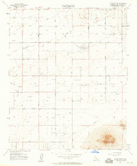
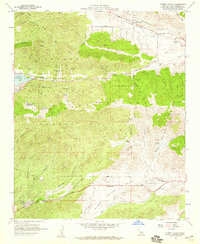
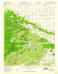
 1958 Ritter Ridge1959 Print · USGSPalmdale and the High Desert are captured here during a period of growth just before major suburban expansion began. Researchers can trace the geological scar of the San Andreas Rift Zone and locate historic mining operations like the Red Rover Mine and Governor Mine.3 unique versions available
 - 1958 Map of Del Sur, 1959 Print
 1958 Del Sur1959 Print · USGSLos Angeles County's high desert and the Leona Valley are captured here in the late fifties, showing a landscape of scattered family ranches and agricultural research. Genealogists can locate named homesteads like the Eric Munz Ranch and Pitchfork Ranch alongside the Del Sur School.4 unique versions available
 - 1958 Map of Lancaster West, 1959 Print
 1958 Lancaster West1959 Print · USGSLancaster and the surrounding Antelope Valley are captured here in the late fifties as the desert grid expanded along the Southern Pacific line. Researchers can trace the mid-century growth of Quartz Hill, locate early schools like Joshua Sch, and find the footprint of the District Fairgrounds.4 unique versions available
 - 1958 Map of Sleepy Valley, 1959 Print
 1958 Sleepy Valley1959 Print · USGSThe Leona Valley and Sierra Pelona highlands were transitioning from remote ranchland to early residential pockets in the late fifties. Genealogists and historians can locate family landmarks like Ritter Ranch, the Leona School, and the historic Gray Eagle Mine.3 unique versions available
 - 1958 Map of Lancaster, 1960 Print
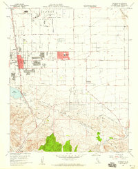
 1958 Lancaster1960 Print · USGSAntelope Valley was transforming into an aerospace and industrial hub during the late fifties. You can trace the San Andreas Fault Zone, locate old mining operations like Governor Mine, and see the early layout of Air Force Plant 42.2 unique versions available
 - 1958 Map of Bouquet Reservoir, 1960 Print
 1958 Bouquet Reservoir1960 Print · USGSThe high desert and mountains of Los Angeles County appear here in the late fifties, showcasing a landscape defined by water infrastructure and rural ranching. Trace old family boundaries and landmarks like Eric Munz Ranch, the Gray Eagle Mine, and Del Sur School.2 unique versions available
 - 1958 Map of San Bernardino, 1975 Print
 1958 San Bernardino1975 Print · USGSSouthern California’s Inland Empire and High Desert come into focus during the mid-century boom, showing the rise of suburbs and massive military installations. Researchers can trace the rail networks of the Union Pacific RR or locate landmarks like Norton AFB and Big Bear Lake.
 - 1959 Map of Los Angeles
 1959 Los Angeles1959 Print · USGSCoastal California and the high desert met in a period of booming growth after the war. Researchers can trace early aviation and military history at the Point Mugu Air Missile Test Ctr or locate desert mining sites like the Double Eagle Mine.3 unique versions available
 - 1959 Map of San Bernardino
 1959 San Bernardino1959 Print · USGSSouthern California underwent a massive transformation in the late fifties as suburban growth and military power reshaped the desert and valley. Researchers can trace the legacy of the Union Pacific Railroad and locate early footprints of Joshua Tree National Monument and Edwards Air Force Base.
End of results
Showing maps 1-17 of 17
Top cities near Palmdale
Top neighborhoods of Palmdale
Frequently asked questions
- What are the different types of historical maps available for Palmdale?
- What is the oldest map of Palmdale?
- Where can I purchase historical maps of Palmdale for my home or office?
- Where can I download high-res historical maps of Palmdale?
- Are there historical topographic maps available for Palmdale?
- Is there historical aerial imagery available for Palmdale?
- Where are historical maps of Palmdale sourced from?