2020s Maps of Palmdale, California
Explore 8 historic maps of Palmdale from the 2020s. These maps offer a rare glimpse into what life looked like during the 2020s — showing old roads, neighborhoods, homes, and landmarks that have changed or disappeared over time.
Whether you're researching your family's past, planning a metal detecting trip, or studying how Palmdale's landscape evolved across the 2020s, these high-resolution maps are a powerful tool for exploring the history of this region.
- Focus on a specific era: All maps on this page are from the 2020s, giving you a focused view of this time period.
- See what’s changed: Compare century-old streets, trails, and buildings to today's modern landscape using overlays and satellite layers.
- Research with precision: Use these maps for genealogy, historical research, land use analysis, or educational projects.
- View, download, or print: Maps are fully viewable online in high resolution, and can be downloaded or printed for your own records.
Start exploring Palmdale's history through authentic maps from the 2020s. This is your window into the past.
Palmdale, CA maps
(8)- 2021 Map of Littlerock, 2021 Print
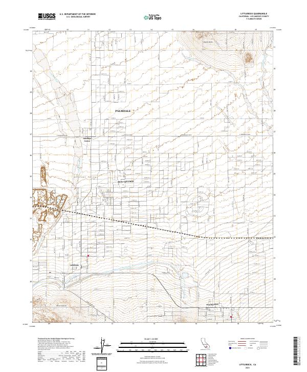 2021 Littlerock2021 Print · USGSThe high desert of Los Angeles County is captured here in the early twenty-first century as suburban growth meets traditional agriculture. Genealogists and historians can trace the local infrastructure around Palmdale, Sun Village, and the vital California Aqueduct.
 - 2021 Map of Del Sur, 2021 Print
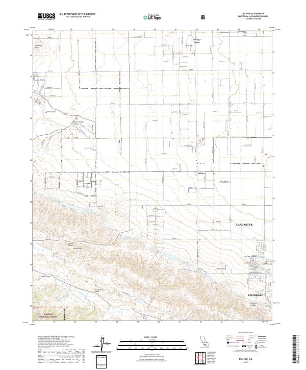 2021 Del Sur2021 Print · USGSThe Antelope Valley's high desert landscape meets the northern edge of the Angeles National Forest in this recent survey. Researchers can trace the massive San Andreas Fault as it runs south of Del Sur and Leona Valley, alongside the California Aqueduct.
 - 2021 Map of Palmdale, 2021 Print
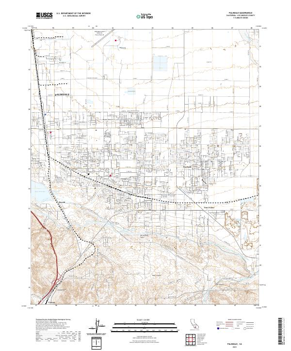 2021 Palmdale2021 Print · USGSPalmdale and the High Desert landscape are captured here in 2021, showing the modern intersection of aerospace industry and residential growth. Researchers can locate the Palmdale United States Air Force Plant 42 and trace the San Andreas Fault past Pearland and Lake Palmdale.
 - 2021 Map of Alpine Butte, 2021 Print
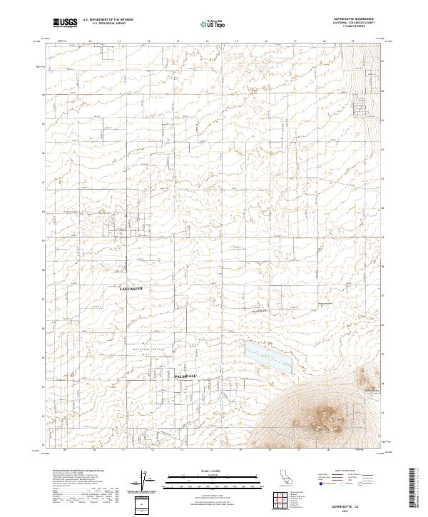 2021 Alpine Butte2021 Print · USGSThe Antelope Valley high desert comes into focus in the early 2020s as residential grids expand toward the Mojave. Trace the desert landscape from the outskirts of Lancaster to the volcanic rises of Alpine Butte and Rocky Buttes.
 - 2022 Map of Lancaster West, 2022 Print
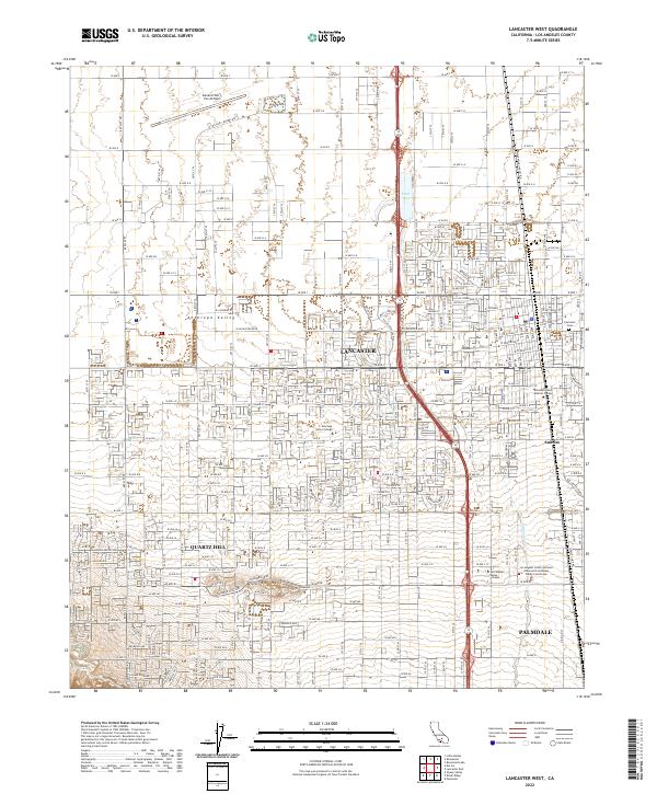 2022 Lancaster West2022 Print · USGSAntelope Valley and the northern reaches of Los Angeles County appear here in a state of mature modern development. Researchers can trace the civic layout of Lancaster and Palmdale or locate local landmarks like the Lancaster Cem and Antelope Valley College.
 - 2022 Map of Lancaster East, 2022 Print
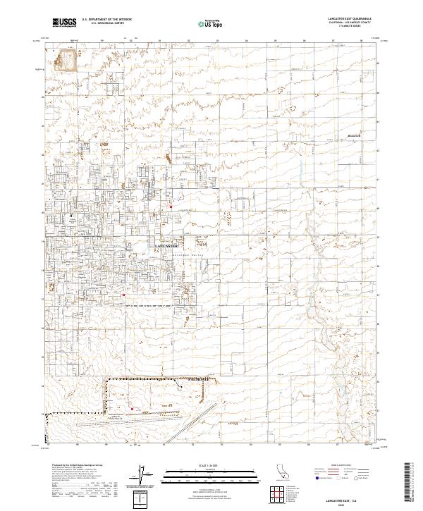 2022 Lancaster East2022 Print · USGSThe high desert of the Antelope Valley comes into focus here, showing the modern growth of Lancaster and Palmdale. Trace the local aerospace footprint at the Palmdale United States Air Force Plant 42 or locate the settlement of Roosevelt.
 - 2022 Map of Sleepy Valley, 2022 Print
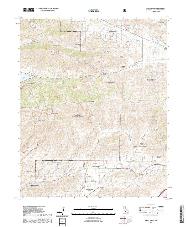 2022 Sleepy Valley2022 Print · USGSHigh desert communities and mountain ridges come into focus in this recent survey of the area north of Los Angeles. Researchers can trace the Pacific Crest National Scenic Trail through the Angeles National Forest or locate rural developments at Leona Valley, White Heather, and Sleepy Valley.
 - 2022 Map of Ritter Ridge, 2022 Print
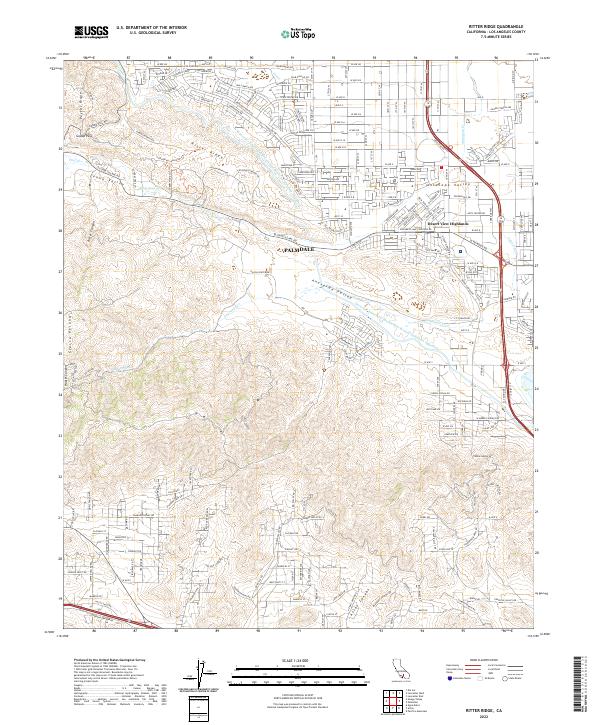 2022 Ritter Ridge2022 Print · USGSPalmdale and the southwestern Antelope Valley are captured here just after the turn of the decade, showing the city's interface with the Sierra Pelona mountains. Trace the path of the California Aqueduct and locate landmarks like Eagle-Butte and Desert View Highlands.
End of results
Showing maps 1-8 of 8
Top cities near Palmdale
Top neighborhoods of Palmdale
Frequently asked questions
- What are the different types of historical maps available for Palmdale?
- What is the oldest map of Palmdale?
- Where can I purchase historical maps of Palmdale for my home or office?
- Where can I download high-res historical maps of Palmdale?
- Are there historical topographic maps available for Palmdale?
- Is there historical aerial imagery available for Palmdale?
- Where are historical maps of Palmdale sourced from?