1930s Maps of Palmdale, California
Explore 16 historic maps of Palmdale from the 1930s. These maps offer a rare glimpse into what life looked like during the 1930s — showing old roads, neighborhoods, homes, and landmarks that have changed or disappeared over time.
Whether you're researching your family's past, planning a metal detecting trip, or studying how Palmdale's landscape evolved across the 1930s, these high-resolution maps are a powerful tool for exploring the history of this region.
- Focus on a specific era: All maps on this page are from the 1930s, giving you a focused view of this time period.
- See what’s changed: Compare century-old streets, trails, and buildings to today's modern landscape using overlays and satellite layers.
- Research with precision: Use these maps for genealogy, historical research, land use analysis, or educational projects.
- View, download, or print: Maps are fully viewable online in high resolution, and can be downloaded or printed for your own records.
Start exploring Palmdale's history through authentic maps from the 1930s. This is your window into the past.
Palmdale, CA maps
(16)- 1930 Map of Little Rock
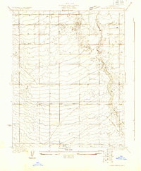
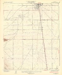
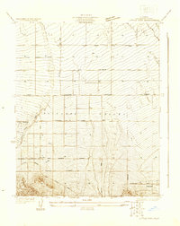 1930 Little Rock1930 Print · USGSAntelope Valley in the early thirties reveals a developing high-desert agricultural landscape defined by citrus-named routes and irrigation. Researchers can trace the layout of the Almondale settlement or locate early desert infrastructure like the Little Rock Ditch and the Apple Blossom Highway.
 - 1930 Map of Lancaster
 1930 Lancaster1930 Print · USGSAntelope Valley during the early 1930s shows the emerging township of Lancaster as it grew along the railroad. Researchers can trace early infrastructure like the Lancaster Tubercular Rest Home and the rural footprint of Antelope Valley High Sch.
 - 1930 Map of Pearland
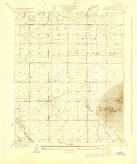
 1930 Pearland1930 Print · USGSThe high desert of Los Angeles County is captured here in the early thirties as the community of Pearland took shape. Genealogists and historians can trace the early orchard-district grid, from the Palmdale Cemetery to the historic Old Fort Tejon Road.
 - 1930 Map of West Alpine Butte
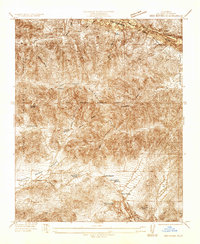
 1930 West Alpine Butte1930 Print · USGSHigh Desert settlement takes shape in northern Los Angeles County during the early thirties, defined by a rigid township grid. Trace early desert infrastructure along Wilsona Road and Sheldon Road, and locate vital water sources marked as Well near the base of Alpine Butte.
 - 1930 Map of Tierra Bonita, 1933 Print
 1930 Tierra Bonita1933 Print · USGSThe high desert of northern Los Angeles County appears here in the early 1930s, just as the rural Antelope Valley began its modern transition. Genealogists and desert historians can trace early homesteads and landmarks like the Tierra Bonita Sch, Twin Joshua Rancho, and Little Rock Wash.
 - 1931 Map of Del Sur
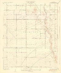
 1931 Del Sur1931 Print · USGSLos Angeles County's northern valleys appear here during the early 1930s as a developing rural grid between the mountains and the desert. Researchers can trace early school districts at Del Sur Sch and Leona Sch or locate water sources like the Spring.
 - 1932 Map of Red Rover
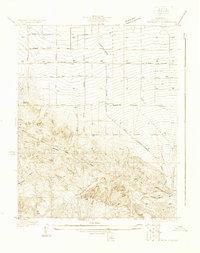
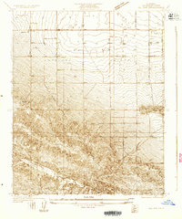
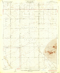
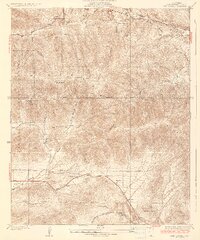
 1932 Red Rover1932 Print · USGSNorthern Los Angeles County in the early thirties reveals a landscape of remote mountain ranches and early roadside service. Trace the San Andreas Rift Zone or locate family landmarks like Ritter Ranch and the Red Rover Mine.
 - 1932 Map of Palmdale
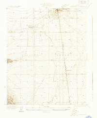
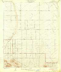
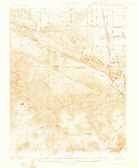 1932 Palmdale1932 Print · USGSPalmdale and the surrounding desert valleys are captured here in the early thirties as the region grew around rail and water infrastructure. Researchers can trace historic homesteads and facilities like the Palmdale Spring Sanitarium, City Ranch, and the Southern Pacific Railroad.
 - 1933 Map of Lancaster
 1933 Lancaster1933 Print · USGSThe Antelope Valley desert is shown here in the early 1930s, long before its post-war suburban boom. You can trace the early rail-side growth of Lancaster and locate the Lancaster Tubercular Rest Home and the settlement at Quartz Hill.3 unique versions available
 - 1933 Map of Tierra Bonita
 1933 Tierra Bonita1933 Print · USGSAntelope Valley was a landscape of pioneering ranching tracts and desert homesteads during the early 1930s. Genealogists and local historians can trace early community sites like Tierra Bonita Sch, the Twin Joshua Rancho, and the riparian corridor of Little Rock Wash.3 unique versions available
 - 1933 Map of West Alpine Butte
 1933 West Alpine Butte1933 Print · USGSAntelope Valley in the early 1930s was a landscape of high desert plains and dry washes before the era of intensive development. Trace early road grids like Avenue M and find landmarks such as Alpine Butte and the seasonal Rock Creek.3 unique versions available
 - 1934 Map of Pearland
 1934 Pearland1934 Print · USGSThe High Desert landscape of the Antelope Valley comes to life in the mid-1930s as agricultural and transport networks expanded. Researchers can trace the Southern Pacific line and historic routes like Old Fort Tejon Road and Pear Blossom Highway near the Pearland settlement.5 unique versions available
 - 1934 Map of Little Rock
 1934 Little Rock1934 Print · USGSAntelope Valley in the early thirties reveals a burgeoning agricultural landscape structured by a precise road grid and early highway routes. Genealogists and historians can trace the foundations of Little Rock, the outskirts of Almondale, and the irrigation network of Little Rock Ditch.4 unique versions available
 - 1936 Map of Del Sur
 1936 Del Sur1936 Print · USGSAntelope Valley was a landscape of remote schools and mountain passes in the mid-1930s before modern expansion. Genealogists and local historians can trace family locations near Del Sur, Belleview Sch, and the distinct San Andreas Rift Zone.4 unique versions available
 - 1937 Map of Palmdale
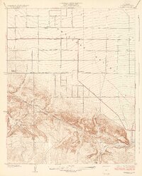
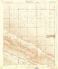
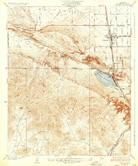 1937 Palmdale1937 Print · USGSAntelope Valley was a landscape of transit and ranching in the 1930s, centered on the railroad corridor and the rift valley. Genealogists can trace early landmarks like Casa del Adobe or follow the Southern Pacific tracks to the small settlements of Harold and Alpine.4 unique versions available
 - 1937 Map of Red Rover
 1937 Red Rover1937 Print · USGSLos Angeles County's northern high desert and the Sierra Pelona mountains come into focus during the mid-1930s. Researchers can locate remote ranching outposts like Hauser Ranch and active mining sites including the Puritan Mine and Red Rover Mine.5 unique versions available
End of results
Showing maps 1-16 of 16
Top cities near Palmdale
Top neighborhoods of Palmdale
Frequently asked questions
- What are the different types of historical maps available for Palmdale?
- What is the oldest map of Palmdale?
- Where can I purchase historical maps of Palmdale for my home or office?
- Where can I download high-res historical maps of Palmdale?
- Are there historical topographic maps available for Palmdale?
- Is there historical aerial imagery available for Palmdale?
- Where are historical maps of Palmdale sourced from?