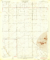
1933 Map of West Alpine Butte
USGS Topo · Published 1933About this map
Antelope Valley dominates this 1930s landscape, a high desert expanse defined more by its dry watercourses and grid of early roads than by dense settlement. The topography is punctuated by the prominent rise of Alpine Butte in the southeast, providing a stark landmark against the surrounding alluvial plains. This survey, conducted under the direction of the Los Angeles County Board of Supervisors, reveals the early infrastructure of the region, including the established corridors of Avenue M, Avenue L, and Avenue N.
Find a feature on this map
9 named features on this map. Tap any name to fly to it.
Don’t see what you’re looking for? This feature index may not catch every label — zoom into the map to look around manually.
Map Details
Editions of this 1933 West Alpine Butte Map
3 editions found
Other maps of this area

1915 · Elizabeth Lake
USGS Topo · 1:125,000

1917 · Elizabeth Lake
USGS Topo · 1:125,000

1930 · Joshua
USGS Topo · 1:24,000

1930 · Lovejoy Springs
USGS Topo · 1:24,000

1930 · Roosevelt School
USGS Topo · 1:24,000

1930 · Little Rock
USGS Topo · 1:24,000

1930 · Llano
USGS Topo · 1:24,000

1930 · Casa Desierta
USGS Topo · 1:24,000

1930 · Pearland
USGS Topo · 1:24,000

1930 · West Alpine Butte
USGS Topo · 1:24,000