1990s Maps of Yosemite Lodge, California
Explore 3 historic maps of Yosemite Lodge from the 1990s. These maps offer a rare glimpse into what life looked like during the 1990s — showing old roads, neighborhoods, homes, and landmarks that have changed or disappeared over time.
Whether you're researching your family's past, planning a metal detecting trip, or studying how Yosemite Lodge's landscape evolved across the 1990s, these high-resolution maps are a powerful tool for exploring the history of this region.
- Focus on a specific era: All maps on this page are from the 1990s, giving you a focused view of this time period.
- See what’s changed: Compare century-old streets, trails, and buildings to today's modern landscape using overlays and satellite layers.
- Research with precision: Use these maps for genealogy, historical research, land use analysis, or educational projects.
- View, download, or print: Maps are fully viewable online in high resolution, and can be downloaded or printed for your own records.
Start exploring Yosemite Lodge's history through authentic maps from the 1990s. This is your window into the past.
Yosemite Lodge, CA maps
(3)- 1990 Map of Half Dome
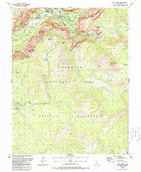 1990 Half Dome1990 Print · USGSThe Yosemite Valley floor and its iconic granite summits are documented here during the late eighties. Researchers can trace the development of Yosemite Village and historic sites like the Ahwahnee Hotel alongside the Half Dome Trail.2 unique versions available
 - 1992 Map of Half Dome, 1995 Print
 1992 Half Dome1995 Print · USGSYosemite Valley in the early 1990s reveals the intricate balance between famous landmarks and a vast trail network. Trace the routes to Half Dome, locate the historic Ahwahnee Hotel, and follow the Merced River through Yosemite Village.
 - 1997 Map of Half Dome, 2002 Print
 1997 Half Dome2002 Print · USGSMariposa County at the close of the twentieth century shows the intersection of wilderness and world-famous infrastructure within Yosemite National Park. Trace the paths of early visitors along the John Muir Trail or locate historic lodging at the Ahwahnee Hotel and Yosemite Lodge.
End of results
Showing maps 1-3 of 3
Frequently asked questions
- What are the different types of historical maps available for Yosemite Lodge?
- What is the oldest map of Yosemite Lodge?
- Where can I purchase historical maps of Yosemite Lodge for my home or office?
- Where can I download high-res historical maps of Yosemite Lodge?
- Are there historical topographic maps available for Yosemite Lodge?
- Is there historical aerial imagery available for Yosemite Lodge?
- Where are historical maps of Yosemite Lodge sourced from?