Old Maps of Albion, California for Genealogy
Trace your family roots with 9 historic maps of Albion. These high-res maps reveal old neighborhoods, homesites, landmarks, and streets — helping you uncover where your ancestors lived and how the area evolved over time.
- Explore historic neighborhoods: Identify where your relatives may have lived in the 1800s or 1900s.
- Compare maps over time: Trace the changes in streets, buildings, and landmarks for multi-generational research.
- Perfect for genealogy & ancestry research: Used by family historians and researchers to map out lineage and migration.
These maps are an incredible resource for exploring your personal connection to Albion's past.
Albion, CA maps
(9)- 1943 Map of Albion
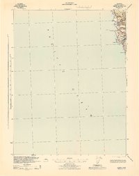 1943 Albion1943 Print · USGSCoastal Mendocino County is mapped during the early 1940s, showing the intersection of the timber-rich hills and the rocky shoreline. Trace early settlements like Albion and Handley, and locate landmarks along the Navarro River and Navarro Ridge Road.2 unique versions available
 - 1957 Map of Ukiah, 1966 Print
 1957 Ukiah1966 Print · USGSNorthern California's diverse terrain comes into focus in the mid-1950s, from the rugged timberlands of the Jackson State Forest to the productive Sacramento Valley. Genealogists and historians can trace the rail lines of the Northwestern Pacific or locate early valley settlements like Arbuckle and Paskenta.3 unique versions available
 - 1960 Map of Ukiah
 1960 Ukiah1960 Print · USGSNorthern California during the late fifties reveals a landscape of deep timber forests and valley agriculture before modern expansion. Trace the historic rail lines of the California Western RR and the Northwestern Pacific RR through settlements like Fort Bragg and Ukiah.2 unique versions available
 - 1960 Map of Albion, 1962 Print
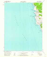 1960 Albion1962 Print · USGSThe Mendocino coast in the early sixties is captured here at the height of its mid-century character. Genealogists and local historians can trace the Whitesboro settlement site and family-named landmarks like McPherson and Handley.3 unique versions available
 - 1981 Map of Ukiah
 1981 Ukiah1981 Print · USGSMendocino County’s timber and rail landscape is captured here in the early eighties, from the coastal lumber mills to the inland valleys. Trace the California Western Railroad and find settlements like Fort Bragg, Comptche, and Navarro.3 unique versions available
 - 2012 Map of Albion, 2012 Print
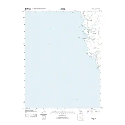 2012 Albion2012 Print · USGSCovers Albion, including Mendocino County, United States, and other nearby areas
 - 2015 Map of Albion, 2015 Print
 2015 Albion2015 Print · USGSCovers Albion, including Mendocino County, United States, and other nearby areas
 - 2018 Map of Albion, 2018 Print
 2018 Albion2018 Print · USGSCovers Albion, including Mendocino County, United States, and other nearby areas
 - 2021 Map of Albion, 2021 Print
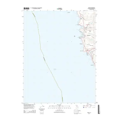
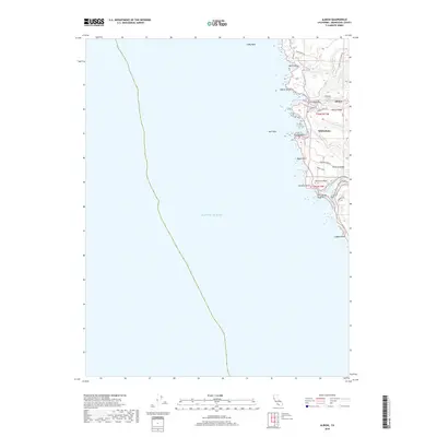
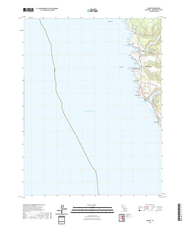 2021 Albion2021 Print · USGSThe Mendocino coast at the start of the 2020s shows a landscape of river-carved ridges and seaside settlements. Trace the coastal roads to reach Whitesboro, Albion Flat, and the distinct Arch of the Navarro at the mouth of the Navarro River.
End of results
Showing maps 1-9 of 9
Top cities near Albion
Frequently asked questions
- What are the different types of historical maps available for Albion?
- What is the oldest map of Albion?
- Where can I purchase historical maps of Albion for my home or office?
- Where can I download high-res historical maps of Albion?
- Are there historical topographic maps available for Albion?
- Is there historical aerial imagery available for Albion?
- Where are historical maps of Albion sourced from?