1900s (20th Century) Maps of Soda Springs, California
Explore 6 historic maps of Soda Springs from the 1900s (20th Century). These maps offer a rare glimpse into what life looked like during the 1900s — showing old roads, neighborhoods, homes, and landmarks that have changed or disappeared over time.
Whether you're researching your family's past, planning a metal detecting trip, or studying how Soda Springs's landscape evolved across the 1900s, these high-resolution maps are a powerful tool for exploring the history of this region.
- Focus on a specific era: All maps on this page are from the 1900s, giving you a focused view of this time period.
- See what’s changed: Compare century-old streets, trails, and buildings to today's modern landscape using overlays and satellite layers.
- Research with precision: Use these maps for genealogy, historical research, land use analysis, or educational projects.
- View, download, or print: Maps are fully viewable online in high resolution, and can be downloaded or printed for your own records.
Start exploring Soda Springs's history through authentic maps from the 1900s. This is your window into the past.
Soda Springs, CA maps
(6)- 1943 Map of Boonville, 1954 Print
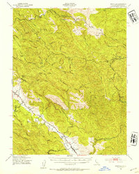 1943 Boonville1954 Print · USGSMendocino County's ranching and timber heartland is captured here during the 1940s, focused on the Anderson Valley settlements. Genealogists and researchers can trace family-named sites like Whipple Ranch and Hagemann Ranch, along with several rural schoolhouses such as Con Creek Sch.
 - 1957 Map of Ukiah, 1966 Print
 1957 Ukiah1966 Print · USGSNorthern California's diverse terrain comes into focus in the mid-1950s, from the rugged timberlands of the Jackson State Forest to the productive Sacramento Valley. Genealogists and historians can trace the rail lines of the Northwestern Pacific or locate early valley settlements like Arbuckle and Paskenta.3 unique versions available
 - 1959 Map of Boonville, 1961 Print
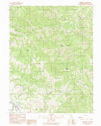
 1959 Boonville1961 Print · USGSAnderson Valley was a thriving timber and ranching corridor in the late fifties. Genealogists and historians can trace family lands at Old Bailey Place, the Philbrick Mill, and the Evergreen Cem near the County Fairgrounds.2 unique versions available
 - 1960 Map of Ukiah
 1960 Ukiah1960 Print · USGSNorthern California during the late fifties reveals a landscape of deep timber forests and valley agriculture before modern expansion. Trace the historic rail lines of the California Western RR and the Northwestern Pacific RR through settlements like Fort Bragg and Ukiah.2 unique versions available
 - 1981 Map of Ukiah
 1981 Ukiah1981 Print · USGSMendocino County’s timber and rail landscape is captured here in the early eighties, from the coastal lumber mills to the inland valleys. Trace the California Western Railroad and find settlements like Fort Bragg, Comptche, and Navarro.3 unique versions available
 - 1991 Map of Boonville
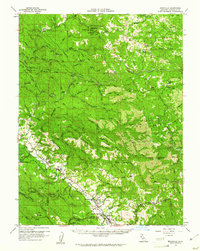
 1991 Boonville1991 Print · USGSBoonville and the southern reaches of the Anderson Valley are documented here in the early nineties, showing a landscape of deep canyons and family-named ridges. Genealogists and researchers can trace local landmarks like Fairground, Soda Spring, and Casabonne Peak.
End of results
Showing maps 1-6 of 6
Top cities near Soda Springs
- Ukiah historical maps
- Redwood Valley historical maps
- Talmage historical maps
- Talmage historical maps
- Boonville historical maps
Frequently asked questions
- What are the different types of historical maps available for Soda Springs?
- What is the oldest map of Soda Springs?
- Where can I purchase historical maps of Soda Springs for my home or office?
- Where can I download high-res historical maps of Soda Springs?
- Are there historical topographic maps available for Soda Springs?
- Is there historical aerial imagery available for Soda Springs?
- Where are historical maps of Soda Springs sourced from?