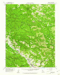
1959 Map of Boonville
USGS Topo · Published 1961About this map
Boonville and Philo anchor the Anderson Valley in this late-1950s survey of the California Coast Ranges. The landscape is defined by the steep ridges of the North Fork Navarro River and the Masonite Industrial Road, a dedicated heavy-haul timber route winding through the backcountry toward Orrs Springs. This network of private and public roads supported a robust logging economy, evidenced by operations like the Philbrick Mill near Lazy Creek.
Find a feature on this map
103 named features on this map. Tap any name to fly to it.
Don’t see what you’re looking for? This feature index may not catch every label — zoom into the map to look around manually.
Map Details
Editions of this 1959 Boonville Map
2 editions found
Other maps of this area

1920 · Glenblair
USGS Topo · 1:62,500

1920 · Ukiah
USGS Topo · 1:62,500

1922 · Willits
USGS Topo · 1:62,500

1938 · Hopland
USGS Topo · 1:62,500

1942 · Willits
USGS Topo · 1:62,500

1943 · Point Arena
USGS Topo · 1:62,500

1943 · Glenblair
USGS Topo · 1:62,500

1943 · Pomo
USGS Topo · 1:62,500

1943 · Boonville
USGS Topo · 1:62,500

1943 · Navarro
USGS Topo · 1:62,500