Old Maps of Le Grand, California for Academic Research
Study the evolution of Le Grand with 24 high-resolution historic maps. Whether you're teaching, researching, or modeling changes in land use, these maps provide essential visual documentation of urban, environmental, and geographic change.
- Analyze long-term change: Track patterns in development, transportation, and natural features.
- Ideal for environmental or urban studies: Support academic projects with primary historical map data.
- Use in the classroom or lab: Educators and researchers rely on these maps to bring historical context to life.
These maps are a powerful tool for teaching, research, and visualizing how Le Grand has changed over the decades.
Le Grand, CA maps
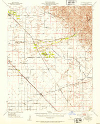
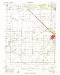
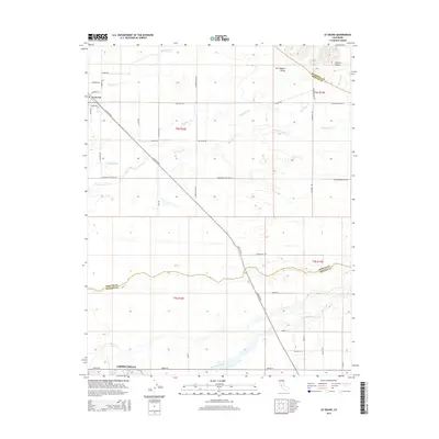
(24)- 1918 Map of La Grand
 1918 La Grand1918 Print · USGSAgricultural life in the San Joaquin Valley comes into focus just before the 1920s, dominated by the railroad and a network of Sierra-fed creeks. You can trace the early rail stops at Dickinson and Marguerite or locate rural landmarks like Appling School and the Chowchilla River.
 - 1919 Map of Plainsberg
 1919 Plainsberg1919 Print · USGSThe Central Valley's agricultural and rail heartland is captured here just after the Great War, showing a landscape defined by seasonal sloughs and early highways. Genealogists can locate family sites near Savanna School or early transit hubs like Plainsberg and Minturn.
 - 1942 Map of Athlone
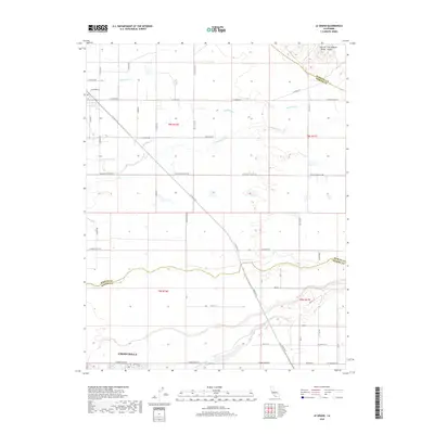
 1942 Athlone1942 Print · USGSThe Merced and Madera county line area is shown here in the early 1940s as agricultural irrigation and rail transport defined the region. Genealogists can locate family-named landmarks like Bliss Ranch and several rural schoolhouses including Alamo Sch and Pioneer Sch.
 - 1946 Map of Le Grand, 1953 Print
 1946 Le Grand1953 Print · USGSThe San Joaquin Valley agricultural heartland comes into focus during the mid-forties, showing the vital rail corridors and watercourses that shaped the region. Genealogists and local researchers can trace early settlements and rural school sites like Dixieland School, Fairmead, and the northern hub of Le Grand.2 unique versions available
 - 1946 Map of Le Grand, 1961 Print
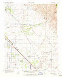
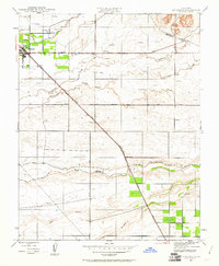 1946 Le Grand1961 Print · USGSLe Grand and the surrounding Central Valley ranch lands are captured here just after the war as the region's agricultural footprint matured. Researchers can trace the path of the Atchison Topeka and Santa Fe through Le Grand and Marguerite, or locate early industrial sites like the Gravel Pit near Mariposa Creek.
 - 1947 Map of Le Grand
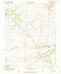
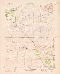 1947 Le Grand1947 Print · USGSThe Central Valley agricultural landscape of Merced and Madera counties comes into focus just after the war. Researchers can trace the Sharon Atchison Topeka and Santa Fe line through Le Grand and Marguerite, past Ash Slough and dozens of rural windmills.
 - 1947 Map of Plainsburg
 1947 Plainsburg1947 Print · USGSIn the San Joaquin Valley after the war, this area shows a landscape defined by irrigation and heavy rail. Trace the old stops at Athlone and Minturn, locate the Savana Sch, or find the numerous windmills dotting the plains near Plainsburg.2 unique versions available
 - 1947 Map of San Jose, 1948 Print
 1947 San Jose1948 Print · USGSNorthern California's heartland is captured here just after the war, showing the rapid growth of the Santa Clara and Central Valleys. Researchers can trace the legacy of rail and water at Castle Air Force Base, Stockton, and the Hetch Hetchy Aqueduct.
 - 1956 Map of San Jose
 1956 San Jose1956 Print · USGSCentral California in the mid-fifties reveals the transition from sprawling orchards to growing urban hubs like San Jose and Stockton. Genealogists and historians can trace the rail-era landscape of the Mother Lode through Chinese Camp and Tuttletown, or follow the water through the Joaquin River and Calaveras Reservoir.
 - 1960 Map of Plainsburg, 1961 Print
 1960 Plainsburg1961 Print · USGSThe San Joaquin Valley's agricultural heartland is captured here at the start of the 1960s, showing a landscape defined by orchards and vital rail corridors. Genealogists and local historians can trace family-named roads and landmarks like Plainsburg, the Savana Sch, and the junction of the Southern Pacific railroad.3 unique versions available
 - 1960 Map of Chowchilla, 1962 Print
 1960 Chowchilla1962 Print · USGSThe San Joaquin Valley's agricultural heartland is mapped here during a period of steady growth along the Southern Pacific rail line. Genealogists can locate family sites near Chowchilla, Le Grand, and Ashview Sch, or trace historical property lines along SANDY MUSH ROAD.
 - 1961 Map of Le Grand, 1962 Print
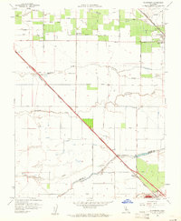
 1961 Le Grand1962 Print · USGSThe agricultural plains of Merced and Madera counties are captured here in the early sixties as irrigation transformed the valley. Genealogists and local historians can trace the Atchison Topeka and Santa Fe line through Le Grand and locate family landmarks like Raynor Ranch.2 unique versions available
 - 1961 Map of Le Grand, 1963 Print
 1961 Le Grand1963 Print · USGSMerced and Madera Counties come into focus in the early sixties, showing the vital intersection of the Southern Pacific and Santa Fe rail lines. Genealogists and researchers can locate the Madera Air Force Station, trace the rural Dixieland Sch, and find the exact positions of settlements like Fairmead and Le Grand.
 - 1962 Map of San Jose
 1962 San Jose1962 Print · USGSCentral California in the early sixties showcases the expansion of the San Joaquin and Santa Clara valleys. Researchers can trace the rail-to-road transition along the Southern Pacific RR or locate landmarks like Castle USAF Base and Loma Prieta.4 unique versions available
 - 1966 Map of San Jose
 1966 San Jose1966 Print · USGSCentral California in the mid-1960s reveals a landscape of massive irrigation projects and expanding Cold War military footprints. Researchers can trace the rail-and-river network of the San Joaquin Valley or locate specialized sites like Castle Air Force Base and the Sharp General Depot (Military).
 - 1983 Map of Merced
 1983 Merced1983 Print · USGSThe San Joaquin Valley at the start of the eighties is captured here in its full agricultural and military height. Trace the legacy of Castle Air Force Base, old mines like Pocahontas Mine, and the vast Kesterson National Wildlife Refuge.
 - 2012 Map of Le Grand, 2012 Print
 2012 Le Grand2012 Print · USGSCovers Le Grand, including Chowchilla, Merced County, and other nearby areas
 - 2012 Map of Plainsburg, 2012 Print
 2012 Plainsburg2012 Print · USGSCovers Le Grand, including Chowchilla, Athlone, and other nearby areas
 - 2015 Map of Plainsburg, 2015 Print
 2015 Plainsburg2015 Print · USGSCovers Le Grand, including Chowchilla, Athlone, and other nearby areas
 - 2015 Map of Le Grand, 2015 Print
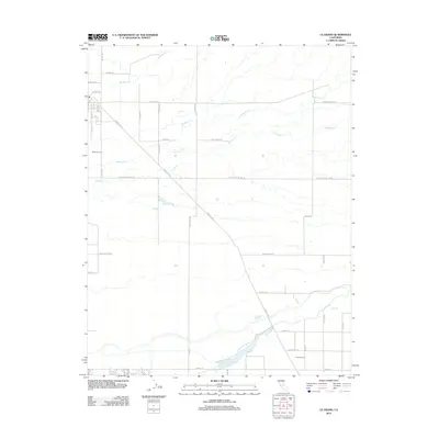
 2015 Le Grand2015 Print · USGSCovers Le Grand, including Chowchilla, Merced County, and other nearby areas
 - 2018 Map of Plainsburg, 2018 Print
 2018 Plainsburg2018 Print · USGSCovers Le Grand, including Chowchilla, Athlone, and other nearby areas
 - 2018 Map of Le Grand, 2018 Print
 2018 Le Grand2018 Print · USGSCovers Le Grand, including Chowchilla, Merced County, and other nearby areas
 - 2021 Map of Le Grand, 2021 Print
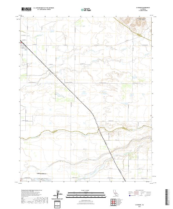 2021 Le Grand2021 Print · USGSMerced and Madera counties meet along the Chowchilla River in this modern survey of the San Joaquin agricultural belt. Genealogists can trace property lines and rural routes like Buchanan Hollow Rd or the northern outskirts of Chowchilla.
 - 2021 Map of Plainsburg, 2021 Print
 2021 Plainsburg2021 Print · USGSThe rural agricultural heart of the San Joaquin Valley is documented here just north of the Madera County line. Genealogists and local historians can trace the areas around Plainsburg, Le Grand, and the Helm - Turner Cem along the Santa Fe Ave corridor.
End of results
Showing maps 1-24 of 24
Top cities near Le Grand
Frequently asked questions
- What are the different types of historical maps available for Le Grand?
- What is the oldest map of Le Grand?
- Where can I purchase historical maps of Le Grand for my home or office?
- Where can I download high-res historical maps of Le Grand?
- Are there historical topographic maps available for Le Grand?
- Is there historical aerial imagery available for Le Grand?
- Where are historical maps of Le Grand sourced from?