Old Maps of Day, California for Genealogy
Trace your family roots with 14 historic maps of Day. These high-res maps reveal old neighborhoods, homesites, landmarks, and streets — helping you uncover where your ancestors lived and how the area evolved over time.
- Explore historic neighborhoods: Identify where your relatives may have lived in the 1800s or 1900s.
- Compare maps over time: Trace the changes in streets, buildings, and landmarks for multi-generational research.
- Perfect for genealogy & ancestry research: Used by family historians and researchers to map out lineage and migration.
These maps are an incredible resource for exploring your personal connection to Day's past.
Day, CA maps
(14)- 1886 Map of Modoc Lava Bed
 1886 Modoc Lava Bed1886 Print · USGSNortheastern California is surveyed here in the years following the Modoc War, showing the volcanic terrain of the Modoc Lava Bed and early river settlements. Trace pioneer history through Modoc Rifle Pits, a Ferry on the Pit River, and old outposts like Bieber and Lookout.
 - 1892 Map of Modoc Lava-Bed
 1892 Modoc Lava-Bed1892 Print · USGSNortheastern California's volcanic terrain is meticulously charted in the 1890s, before modern irrigation altered the great northern basins. Genealogists and historians can locate early outposts like Burgettville, the Modoc Rifle Pit, and the high-altitude Ice Cave.7 unique versions available
 - 1954 Map of Alturas, 1968 Print
 1954 Alturas1968 Print · USGSThe Modoc Plateau and Surprise Valley appear in the mid-1950s as a landscape of remote ranching towns and vast wildlife refuges. Researchers can trace early settlements like Fort Bidwell, locate the McArthur Grain Elevator, and follow the Southern Pacific rail lines.4 unique versions available
 - 1958 Map of Alturas
 1958 Alturas1958 Print · USGSThe Modoc Plateau and Warner Mountains appear here during the late fifties, showcasing a landscape of high-desert ranching and volcanic terrain. Researchers can trace the rail-and-water economy through Alturas, Cedarville, and the Fort Bidwell Indian Res.2 unique versions available
 - 1961 Map of Fall River Mills, 1963 Print
 1961 Fall River Mills1963 Print · USGSNortheastern California at the dawn of the 1960s reveals a unique landscape of volcanic lava beds and extensive river irrigation. Researchers can trace family history at Pine Grove Cemetery and Island School, or explore the complex waterways of Big Lake and the Fall River.2 unique versions available
 - 1962 Map of Alturas
 1962 Alturas1962 Print · USGSThe high desert of Modoc and Siskiyou counties is shown in the early sixties as a hub of timber, rail, and agriculture. Genealogists and historians can trace rail-side life via the Southern Pacific RR, the Tionesta PO, and the McArthur Grain Elevator.
 - 1965 Map of Alturas
 1965 Alturas1965 Print · USGSNortheastern California and southern Oregon appear in this mid-century survey of the high plateau and volcanic highlands. Researchers can trace the path of the Southern Pacific railroad through Alturas or locate rural outposts like Stronghold and Eagleville.
 - 1984 Map of McArthur
 1984 McArthur1984 Print · USGSThe northern California high country near McArthur is captured in the mid-1980s, showcasing a landscape of volcanic peaks and river valleys. Genealogists and historians can trace the rail connections at Nubieber and Bieber, or locate family sites near Pittville and Glenburn.
 - 1990 Map of Day
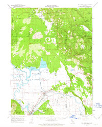
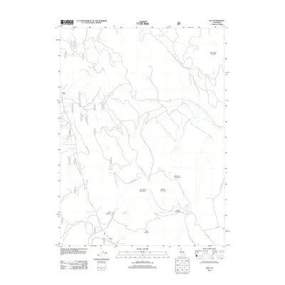
 1990 Day1990 Print · USGSUpper Modoc and Shasta counties appear as a rugged landscape of volcanic peaks and forest basins during the 1990s. Researchers can trace the Old Railroad Grade, locate the isolated settlement of Day with its cemetery, and identify the Widow Mountain Radio Facility.
 - 1995 Map of Day, 1997 Print
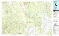
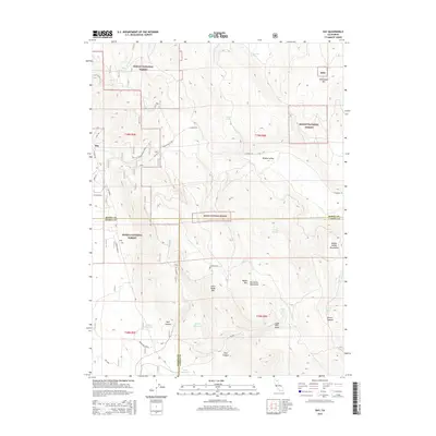
 1995 Day1997 Print · USGSThe Modoc high country comes into focus in the mid-nineties, showing the rural settlement of Day and the tri-county borders of Shasta, Lassen, and Modoc. Researchers can trace the path of the Old R.R. Grade or locate family landmarks like Brown Cabin and the local Cem.
 - 2012 Map of Day, 2012 Print
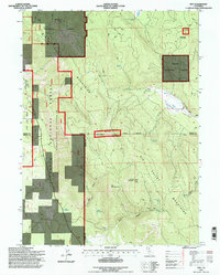
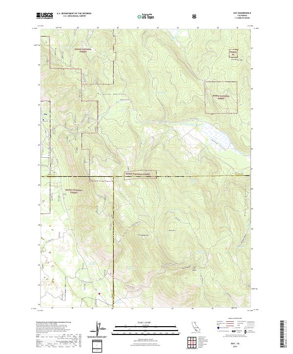
 2012 Day2012 Print · USGSCovers Day, including Shasta County, Lassen County, and other nearby areas
 - 2015 Map of Day, 2015 Print
 2015 Day2015 Print · USGSCovers Day, including Shasta County, Lassen County, and other nearby areas
 - 2018 Map of Day, 2018 Print
 2018 Day2018 Print · USGSCovers Day, including Shasta County, Lassen County, and other nearby areas
 - 2021 Map of Day, 2021 Print
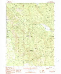
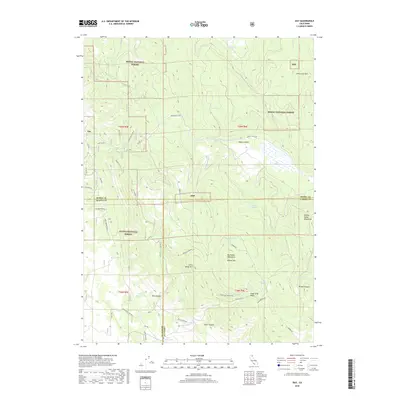
 2021 Day2021 Print · USGSThe high timber and mountain valleys of Modoc and Shasta counties are captured here in the early twenty-first century. Researchers can trace land use through the Day Cem and Pit Indian Cem, or locate remote landmarks like Jimmerson Mtn and Indian Reservoir.
End of results
Showing maps 1-14 of 14
Frequently asked questions
- What are the different types of historical maps available for Day?
- What is the oldest map of Day?
- Where can I purchase historical maps of Day for my home or office?
- Where can I download high-res historical maps of Day?
- Are there historical topographic maps available for Day?
- Is there historical aerial imagery available for Day?
- Where are historical maps of Day sourced from?