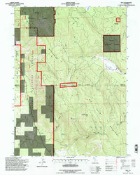
1995 Map of Day
USGS Topo · Published 1997About this map
The settlement of Day stands at the northwestern edge of a landscape defined by the intersection of three counties and the boundaries of the Modoc National Forest and Shasta National Forest. This 1990s revision reveals a terrain dominated by the Modoc Mountains and high basins like Widow Valley. A legacy of industrial transport is etched into the earth via the Old R.R. Grade which winds through the valley floor, suggesting the region's historical reliance on timber or mineral extraction.
Find a feature on this map
41 named features on this map. Tap any name to fly to it.
Don’t see what you’re looking for? This feature index may not catch every label — zoom into the map to look around manually.
Map Details
Editions of this 1995 Day Map
This is the sole edition of this map. No revisions or reprints were ever made.
Other maps of this area

1886 · Modoc Lava Bed
USGS Topo · 1:250,000

1892 · Modoc Lava-Bed
USGS Topo · 1:250,000

1954 · Alturas
USGS Topo · 1:250,000

1958 · Alturas
USGS Topo · 1:250,000

1961 · Bieber
USGS Topo · 1:62,500

1961 · Fall River Mills
USGS Topo · 1:62,500

1962 · Alturas
USGS Topo · 1:250,000

1962 · Crank Mountain
USGS Topo · 1:62,500

1962 · White Horse
USGS Topo · 1:62,500

1965 · Alturas
USGS Topo · 1:250,000