Old Maps of Bodie, California for Academic Research
Study the evolution of Bodie with 15 high-resolution historic maps. Whether you're teaching, researching, or modeling changes in land use, these maps provide essential visual documentation of urban, environmental, and geographic change.
- Analyze long-term change: Track patterns in development, transportation, and natural features.
- Ideal for environmental or urban studies: Support academic projects with primary historical map data.
- Use in the classroom or lab: Educators and researchers rely on these maps to bring historical context to life.
These maps are a powerful tool for teaching, research, and visualizing how Bodie has changed over the decades.
Bodie, CA maps
(15)- 1909 Map of Bridgeport, 1956 Print
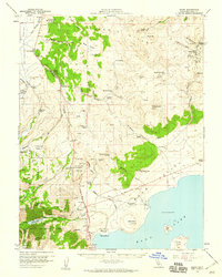
 1909 Bridgeport1956 Print · USGSThe High Sierra and Mono Basin are seen here in the decade following the peak of the local gold boom. Genealogists and historians can trace old stage routes and find significant mining sites like the Dunderberg Mine and the remote settlement of Belfort.
 - 1911 Map of Bridgeport
 1911 Bridgeport1911 Print · USGSMono County at the start of the twentieth century was a landscape of high-altitude mining camps and early park boundaries. Trace the footprints of the gold era at Bodie, locate family ranching history at Mormon Ranch, or study the remote Masonic Liberty Mine.7 unique versions available
 - 1920 Map of Bridgeport
 1920 Bridgeport1920 Print · USGSThe High Sierra and Mono Basin are shown here in the early twentieth century, during a peak period of mining and ranching. Researchers can locate vanished camps like Star City, trace the California Masonic Road, and find family names at Conway Ranch.
 - 1948 Map of Walker Lake
 1948 Walker Lake1948 Print · USGSThe high desert of Nevada and the eastern Sierra Nevada are captured just after the war as mining and ranching shaped the local economy. Genealogists can trace family connections to centers like Hawthorne and Mina or locate the historic Rockland Mines and Aurora.2 unique versions available
 - 1957 Map of Walker Lake
 1957 Walker Lake1957 Print · USGSThe Nevada-California borderlands in the mid-1950s show a rugged network of mining camps and river-valley towns centered around Walker Lake. Researchers can trace the Southern Pacific rail line and locate historical sites like Bodie, Sodaville, and the Leviathan Sulphur Mine.4 unique versions available
 - 1958 Map of Bodie, 1959 Print
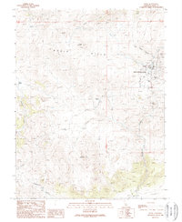
 1958 Bodie1959 Print · USGSThe Bodie Hills and Mono Lake shoreline are captured here in the late fifties, during a period when the historic mining district still stood in stark isolation. Genealogists and historians can trace the foundations of the boom era through the Bodie Cem, Mono Diggings, and the Red Cloud Mine.3 unique versions available
 - 1962 Map of Walker Lake
 1962 Walker Lake1962 Print · USGSThe high desert of western Nevada and the Sierra Nevada crest meet in this mid-century study of the Eastern Sierra frontier. Researchers can trace the Southern Pacific rail lines connecting Hawthorne to remote mining outposts like Bodie, Aurora, and Mina.
 - 1964 Map of Walker Lake
 1964 Walker Lake1964 Print · USGSThe high desert and the Sierra Nevada peaks come together in the mid-1960s, showing a landscape defined by mining, military installations, and vast wilderness. Genealogists and historians can trace the remnants of old mining camps at Bodie or Candelaria and follow the Southern Pacific rail lines.2 unique versions available
 - 1985 Map of Bridgeport
 1985 Bridgeport1985 Print · USGSThe High Sierra and Nevada borderlands are captured in the mid-1980s, documenting a landscape of national forests and high-altitude mining districts. Researchers can trace historic operations like the Bodie Mine and May Lundy Mine or locate early settlements at Aurora and Baker Station.
 - 1989 Map of Bodie
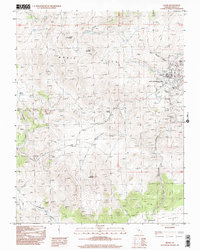
 1989 Bodie1989 Print · USGSThe mining landscape of the eastern Sierra unfolds here in the late eighties, centered on the high-elevation town of Bodie. Researchers can trace the extensive network of prospects, including the Red Cloud Mine, and locate the State Historical Park Cemetery.
 - 1998 Map of Bodie, 2002 Print
 1998 Bodie2002 Print · USGSThe mining district of the Bodie Hills is captured in the late twentieth century, showing the preserved townsite of Bodie and its surrounding industry. Researchers can trace the layout of Mine Shafts, the local Cemetery, and trails leading to Potato Peak.
 - 2012 Map of Bodie, 2012 Print
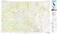
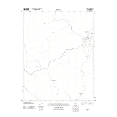 2012 Bodie2012 Print · USGSCovers Bodie, including Mono County, United States, and other nearby areas
 - 2015 Map of Bodie, 2015 Print
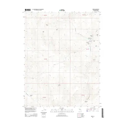 2015 Bodie2015 Print · USGSCovers Bodie, including Mono County, United States, and other nearby areas
 - 2018 Map of Bodie, 2018 Print
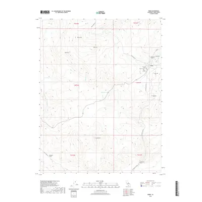 2018 Bodie2018 Print · USGSCovers Bodie, including Mono County, United States, and other nearby areas
 - 2021 Map of Bodie, 2021 Print
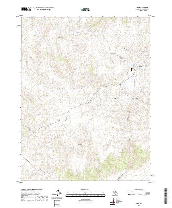 2021 Bodie2021 Print · USGSHigh-elevation mining country in Mono County comes into focus in this modern survey. Researchers can locate the famous town of Bodie and its three distinct cemeteries, Wards Cem, Masonic Cem, and Miners Union Cem.
End of results
Showing maps 1-15 of 15
Frequently asked questions
- What are the different types of historical maps available for Bodie?
- What is the oldest map of Bodie?
- Where can I purchase historical maps of Bodie for my home or office?
- Where can I download high-res historical maps of Bodie?
- Are there historical topographic maps available for Bodie?
- Is there historical aerial imagery available for Bodie?
- Where are historical maps of Bodie sourced from?