1900s (20th Century) Maps of Bradley, California
Explore 12 historic maps of Bradley from the 1900s (20th Century). These maps offer a rare glimpse into what life looked like during the 1900s — showing old roads, neighborhoods, homes, and landmarks that have changed or disappeared over time.
Whether you're researching your family's past, planning a metal detecting trip, or studying how Bradley's landscape evolved across the 1900s, these high-resolution maps are a powerful tool for exploring the history of this region.
- Focus on a specific era: All maps on this page are from the 1900s, giving you a focused view of this time period.
- See what’s changed: Compare century-old streets, trails, and buildings to today's modern landscape using overlays and satellite layers.
- Research with precision: Use these maps for genealogy, historical research, land use analysis, or educational projects.
- View, download, or print: Maps are fully viewable online in high resolution, and can be downloaded or printed for your own records.
Start exploring Bradley's history through authentic maps from the 1900s. This is your window into the past.
Bradley, CA maps
(12)- 1919 Map of Bradley
 1919 Bradley1919 Print · USGSThe Salinas River valley comes alive in the late 1910s, showing the early railroad era in Monterey County. Genealogists can trace family-named sites like Williams Ranch and schools like Hames Valley School or Nacimiento School.4 unique versions available
 - 1941 Map of Bradley
 1941 Bradley1941 Print · USGSCoastal California ranching and rail life are recorded here during the early years of the war. Genealogists and local historians can locate early homesteads and schoolhouses like Hames School or trace the Southern Pacific Coast Line through Bradley.
 - 1947 Map of San Luis Obispo, 1948 Print
 1947 San Luis Obispo1948 Print · USGSCoastal California at the dawn of the Cold War reveals a landscape of massive military reservations and quiet seaside towns. Genealogists and researchers can trace the Southern Pacific rail line, old mining sites like Los Burros Mine, and local landmarks from Point Buchon to the Carrizo Plain.
 - 1948 Map of San Luis Obispo
 1948 San Luis Obispo1948 Print · USGSCentral Coast life in the late 1940s is centered on the Southern Pacific rail line and expanding military bases. Genealogists can trace early rural life through Union School and local operations like the Klau Mine or Buena Vista Mine.
 - 1948 Map of Bradley, 1957 Print
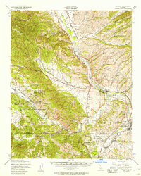 1948 Bradley1957 Print · USGSMonterey and San Luis Obispo counties come together in the late 1940s as military expansion meets traditional ranching along the Salinas River. Genealogists and historians can trace the transition from rural holdings like Branch Ranch to the borders of Camp Roberts and the Hunter Liggett Military Reservation.2 unique versions available
 - 1949 Map of Bradley, 1953 Print
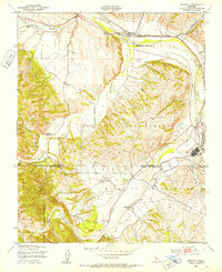 1949 Bradley1953 Print · USGSSouthern Monterey County at the close of the 1940s is defined by its major river junctions and the footprint of the Camp Roberts Military Reservation. Researchers can trace the Southern Pacific rail line through Bradley or locate family sites at Nacimiento Ranch and the local Cem.7 unique versions available
 - 1956 Map of San Luis Obispo, 1963 Print
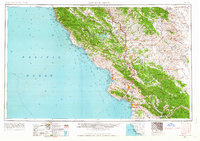 1956 San Luis Obispo1963 Print · USGSCentral California coastal and valley life unfolds in the mid-fifties, from the shoreline of Pismo Beach to the arid Carrizo Plain. Trace early travel routes along the Southern Pacific RR or locate family sites near the Templeton Cemetery and Paso Robles County Cemetery.5 unique versions available
 - 1957 Map of San Luis Obispo
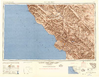 1957 San Luis Obispo1957 Print · USGSCoastal California in the late fifties is defined by the steep Santa Lucia Range and the rail-connected hub of San Luis Obispo. Genealogists and researchers can trace rural life via Union School, the Southern Pacific line, and old sites like the Polar Star Mine.
 - 1958 Map of San Luis Obispo
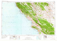 1958 San Luis Obispo1958 Print · USGSThe Central Coast in the late fifties reveals a landscape of ranching and early tourism before the massive expansion of the modern era. Trace the path of the Southern Pacific through Atascadero or locate family roots in coastal towns like Cayucos and Cambria.
 - 1961 Map of Bradley, 1968 Print
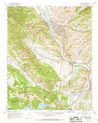 1961 Bradley1968 Print · USGSMonterey County in the early sixties is a landscape defined by the intersection of military training grounds, oil extraction, and ranching life. Researchers can trace the path of the Southern Pacific Railroad through Bradley or locate family sites near Pleyto and Hames Valley Hall.2 unique versions available
 - 1976 Map of Bradley
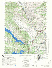 1976 Bradley1976 Print · USGSThe Salinas River valley in the mid-1970s shows a complex landscape of oil extraction, military training, and massive reservoirs. Researchers can trace the legacy of the Southern Pacific railroad, the rural Hames Valley Hall, and the vast Camp Roberts Military Reservation.
 - 1989 Map of Paso Robles
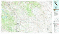 1989 Paso Robles1989 Print · USGSCoastal mountains and the Salinas River valley meet in the late eighties as this region balances military installations and agriculture. Genealogists and historians can trace the Southern Pacific line through Paso Robles and Templeton or locate the Klau Mine and San Miguel.
End of results
Showing maps 1-12 of 12
Top cities near Bradley
Frequently asked questions
- What are the different types of historical maps available for Bradley?
- What is the oldest map of Bradley?
- Where can I purchase historical maps of Bradley for my home or office?
- Where can I download high-res historical maps of Bradley?
- Are there historical topographic maps available for Bradley?
- Is there historical aerial imagery available for Bradley?
- Where are historical maps of Bradley sourced from?