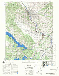
1976 Map of Bradley
USGS Topo · Published 1976About this map
San Ardo Oil Field occupies the high ground east of the Salinas River, illustrating the industrial footprint of petroleum extraction in Monterey County during the mid-1970s. The valley below is dominated by the Southern Pacific railroad corridor and U S Highway 101, which parallel the river's winding course through Bradley. To the south and west, the landscape shifts toward massive water management projects and military utility. The confluence of the San Antonio River and Nacimiento River is transformed by the San Antonio Dam and Nacimiento Dam, creating expansive reservoirs that straddle the Monterey Co San Luis Obispo Co line. These waters border the northern reaches of the Camp Roberts Military Reservation, while isolated landmarks like Hames Valley Hall and the Cem near the river provide evidence of the area's rural social fabric.
Find a feature on this map
45 named features on this map. Tap any name to fly to it.
Don’t see what you’re looking for? This feature index may not catch every label — zoom into the map to look around manually.
Map Details
Editions of this 1976 Bradley Map
This is the sole edition of this map. No revisions or reprints were ever made.
Other maps of this area

1912 · San Ardo
USGS Topo · 1:31,680

1915 · Priest Valley
USGS Topo · 1:125,000

1919 · San Miguel
USGS Topo · 1:62,500

1919 · King City
USGS Topo · 1:62,500

1919 · Bryson
USGS Topo · 1:62,500

1919 · Paso Robles
USGS Topo · 1:62,500

1919 · Bradley
USGS Topo · 1:62,500

1919 · Adelaida
USGS Topo · 1:62,500

1919 · San Simeon
USGS Topo · 1:62,500

1932 · Adelaida
USGS Topo · 1:62,500