Old Maps of Plaskett, California for Hiking & Exploration
Hike through history with 18 historic maps of Plaskett. Explore old trails, ghost towns, and forgotten backroads — perfect for outdoor adventurers and local explorers.
- Rediscover forgotten places: Map out old mining camps, roads, and footpaths that no longer exist on modern maps.
- Layer with modern tools: Combine with LiDAR or satellite views to plan hikes through historical terrain.
- Made for exploration: Popular among hikers, overlanders, and local history lovers.
Use these maps to find adventure and explore the hidden past of Plaskett.
Plaskett, CA maps
(18)- 1921 Map of Cape San Martin
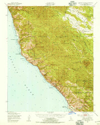
 1921 Cape San Martin1921 Print · USGSThe Big Sur coast and its remote mining interior are documented here during the early twenties, prior to the construction of the modern highway. Local historians can trace family operations like the Krenkels Ranch or investigate the gold-mining era at the Los Burros Mine and the Calizona Mines.6 unique versions available
 - 1941 Map of Cape San Martin
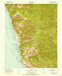
 1941 Cape San Martin1941 Print · USGSThe central California coast was a landscape of remote mining claims and family ranchlands during the early 1940s. Trace the history of the Los Burros Mine and the W R Hearst Foremans Headquarters as the Coast Highway winds past Gorda P O.
 - 1942 Map of Cape San Martin
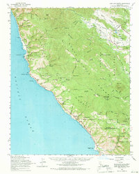
 1942 Cape San Martin1942 Print · USGSThe Monterey coast and Santa Lucia Range are captured here during the early 1940s, just as military use of the backcountry intensified. Genealogists and researchers can locate remote homesteads like the Krenkel Ranch and Dutra Place, alongside several workings like the Polar Star Mine.
 - 1947 Map of San Luis Obispo, 1948 Print
 1947 San Luis Obispo1948 Print · USGSCoastal California at the dawn of the Cold War reveals a landscape of massive military reservations and quiet seaside towns. Genealogists and researchers can trace the Southern Pacific rail line, old mining sites like Los Burros Mine, and local landmarks from Point Buchon to the Carrizo Plain.
 - 1948 Map of San Luis Obispo
 1948 San Luis Obispo1948 Print · USGSCentral Coast life in the late 1940s is centered on the Southern Pacific rail line and expanding military bases. Genealogists can trace early rural life through Union School and local operations like the Klau Mine or Buena Vista Mine.
 - 1948 Map of Cape San Martin, 1955 Print
 1948 Cape San Martin1955 Print · USGSThe Big Sur coastline and the Santa Lucia Range meet in this post-war survey of the central California coast. Genealogists and hikers can trace the original Cabrillo Highway through remote settlements like Gorda and past the Point Star Mine (Abandoned).2 unique versions available
 - 1949 Map of Cape San Martin, 1953 Print
 1949 Cape San Martin1953 Print · USGSThe Monterey coast in the late 1940s reveals a secluded landscape defined by military boundaries and national forest lands. Researchers can trace the Pacific coastline through early settlements at Gorda and Plaskett, finding local landmarks like the Pacific Valley Sch and the peaks of the Santa Lucia Range.4 unique versions available
 - 1956 Map of San Luis Obispo, 1963 Print
 1956 San Luis Obispo1963 Print · USGSCentral California coastal and valley life unfolds in the mid-fifties, from the shoreline of Pismo Beach to the arid Carrizo Plain. Trace early travel routes along the Southern Pacific RR or locate family sites near the Templeton Cemetery and Paso Robles County Cemetery.5 unique versions available
 - 1957 Map of San Luis Obispo
 1957 San Luis Obispo1957 Print · USGSCoastal California in the late fifties is defined by the steep Santa Lucia Range and the rail-connected hub of San Luis Obispo. Genealogists and researchers can trace rural life via Union School, the Southern Pacific line, and old sites like the Polar Star Mine.
 - 1958 Map of San Luis Obispo
 1958 San Luis Obispo1958 Print · USGSThe Central Coast in the late fifties reveals a landscape of ranching and early tourism before the massive expansion of the modern era. Trace the path of the Southern Pacific through Atascadero or locate family roots in coastal towns like Cayucos and Cambria.
 - 1961 Map of Cape San Martin, 1968 Print
 1961 Cape San Martin1968 Print · USGSThe Big Sur coast and Santa Lucia Range are shown here in the early sixties, before the full development of modern tourism. Researchers can trace remote coastal settlements like Plaskett and Gorda, find the Pacific Valley Sch, and locate the Polar Star Mine.2 unique versions available
 - 1962 Map of Cape San Martin
 1962 Cape San Martin1962 Print · USGSThe Big Sur coast meets the high ridges of the Santa Lucia Range in the early sixties. Trace the rugged terrain from Gorda to the Polar Star Mine, or locate historic sites like San Miguelito Ranch and Dutra Flats Camp.
 - 1980 Map of Cambria
 1980 Cambria1980 Print · USGSThe Central Coast in the early eighties shows a landscape of grand estates and isolated seaside outposts. Trace family roots and local history through the coastal village of Cambria, the Hearst Castle grounds, and the historic Lighthouse at Piedras Blancas.2 unique versions available
 - 1995 Map of Cape San Martin, 2000 Print
 1995 Cape San Martin2000 Print · USGSThe Monterey coast in the mid-nineties shows a landscape of dramatic wilderness and small seaside outposts. Trace the coastal Highway 1 through Gorda and Plaskett, or locate family landmarks like Pacific Valley Station and the Prewitt Ridge Campsite.
 - 2012 Map of Cape San Martin, 2012 Print
 2012 Cape San Martin2012 Print · USGSCovers Plaskett, including Gorda, Monterey County, and other nearby areas
 - 2015 Map of Cape San Martin, 2015 Print
 2015 Cape San Martin2015 Print · USGSCovers Plaskett, including Gorda, Monterey County, and other nearby areas
 - 2018 Map of Cape San Martin, 2018 Print
 2018 Cape San Martin2018 Print · USGSCovers Plaskett, including Gorda, Monterey County, and other nearby areas
 - 2021 Map of Cape San Martin, 2021 Print
 2021 Cape San Martin2021 Print · USGSThe Monterey coast and Santa Lucia mountains are captured here in the early twenty-first century. Researchers can trace remote trails and coastal settlements like Gorda or locate geographic landmarks such as Plaskett Rock and Chalk Peak.
End of results
Showing maps 1-18 of 18
Top cities near Plaskett
Frequently asked questions
- What are the different types of historical maps available for Plaskett?
- What is the oldest map of Plaskett?
- Where can I purchase historical maps of Plaskett for my home or office?
- Where can I download high-res historical maps of Plaskett?
- Are there historical topographic maps available for Plaskett?
- Is there historical aerial imagery available for Plaskett?
- Where are historical maps of Plaskett sourced from?