1900s (20th Century) Maps of Huntington Harbor, Huntington Beach
Explore 15 historic maps of Huntington Harbor from the 1900s (20th Century). These maps offer a rare glimpse into what life looked like during the 1900s — showing old roads, neighborhoods, homes, and landmarks that have changed or disappeared over time.
Whether you're researching your family's past, planning a metal detecting trip, or studying how Huntington Harbor's landscape evolved across the 1900s, these high-resolution maps are a powerful tool for exploring the history of this region.
- Focus on a specific era: All maps on this page are from the 1900s, giving you a focused view of this time period.
- See what’s changed: Compare century-old streets, trails, and buildings to today's modern landscape using overlays and satellite layers.
- Research with precision: Use these maps for genealogy, historical research, land use analysis, or educational projects.
- View, download, or print: Maps are fully viewable online in high resolution, and can be downloaded or printed for your own records.
Start exploring Huntington Harbor's history through authentic maps from the 1900s. This is your window into the past.
Huntington Harbor, Huntington Beach maps
(15)- 1901 Map of Southern California Sheet No. 1
 1901 Southern California Sheet No. 11901 Print · USGSGreater Los Angeles at the dawn of the twentieth century is a landscape of growing citrus towns and a burgeoning rail network. Genealogists and historians can trace the early gridded streets of Hollywood and Pasadena or locate landmarks like Bear Lake and the Cahuilla Indian Reservation.6 unique versions available
 - 1904 Map of Southern California Sheet No. 1, 1905 Print
 1904 Southern California Sheet No. 11905 Print · USGSSouthern California at the dawn of the twentieth century shows a landscape of citrus groves and coastal towns connected by rail. Genealogists and historians can trace early settlements like San Juan Capistrano, find remote sites like the Rose Mine, and study the original water systems of the Santa Ana River.2 unique versions available
 - 1935 Map of Seal Beach
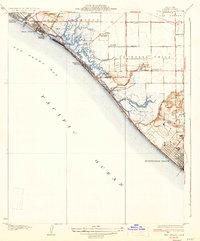 1935 Seal Beach1935 Print · USGSThe Orange County coast in the mid-thirties remains a landscape of sprawling salt marshes and private gun clubs. Trace the early shorefront at Sunset Beach or locate historic markers like Anaheim Landing and the Springdale Sch.3 unique versions available
 - 1941 Map of Las Bolsas, 1961 Print
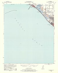 1941 Las Bolsas1961 Print · USGSCoastal Orange County appears at the brink of the war years, showing a shoreline defined by marshlands and early beach communities. Genealogists and local historians can trace the Pacific Electric line and explore landmarks like the Bolsa Chica Gun Club and Meadow Lark Country Club Sch.2 unique versions available
 - 1943 Map of Las Bolsas
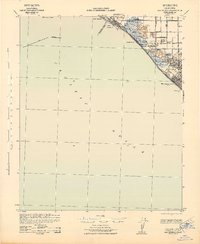 1943 Las Bolsas1943 Print · USGSThe Orange County coast and wetlands come into focus during the early 1940s as agricultural grids meet the sea. Local historians can trace the early rail influence of the Pacific Electric and locate old landmarks like the Springdale Sch or Wintersburg.
 - 1943 Map of San Pedro
 1943 San Pedro1943 Print · USGSThe South Bay and Los Angeles Harbor area appear here during the Second World War, showing a landscape of burgeoning industry and aviation. Trace wartime infrastructure and local landmarks like Hughes Airport, Terminal Island, and Inglewood Park Cem.
 - 1949 Map of Long Beach
 1949 Long Beach1949 Print · USGSSouthern California at the start of the post-war boom shows the rapid development of the Los Angeles basin and the South Bay. Genealogists and historians can trace the evolution of early suburbs like Gardena and Lynwood or the coastal defenses at Ft MacArthur Lower Reservation.2 unique versions available
 - 1949 Map of Seal Beach, 1957 Print
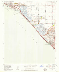 1949 Seal Beach1957 Print · USGSCoastal Orange County is captured here in the late 1940s, showing a landscape of naval installations, early oil production, and marshland gun clubs. Researchers can trace the path of the Pacific Electric rail line past the Allied Trades Institute and the sprawling Oil Wells of the Las Bolsas area.2 unique versions available
 - 1950 Map of Seal Beach
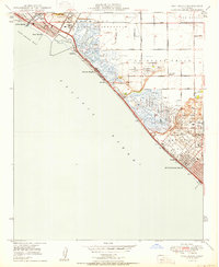 1950 Seal Beach1950 Print · USGSThe Orange County coast in the late Forties is a landscape of expansive wetlands, oil derricks, and emerging beach towns. Researchers can trace the Pacific Electric rail route or locate vanished landmarks like East Long Beach Airport and Wintersburg.
 - 1957 Map of Long Beach
 1957 Long Beach1957 Print · USGSThe Los Angeles coast and the Channel Islands appear here during the mid-fifties era of rapid suburbanization and naval expansion. Genealogists and researchers can locate early industrial neighborhoods like South Gate and trace military boundaries at Ft MacArthur Upper Reservation or the remote San Nicolas Island.4 unique versions available
 - 1958 Map of Long Beach
 1958 Long Beach1958 Print · USGSCoastal Southern California is shown during a mid-century period of intense suburbanization and military readiness. Genealogists and historians can trace the growth of Long Beach, identify early neighborhoods in Lakewood Village, or locate the bounds of Ft MacArthur Lower Reservation.
 - 1960 Map of Long Beach
 1960 Long Beach1960 Print · USGSCoastal California at the height of post-war expansion reveals a dense network of suburban growth and maritime industry. Trace the development of the South Bay and inland neighborhoods like Lakewood Village, or explore the topography of Santa Catalina Island and Los Angeles Harbor.2 unique versions available
 - 1965 Map of Seal Beach, 1967 Print
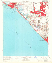 1965 Seal Beach1967 Print · USGSCoastal Orange County undergoes significant postwar development during the mid-sixties, from the massive U S Naval Weapons Station to the developing shore. Trace local history through Meadowlark Airport, the Southern Pacific railroad, and neighborhood schools like McGaugh Sch.3 unique versions available
 - 1974 Map of Seal Beach, 1977 Print
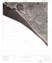 1974 Seal Beach1977 Print · USGSThe Orange County coast comes into sharp focus in the mid-1970s, showing the rapid suburbanization of the shoreline. Trace the expansion of Seal Beach and Huntington Beach through these detailed aerial photographs.
 - 1981 Map of Long Beach
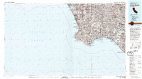 1981 Long Beach1981 Print · USGSCoastal Los Angeles and the South Bay reached a peak of industrial and suburban maturity in the early eighties. Researchers can trace the development of aerospace and maritime hubs through landmarks like the Queen Mary, Fort MacArthur, and Signal Hill.3 unique versions available
End of results
Showing maps 1-15 of 15
Top cities near Huntington Harbor
- Los Angeles historical maps
- Long Beach historical maps
- Anaheim historical maps
- Santa Ana historical maps
- Irvine historical maps
- Huntington Beach historical maps
See more
Frequently asked questions
- What are the different types of historical maps available for Huntington Harbor?
- What is the oldest map of Huntington Harbor?
- Where can I purchase historical maps of Huntington Harbor for my home or office?
- Where can I download high-res historical maps of Huntington Harbor?
- Are there historical topographic maps available for Huntington Harbor?
- Is there historical aerial imagery available for Huntington Harbor?
- Where are historical maps of Huntington Harbor sourced from?