1950s Maps of Palm Springs, California
Explore 12 historic maps of Palm Springs from the 1950s. These maps offer a rare glimpse into what life looked like during the 1950s — showing old roads, neighborhoods, homes, and landmarks that have changed or disappeared over time.
Whether you're researching your family's past, planning a metal detecting trip, or studying how Palm Springs's landscape evolved across the 1950s, these high-resolution maps are a powerful tool for exploring the history of this region.
- Focus on a specific era: All maps on this page are from the 1950s, giving you a focused view of this time period.
- See what’s changed: Compare century-old streets, trails, and buildings to today's modern landscape using overlays and satellite layers.
- Research with precision: Use these maps for genealogy, historical research, land use analysis, or educational projects.
- View, download, or print: Maps are fully viewable online in high resolution, and can be downloaded or printed for your own records.
Start exploring Palm Springs's history through authentic maps from the 1950s. This is your window into the past.
Palm Springs, CA maps
(12)- 1955 Map of Desert Hot Springs, 1956 Print
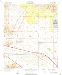 1955 Desert Hot Springs1956 Print · USGSThe Coachella Valley comes into focus in the mid-1950s as Desert Hot Springs expands alongside the Southern Pacific rail line. Trace family landmarks like Lost Heads Ranch and Lazy C Ranch or the path of the Colorado River Aqueduct.4 unique versions available
 - 1955 Map of Whitewater, 1956 Print
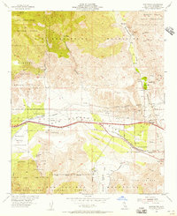 1955 Whitewater1956 Print · USGSSan Gorgonio Pass in the mid-fifties is captured as a vital corridor for water, rail, and early desert settlement. Genealogists and historians can trace family-named sites like Cox Ranch or locate the old Palm Springs Station and White Water PO.4 unique versions available
 - 1956 Map of Santa Ana
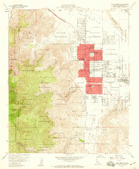
 1956 Santa Ana1956 Print · USGSSouthern California underwent massive mid-century transformation as suburban growth met major military and water projects. Trace the postwar expansion of Santa Ana and Riverside, the layout of Camp Pendleton, and the path of the Colorado River Aqueduct.
 - 1957 Map of Palm Springs, 1959 Print
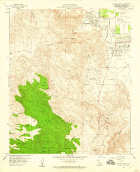
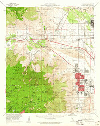
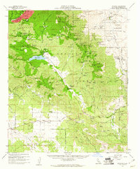
 1957 Palm Springs1959 Print · USGSPalm Springs and the Coachella Valley are captured during a period of rapid mid-century growth and desert development. Researchers can find numerous neighborhood schools like Cahuilla Sch, local landmarks including the KPAL Radio Tower, and the remote Tollgate Cemetery.6 unique versions available
 - 1957 Map of Rancho Mirage, 1960 Print
 1957 Rancho Mirage1960 Print · USGSMid-century Rancho Mirage and Palm Desert are caught at the beginning of their growth into desert retreats. Researchers can trace early residential streets like El Paseo alongside the Landing Field and remote sites such as Shumway Ranch and Magnesia Spring.5 unique versions available
 - 1957 Map of Palm Springs, 1960 Print
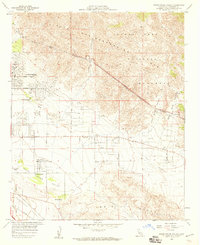
 1957 Palm Springs1960 Print · USGSPalm Springs and the San Jacinto peaks are captured here in the late fifties, showing the desert resort's mid-century expansion. Researchers can locate established landmarks like the White Water PO, trace old mountain retreats at Laws Camp, and see early desert schools like Coffman Sch.4 unique versions available
 - 1958 Map of Seven Palms Valley, 1959 Print
 1958 Seven Palms Valley1959 Print · USGSThe Coachella Valley was transforming into a destination for ranching and geothermal health in the late fifties. You can locate early local landmarks like Two Bunch Palms and Miracle Hill alongside the path of the Colorado River Aqueduct.5 unique versions available
 - 1958 Map of Cathedral City, 1960 Print
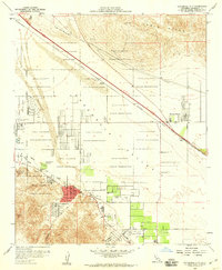 1958 Cathedral City1960 Print · USGSThe mid-century Coachella Valley emerges in this survey as leisure culture begins to reshape the desert landscape alongside the Southern Pacific tracks. Genealogists can locate old landmarks like Palm Springs Dist Cem, the Palm Valley School, and the early layout of Cathedral City.8 unique versions available
 - 1958 Map of Thousand Palms, 1960 Print
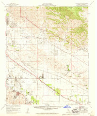 1958 Thousand Palms1960 Print · USGSThe Coachella Valley was rapidly transforming in the late fifties as ranch life met modern resort culture. You can trace the lineage of early desert settlements like Edom and Miracle Hill, or locate family-named landmarks like Chuckwalla Ranch and Macomber Palms.3 unique versions available
 - 1959 Map of Idyllwild, 1961 Print
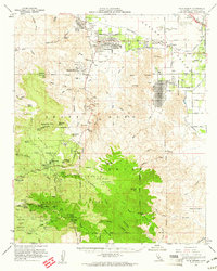
 1959 Idyllwild1961 Print · USGSThe high San Jacinto peaks and ranchlands of Riverside County are captured here in the late fifties. Genealogists and local historians can trace family properties like Fleming Ranch or locate the Lucky Deer Mine and the Hamilton Sch.3 unique versions available
 - 1959 Map of Palm Desert, 1961 Print
 1959 Palm Desert1961 Print · USGSThe Coachella Valley was rapidly evolving in the late fifties as desert resorts expanded toward the high peaks. Genealogists and historians can locate early landmarks like Shumway Ranch, the Asbestos Mine, and the Indian Village Site.4 unique versions available
 - 1959 Map of Santa Ana, 1971 Print
 1959 Santa Ana1971 Print · USGSSouthern California is captured in a decade of transformation, from the Orange County coast to the desert floor. Researchers can trace the mid-century footprints of Camp Pendleton, March Air Force Base, and the original Ortega Highway.3 unique versions available
End of results
Showing maps 1-12 of 12
Top cities near Palm Springs
- Cathedral City historical maps
- Palm Desert historical maps
- Desert Hot Springs historical maps
- Rancho Mirage historical maps
- Indian Wells historical maps
- Idyllwild historical maps
See more
Top neighborhoods of Palm Springs
- Garnet historical maps
- Racquet Club Estates historical maps
- Twin Palms historical maps
- Old Las Palmas historical maps
- The Movie Colony historical maps
- The Mesa historical maps
See more
Frequently asked questions
- What are the different types of historical maps available for Palm Springs?
- What is the oldest map of Palm Springs?
- Where can I purchase historical maps of Palm Springs for my home or office?
- Where can I download high-res historical maps of Palm Springs?
- Are there historical topographic maps available for Palm Springs?
- Is there historical aerial imagery available for Palm Springs?
- Where are historical maps of Palm Springs sourced from?