1900s (20th Century) Maps of Summit, California
Explore 10 historic maps of Summit from the 1900s (20th Century). These maps offer a rare glimpse into what life looked like during the 1900s — showing old roads, neighborhoods, homes, and landmarks that have changed or disappeared over time.
Whether you're researching your family's past, planning a metal detecting trip, or studying how Summit's landscape evolved across the 1900s, these high-resolution maps are a powerful tool for exploring the history of this region.
- Focus on a specific era: All maps on this page are from the 1900s, giving you a focused view of this time period.
- See what’s changed: Compare century-old streets, trails, and buildings to today's modern landscape using overlays and satellite layers.
- Research with precision: Use these maps for genealogy, historical research, land use analysis, or educational projects.
- View, download, or print: Maps are fully viewable online in high resolution, and can be downloaded or printed for your own records.
Start exploring Summit's history through authentic maps from the 1900s. This is your window into the past.
Summit, CA maps
(10)- 1940 Map of Canyon Spring, 1957 Print
 1940 Canyon Spring1957 Print · USGSThe Colorado Desert of Riverside County is captured in this 1940s survey at a time of early infrastructure and ranching. Genealogists and researchers can trace remote water sources and landmarks like Hayfield Reservoir, Shaver Summit, and the Skylark Ranch.2 unique versions available
 - 1943 Map of Canyon Spring, 1944 Print
 1943 Canyon Spring1944 Print · USGSRiverside County's high desert is captured here during the early 1940s, showing the intersection of vital water infrastructure and mountain passes. Researchers can locate remote outposts like Skylark Ranch, trace the route through Shaver Summit, or find isolated water sources at Canyon Spring and Clemens Well.
 - 1954 Map of Salton Sea
 1954 Salton Sea1954 Print · USGSThe Colorado River and Imperial Valley desert frontiers are captured here in the 1950s. Trace the irrigation networks of Calipatria and mining sites like Eagle Mountain Mine.
 - 1955 Map of Salton Sea
 1955 Salton Sea1955 Print · USGSThe Colorado River and Imperial Valley desert basins appear here during the mid-fifties, revealing a landscape of remote mines and agricultural irrigation. Genealogists and researchers can trace locations like the Parker Alien Reception Center Unit No 1, Blythe, and the Kane Springs School.2 unique versions available
 - 1959 Map of Salton Sea, 1968 Print
 1959 Salton Sea1968 Print · USGSThe Colorado River and Salton Sea basin are shown here during a decade of intense military and agricultural activity. Trace family roots in Blythe or Niland, and locate historical mining operations like the Eagle Mountain Mine and Red Cloud Mine.4 unique versions available
 - 1963 Map of Salton Sea
 1963 Salton Sea1963 Print · USGSThe Colorado Desert during the early sixties shows a landscape defined by massive water projects and Cold War military ranges. Trace the growth of Salton City and Brawley, or locate remote desert outposts like the Paymaster Mine and Desert Center.
 - 1963 Map of Hayfield, 1965 Print
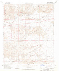 1963 Hayfield1965 Print · USGSRiverside County’s desert interior is seen here in the early sixties, highlighting the massive water infrastructure of the Colorado River Aqueduct. Researchers can trace the path of Bradshaw Road and locate remote outposts like Hayfield Station and Clemens Well (Dry).3 unique versions available
 - 1965 Map of Salton Sea
 1965 Salton Sea1965 Print · USGSThe Colorado Desert and Imperial Valley are caught in a period of intense irrigation and military expansion during the mid-sixties. Researchers can trace the desert's industrial footprint through the Eagle Mountain Mine, the remote Desert Center, and the Salton Sea Test Base.
 - 1986 Map of Eagle Mountains
 1986 Eagle Mountains1986 Print · USGSRiverside County's high desert was a hub of mining and water infrastructure in the mid-eighties. Genealogists and desert historians can trace remote outposts like Desert Center, early mining sites including the Paymaster Mine, and the vital Coachella Canal.2 unique versions available
 - 1987 Map of East of Red Canyon
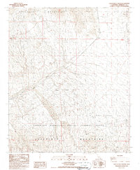 1987 East of Red Canyon1987 Print · USGSRiverside County’s high desert is shown in the late 1980s as a landscape of military reservations and rugged terrain. Researchers can trace the path of the Bradshaw Road and locate the Chocolate Mountain Aerial Gunnery Range and Salt Creek.2 unique versions available
End of results
Showing maps 1-10 of 10
Frequently asked questions
- What are the different types of historical maps available for Summit?
- What is the oldest map of Summit?
- Where can I purchase historical maps of Summit for my home or office?
- Where can I download high-res historical maps of Summit?
- Are there historical topographic maps available for Summit?
- Is there historical aerial imagery available for Summit?
- Where are historical maps of Summit sourced from?