2020s Maps of Land Park, Sacramento
Explore 3 historic maps of Land Park from the 2020s. These maps offer a rare glimpse into what life looked like during the 2020s — showing old roads, neighborhoods, homes, and landmarks that have changed or disappeared over time.
Whether you're researching your family's past, planning a metal detecting trip, or studying how Land Park's landscape evolved across the 2020s, these high-resolution maps are a powerful tool for exploring the history of this region.
- Focus on a specific era: All maps on this page are from the 2020s, giving you a focused view of this time period.
- See what’s changed: Compare century-old streets, trails, and buildings to today's modern landscape using overlays and satellite layers.
- Research with precision: Use these maps for genealogy, historical research, land use analysis, or educational projects.
- View, download, or print: Maps are fully viewable online in high resolution, and can be downloaded or printed for your own records.
Start exploring Land Park's history through authentic maps from the 2020s. This is your window into the past.
Land Park, Sacramento maps
(3)- 2021 Map of Sacramento East, 2021 Print
 2021 Sacramento East2021 Print · USGSSacramento and its eastern suburbs are shown here in the early twenty-first century as they sprawl across the Central Valley. Genealogists and historians can trace numerous local sites such as Saint Mary Cem, Whisky Hill, and the Sacramento Executive Airport.
 - 2022 Map of Sacramento West, 2022 Print
 2022 Sacramento West2022 Print · USGSCovers Land Park, including Sacramento, West Sacramento, and other nearby areas
 - 2023 Map of Sacramento West, 2023 Print
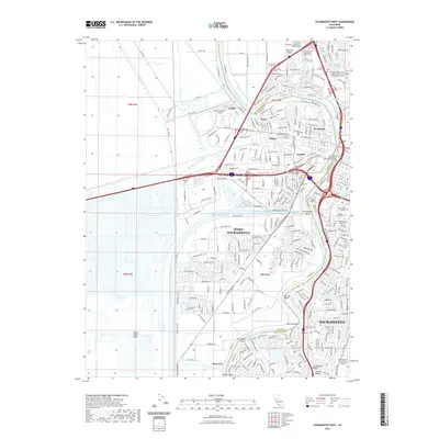
 2023 Sacramento West2023 Print · USGSThe riverfront and industrial districts of Yolo and Sacramento Counties are shown here in the 2020s, revealing a landscape defined by massive shipping channels and urban growth. Researchers can trace historic neighborhoods like Broderick and Bryte or locate resting places at the Sacramento City Cem and Odd Fellows Lawn Cem.
End of results
Showing maps 1-3 of 3
Frequently asked questions
- What are the different types of historical maps available for Land Park?
- What is the oldest map of Land Park?
- Where can I purchase historical maps of Land Park for my home or office?
- Where can I download high-res historical maps of Land Park?
- Are there historical topographic maps available for Land Park?
- Is there historical aerial imagery available for Land Park?
- Where are historical maps of Land Park sourced from?