Old Maps of Barstow, California
Explore 18 old maps of Barstow, spanning from 1932 to today. These high-resolution historic maps reveal how streets, neighborhoods, landmarks, and natural features evolved over time — perfect for genealogy, metal detecting, research, and local history exploration.
What you can do with these maps:
- See how Barstow changed over time: Compare historical maps to modern-day views to trace roads, homesites, rail lines & more.
- View detailed metadata: Each map includes creators, publishers, year, scale, and archive source.
- Overlay maps with satellite & LiDAR: Visualize the past alongside modern tools to explore terrain & human change.
- Trusted historical sources: Maps sourced from the USGS, Library of Congress, and other archives.
- Access maps your way: View online, download high-res files, or order prints for personal or research use.
Start exploring old maps of Barstow to uncover forgotten places, hidden landmarks, and the deep history beneath your feet.
Barstow, CA maps
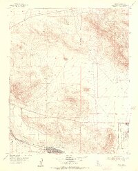
(18)- 1932 Map of Barstow, 1956 Print
 1932 Barstow1956 Print · USGSCovers Barstow, including Victorville, Apple Valley, and other nearby areas
 - 1934 Map of Barstow
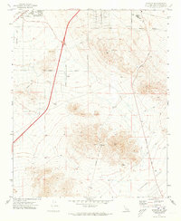
 1934 Barstow1934 Print · USGSCovers Barstow, including Victorville, Apple Valley, and other nearby areas3 unique versions available
 - 1953 Map of San Bernardino
 1953 San Bernardino1953 Print · USGSCovers Barstow, including Riverside, Fontana, and other nearby areas2 unique versions available
 - 1953 Map of Nebo, 1956 Print
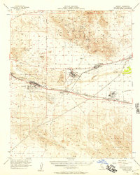
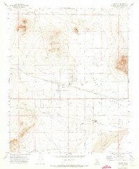
 1953 Nebo1956 Print · USGSCovers Barstow, including Yermo, Daggett, and other nearby areas4 unique versions available
 - 1956 Map of San Bernardino
 1956 San Bernardino1956 Print · USGSCovers Barstow, including Riverside, Fontana, and other nearby areas
 - 1956 Map of Daggett, 1957 Print
 1956 Daggett1957 Print · USGSCovers Barstow, including Newberry Springs, Yermo, and other nearby areas4 unique versions available
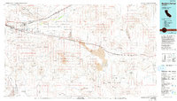
 - 1956 Map of Barstow, 1957 Print
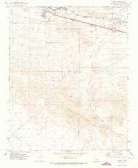
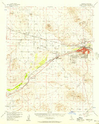 1956 Barstow1957 Print · USGSCovers Barstow, including Lenwood, Hinkley, and other nearby areas3 unique versions available
 - 1957 Map of San Bernardino
 1957 San Bernardino1957 Print · USGSCovers Barstow, including Riverside, Fontana, and other nearby areas
 - 1958 Map of San Bernardino, 1975 Print
 1958 San Bernardino1975 Print · USGSCovers Barstow, including Riverside, Fontana, and other nearby areas
 - 1959 Map of San Bernardino
 1959 San Bernardino1959 Print · USGSCovers Barstow, including Riverside, Fontana, and other nearby areas
 - 1966 Map of San Bernardino
 1966 San Bernardino1966 Print · USGSCovers Barstow, including Riverside, Fontana, and other nearby areas
 - 1971 Map of Hodge, 1973 Print
 1971 Hodge1973 Print · USGSCovers Barstow, including Johnstons Corner, San Bernardino County, and other nearby areas3 unique versions available
 - 1971 Map of Barstow SE, 1973 Print
 1971 Barstow SE1973 Print · USGSCovers Barstow, including Lenwood, Barstow Heights, and other nearby areas2 unique versions available
 - 1971 Map of Daggett, 1973 Print
 1971 Daggett1973 Print · USGSCovers Barstow, including Desert View Housing Area, Daggett, and other nearby areas2 unique versions available
 - 1971 Map of Hinkley, 1973 Print
 1971 Hinkley1973 Print · USGSCovers Barstow, including Hinkley, San Bernardino County, and other nearby areas3 unique versions available
 - 1971 Map of Barstow, 1974 Print
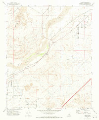
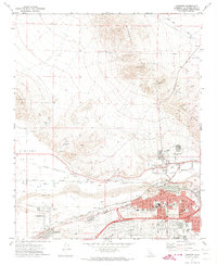 1971 Barstow1974 Print · USGSCovers Barstow, including Lenwood, Irwin Estates, and other nearby areas5 unique versions available
 - 1977 Map of Newberry Springs, 1993 Print
 1977 Newberry Springs1993 Print · USGSCovers Barstow, including Ludlow, Newberry Springs, and other nearby areas
 - 1982 Map of Victorville
 1982 Victorville1982 Print · USGSCovers Barstow, including Palmdale, Lancaster, and other nearby areas2 unique versions available
End of results
Showing maps 1-18 of 18
Top cities near Barstow
Top neighborhoods of Barstow
Frequently asked questions
- What are the different types of historical maps available for Barstow?
- What is the oldest map of Barstow?
- Where can I purchase historical maps of Barstow for my home or office?
- Where can I download high-res historical maps of Barstow?
- Are there historical topographic maps available for Barstow?
- Is there historical aerial imagery available for Barstow?
- Where are historical maps of Barstow sourced from?