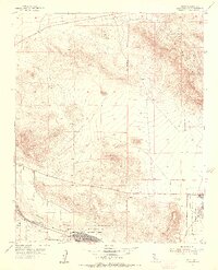
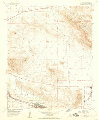
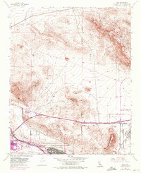
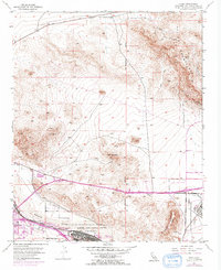
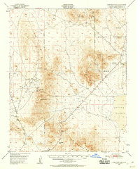
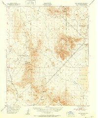
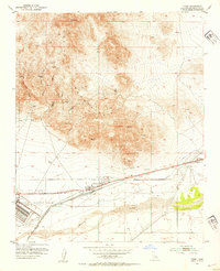
1953 Map of Nebo
USGS Topo · Published 1956About this map
The Calico Mountains and the arid basin of the Mojave River dominate this desert landscape during the early 1950s. This survey records an era of significant military and industrial presence in the High Desert, centered on the Nebo Marine Base (Barstow Annex) and the eastern edge of Barstow. The transport infrastructure is anchored by the Atchison Topeka and Santa Fe railroad, which parallels the river and serves the logistical needs of the base and local mining operations.
Find a feature on this map
18 named features on this map. Tap any name to fly to it.
Don’t see what you’re looking for? This feature index may not catch every label — zoom into the map to look around manually.
Map Details
Editions of this 1953 Nebo Map
4 editions found
Other maps of this area

1915 · Searles Lake
USGS Topo · 1:250,000

1932 · Barstow
USGS Topo · 1:125,000

1933 · Avawatz Mountains
USGS Topo · 1:250,000

1934 · Barstow
USGS Topo · 1:125,000

1947 · Trona
USGS Topo · 1:250,000

1948 · Trona
USGS Topo · 1:250,000
1948 · Lane Mountain
USGS Topo · 1:62,500
1951 · Lane Mountain
USGS Topo · 1:62,500

1953 · San Bernardino
USGS Topo · 1:250,000
1953 · Yermo
USGS Topo · 1:24,000