1960s Maps of Rancho Cucamonga, California
Explore 6 historic maps of Rancho Cucamonga from the 1960s. These maps offer a rare glimpse into what life looked like during the 1960s — showing old roads, neighborhoods, homes, and landmarks that have changed or disappeared over time.
Whether you're researching your family's past, planning a metal detecting trip, or studying how Rancho Cucamonga's landscape evolved across the 1960s, these high-resolution maps are a powerful tool for exploring the history of this region.
- Focus on a specific era: All maps on this page are from the 1960s, giving you a focused view of this time period.
- See what’s changed: Compare century-old streets, trails, and buildings to today's modern landscape using overlays and satellite layers.
- Research with precision: Use these maps for genealogy, historical research, land use analysis, or educational projects.
- View, download, or print: Maps are fully viewable online in high resolution, and can be downloaded or printed for your own records.
Start exploring Rancho Cucamonga's history through authentic maps from the 1960s. This is your window into the past.
Rancho Cucamonga, CA maps
(6)- 1966 Map of San Bernardino
 1966 San Bernardino1966 Print · USGSThe San Bernardino Valley and Mojave Desert met during a period of massive military and suburban growth in the mid-sixties. Genealogists and historians can trace the development of Edwards Air Force Base, old desert mines like the Bagdad Chase Mine, and mountain communities near Big Bear Lake.
 - 1966 Map of Cucamonga Peak, 1968 Print
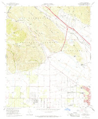
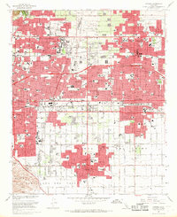
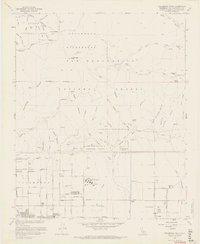 1966 Cucamonga Peak1968 Print · USGSSan Bernardino County in the mid-sixties shows a landscape of transition where the high peaks of the San Gabriel Mountains meet the expanding foothill towns. Trace the early development of Alta Loma and Etiwanda or locate mountain landmarks like Kelly Camp and Chaffey Union Jr College.9 unique versions available
 - 1966 Map of Devore, 1968 Print
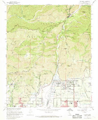
 1966 Devore1968 Print · USGSSan Bernardino's mountain foothills and the bustling rail corridor of Cajon Canyon are captured here in the mid-1960s. Researchers can trace the legacy of local aviation at Gilfillan Airport, locate historic schools like Trapp Sch, and follow the complex rail network of the Union Pacific through Devore.6 unique versions available
 - 1966 Map of Guasti, 1969 Print
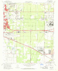 1966 Guasti1969 Print · USGSThe Inland Empire is shown at a pivotal moment of industrial and suburban growth in the mid-1960s. Genealogists and researchers can locate family-named landmarks like the John Rains House, the historic Guasti settlement, and local centers like Mission Bell Ch.4 unique versions available
 - 1967 Map of Mt. Baldy, 1968 Print
 1967 Mt. Baldy1968 Print · USGSThe foothills and high peaks of the San Gabriel Mountains meet the expanding orange groves and suburbs of the San Bernardino Valley in the late sixties. Researchers can trace the development of Claremont and Upland alongside mountain landmarks like the Padua Hills Theater, San Antonio Dam, and Mt Baldy.5 unique versions available
 - 1967 Map of Ontario, 1969 Print
 1967 Ontario1969 Print · USGSThe Pomona Valley at the height of the 1960s suburban boom shows a dense landscape of industry, academia, and transit. Researchers can trace the layout of the Claremont Colleges, find historic resting places like Palomares Cem, and locate the expansive Ontario International Airport.3 unique versions available
End of results
Showing maps 1-6 of 6
Top cities near Rancho Cucamonga
- Riverside historical maps
- Fontana historical maps
- Ontario historical maps
- Pomona historical maps
- Corona historical maps
- Rialto historical maps
See more
Top neighborhoods of Rancho Cucamonga
- Grapeland historical maps
- North Cucamonga historical maps
- Rochester historical maps
- Etiwanda historical maps
- Alta Loma historical maps
- Etiwanda historical maps
See more
Frequently asked questions
- What are the different types of historical maps available for Rancho Cucamonga?
- What is the oldest map of Rancho Cucamonga?
- Where can I purchase historical maps of Rancho Cucamonga for my home or office?
- Where can I download high-res historical maps of Rancho Cucamonga?
- Are there historical topographic maps available for Rancho Cucamonga?
- Is there historical aerial imagery available for Rancho Cucamonga?
- Where are historical maps of Rancho Cucamonga sourced from?