Old Maps of Clover Flat, California for Genealogy
Trace your family roots with 12 historic maps of Clover Flat. These high-res maps reveal old neighborhoods, homesites, landmarks, and streets — helping you uncover where your ancestors lived and how the area evolved over time.
- Explore historic neighborhoods: Identify where your relatives may have lived in the 1800s or 1900s.
- Compare maps over time: Trace the changes in streets, buildings, and landmarks for multi-generational research.
- Perfect for genealogy & ancestry research: Used by family historians and researchers to map out lineage and migration.
These maps are an incredible resource for exploring your personal connection to Clover Flat's past.
Clover Flat, CA maps
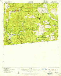
(12)- 1931 Map of Carrizo, 1938 Print
 1931 Carrizo1938 Print · USGSCovers Clover Flat, including La Rumorosa, Campo, and other nearby areas
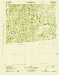
 - 1939 Map of Campo, 1956 Print
 1939 Campo1956 Print · USGSCovers Clover Flat, including Campo, El Hongo, and other nearby areas
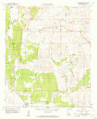
 - 1942 Map of Campo, 1944 Print
 1942 Campo1944 Print · USGSCovers Clover Flat, including Campo, El Hongo, and other nearby areas
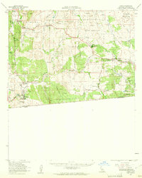
 - 1950 Map of San Diego, 1954 Print
 1950 San Diego1954 Print · USGSCovers Clover Flat, including Tijuana, San Diego, and other nearby areas
 - 1954 Map of San Diego
 1954 San Diego1954 Print · USGSCovers Clover Flat, including Tijuana, San Diego, and other nearby areas
 - 1955 Map of San Diego
 1955 San Diego1955 Print · USGSCovers Clover Flat, including Tijuana, San Diego, and other nearby areas
 - 1958 Map of San Diego, 1961 Print
 1958 San Diego1961 Print · USGSCovers Clover Flat, including Tijuana, San Diego, and other nearby areas4 unique versions available
 - 1959 Map of Cameron Corners, 1961 Print
 1959 Cameron Corners1961 Print · USGSCovers Clover Flat, including Barrett, Cameron Corners, and other nearby areas7 unique versions available
 - 1959 Map of Campo, 1961 Print
 1959 Campo1961 Print · USGSCovers Clover Flat, including Campo, El Hongo, and other nearby areas2 unique versions available
 - 1979 Map of El Cajon
 1979 El Cajon1979 Print · USGSCovers Clover Flat, including San Diego, Chula Vista, and other nearby areas2 unique versions available
 - 1997 Map of Cameron Corners, 2000 Print
 1997 Cameron Corners2000 Print · USGSCovers Clover Flat, including Barrett, Cameron Corners, and other nearby areas
 - 2021 Map of Cameron Corners, 2021 Print
 2021 Cameron Corners2021 Print · USGSCovers Clover Flat, including Boulder Oaks, Barrett, and other nearby areas
End of results
Showing maps 1-12 of 12
Top cities near Clover Flat
- Campo historical maps
- Pine Valley historical maps
- Descanso historical maps
- Potrero historical maps
- Boulevard historical maps
- Tecate historical maps
See more
Frequently asked questions
- What are the different types of historical maps available for Clover Flat?
- What is the oldest map of Clover Flat?
- Where can I purchase historical maps of Clover Flat for my home or office?
- Where can I download high-res historical maps of Clover Flat?
- Are there historical topographic maps available for Clover Flat?
- Is there historical aerial imagery available for Clover Flat?
- Where are historical maps of Clover Flat sourced from?