Old Maps of De Luz, California for Hiking & Exploration
Hike through history with 21 historic maps of De Luz. Explore old trails, ghost towns, and forgotten backroads — perfect for outdoor adventurers and local explorers.
- Rediscover forgotten places: Map out old mining camps, roads, and footpaths that no longer exist on modern maps.
- Layer with modern tools: Combine with LiDAR or satellite views to plan hikes through historical terrain.
- Made for exploration: Popular among hikers, overlanders, and local history lovers.
Use these maps to find adventure and explore the hidden past of De Luz.
De Luz, CA maps
(21)- 1901 Map of San Luis Rey
 1901 San Luis Rey1901 Print · USGSNorthern San Diego County is shown at the turn of the century as a landscape of sprawling ranchos, early coastal railroads, and secluded mountain valleys. Researchers can trace the routes of the California Southern RR or locate early settlements like De Luz, Pala, and the Temecula Indian Res.8 unique versions available
 - 1904 Map of Southern California Sheet No. 2
 1904 Southern California Sheet No. 21904 Print · USGSSouthern California during the early 1900s shows the transition from vast ranchos to coastal rail towns. Genealogists and researchers can trace the Southern California R.R. through Oceanside, explore old land grants like Mission Viejo, and locate early settlements from Fallbrook to Julian.5 unique versions available
 - 1941 Map of Margarita Peak, 1961 Print
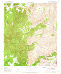
 1941 Margarita Peak1961 Print · USGSSan Diego's coastal ranch lands and backcountry peaks are captured here in the early forties, just before the landscape shifted toward major military use. Researchers can trace historic family estates like Rancho Santa Margarita and old rail stops along the AT&SF RR near De Luz Station.
 - 1942 Map of Margarita Peak
 1942 Margarita Peak1942 Print · USGSDuring the early years of World War II, this region of San Diego County remained a landscape of vast ranchos and scattered citrus groves. Genealogists can trace family holdings like Doville Ranch and community hubs including Deluz PO and the Horno Canyon CCC Camp.
 - 1944 Map of Margarita Peak
 1944 Margarita Peak1944 Print · USGSThe northern reaches of San Diego County are documented here during the mid-1940s, highlighting the vast ranching estates and mountain canyons. Trace the path of the Atchison Topeka and Santa Fe railroad or locate legacy holdings like Rancho Santa Margarita and Doville Ranch.
 - 1947 Map of Santa Ana, 1949 Print
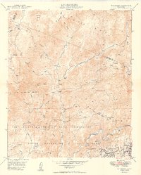
 1947 Santa Ana1949 Print · USGSSouthern California is depicted here in the late forties, showing the expansion of the Inland Empire and the Orange County coast. Researchers can trace the early layout of Palm Springs or locate long-standing tribal lands like the Pala Indian Reservation and Rincon Indian Res.
 - 1948 Map of Fallbrook, 1964 Print
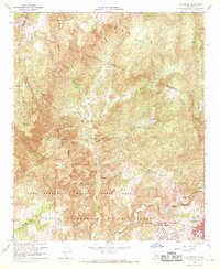
 1948 Fallbrook1964 Print · USGSNorthern San Diego County appears here shortly after the war, showing the expansion of military lands over traditional ranching country. Researchers can find historical boundaries for Sky Ranch, the rural De Luz Sch, and the extensive Camp Joseph H Pendleton Naval Reservation.
 - 1949 Map of Fallbrook
 1949 Fallbrook1949 Print · USGSNorthern San Diego County is shown just after the war, where military reservations and historic ranching estates meet. Genealogists and local historians can locate early homesteads like Sky Ranch and the De Luz Sch, or trace the winding Santa Margarita River.3 unique versions available
 - 1949 Map of Santa Ana
 1949 Santa Ana1949 Print · USGSSouthern California underwent a profound transformation in the late 1940s as military installations and citrus groves shared the landscape. Researchers can trace early coastal growth at Laguna Beach, military history at Camp Pendleton, and the rail corridors of the Pacific Electric.
 - 1954 Map of Margarita Peak, 1964 Print
 1954 Margarita Peak1964 Print · USGSCoastal San Diego and Riverside counties appear here in the early 1940s as military and ranching interests shaped the landscape. Genealogists and researchers can trace family-named sites like Johnson Ranch, De Luz School, and the Atchison Topeka and Santa Fe rail line.
 - 1956 Map of Santa Ana
 1956 Santa Ana1956 Print · USGSSouthern California underwent massive mid-century transformation as suburban growth met major military and water projects. Trace the postwar expansion of Santa Ana and Riverside, the layout of Camp Pendleton, and the path of the Colorado River Aqueduct.
 - 1959 Map of Santa Ana, 1971 Print
 1959 Santa Ana1971 Print · USGSSouthern California is captured in a decade of transformation, from the Orange County coast to the desert floor. Researchers can trace the mid-century footprints of Camp Pendleton, March Air Force Base, and the original Ortega Highway.3 unique versions available
 - 1960 Map of Santa Ana
 1960 Santa Ana1960 Print · USGSSouthern California's coastal plains and inland deserts meet in this mid-century survey of the burgeoning Orange and Riverside county corridors. Researchers can trace the layout of early freeway systems, find tribal lands like the Soboba Indian Reservation, and locate military landmarks such as March Field.2 unique versions available
 - 1965 Map of Santa Ana
 1965 Santa Ana1965 Print · USGSSouthern California is captured in a decade of rapid growth, showing the coastal expansion from Santa Ana down to Oceanside. Genealogists and historians can trace the mid-century development of places like Garden Grove or the rural reaches of Escondido and the Palomar Observatory.
 - 1968 Map of Fallbrook, 1970 Print
 1968 Fallbrook1970 Print · USGSFallbrook and the surrounding canyons were undergoing significant military and agricultural shaping in the late sixties. Researchers can trace the boundaries of Sky Ranch, locate the Fallbrook Sch, and see the early layout of Camp Pendleton.3 unique versions available
 - 1982 Map of Oceanside, 1983 Print
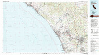 1982 Oceanside1983 Print · USGSCoastal San Diego and Orange counties are captured here in the early eighties, showing the transition from mid-century beach towns to modern suburban hubs. Genealogists and local historians can trace the Atchison Topeka and Santa Fe rail line through Cardiff-by-the-Sea or locate early developments near Lake Hodges.2 unique versions available
 - 1997 Map of Fallbrook, 2000 Print
 1997 Fallbrook2000 Print · USGSThe foothills of San Diego County are captured here in the late nineties, where historic land grants meet modern military installations. Genealogists and local historians can locate early landmarks like De Luz Sch, Garnsey Ranch, and the winding path of Daily Road.
 - 2012 Map of Fallbrook, 2012 Print
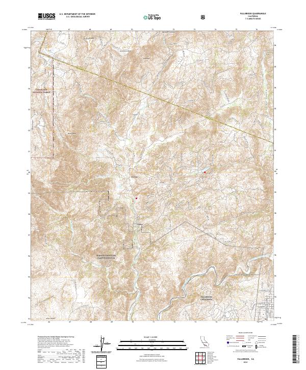
 2012 Fallbrook2012 Print · USGSCovers De Luz, including Fallbrook, De Luz Heights, and other nearby areas
 - 2015 Map of Fallbrook, 2015 Print
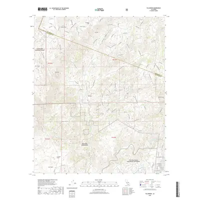
 2015 Fallbrook2015 Print · USGSCovers De Luz, including Fallbrook, De Luz Heights, and other nearby areas
 - 2018 Map of Fallbrook, 2018 Print
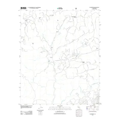
 2018 Fallbrook2018 Print · USGSCovers De Luz, including Fallbrook, De Luz Heights, and other nearby areas
 - 2021 Map of Fallbrook, 2021 Print
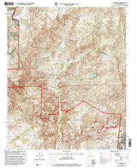
 2021 Fallbrook2021 Print · USGSCoastal California’s rugged mesas and canyons are meticulously charted here during the early twenty-first century. Researchers can trace the interface between the Marine Corps Base Camp Pendleton boundary and local landmarks like De Luz, Ross Lake, and the winding Santa Margarita River.
End of results
Showing maps 1-21 of 21
Top cities near De Luz
- Oceanside historical maps
- Murrieta historical maps
- Temecula historical maps
- Vista historical maps
- Menifee historical maps
- Lake Elsinore historical maps
See more
Frequently asked questions
- What are the different types of historical maps available for De Luz?
- What is the oldest map of De Luz?
- Where can I purchase historical maps of De Luz for my home or office?
- Where can I download high-res historical maps of De Luz?
- Are there historical topographic maps available for De Luz?
- Is there historical aerial imagery available for De Luz?
- Where are historical maps of De Luz sourced from?