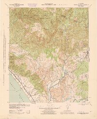
1944 Map of Margarita Peak
USGS Topo · Published 1944About this map
The Santa Margarita Mountains dominate the landscape of this 1944 War Department survey, which captures the rugged coastal backcountry of San Diego and Riverside counties during the Second World War. The topography is defined by a series of deep canyons, including San Mateo Canyon and San Onofre Canyon, which carve through the Cleveland National Forest toward the Pacific Ocean. Notable for its depiction of early Southern California ranching culture, the map identifies numerous family holdings such as the Johnson Ranch, Merchant Ranch, and the expansive Rancho Santa Margarita. Transport infrastructure of the era is anchored by the Atchison Topeka and Santa Fe railroad, which follows the coastline through Las Flores and turns inland toward Fallbrook. This map provides a clear record of the transition between high mountain lookouts like Margarita LO and the river valley settlements along the San Luis Rey River.
Find a feature on this map
63 named features on this map. Tap any name to fly to it.
Don’t see what you’re looking for? This feature index may not catch every label — zoom into the map to look around manually.
Map Details
Editions of this 1944 Margarita Peak Map
This is the sole edition of this map. No revisions or reprints were ever made.
Other maps of this area

1893 · Oceanside
USGS Topo · 1:62,500

1893 · Escondido
USGS Topo · 1:62,500

1898 · Oceanside
USGS Topo · 1:62,500

1901 · Southern California Sheet No. 1
USGS Topo · 1:250,000

1901 · Elsinore
USGS Topo · 1:125,000

1901 · Escondido
USGS Topo · 1:62,500

1901 · Oceanside
USGS Topo · 1:62,500

1901 · San Luis Rey
USGS Topo · 1:125,000

1902 · Capistrano
USGS Topo · 1:125,000

1902 · Corona
USGS Topo · 1:125,000
Featured Places
- Oceanside, CA
- Fallbrook, CA
- Marine Corps Base Camp Pendleton, CA
- Santa Margarita Groves, CA
- De Luz Heights, CA