1960s Maps of San Joaquin County, California
Explore 23 historic maps of San Joaquin County from the 1960s. These maps offer a rare glimpse into what life looked like during the 1960s — showing old roads, neighborhoods, homes, and landmarks that have changed or disappeared over time.
Whether you're researching your family's past, planning a metal detecting trip, or studying how San Joaquin County's landscape evolved across the 1960s, these high-resolution maps are a powerful tool for exploring the history of this region.
- Focus on a specific era: All maps on this page are from the 1960s, giving you a focused view of this time period.
- See what’s changed: Compare century-old streets, trails, and buildings to today's modern landscape using overlays and satellite layers.
- Research with precision: Use these maps for genealogy, historical research, land use analysis, or educational projects.
- View, download, or print: Maps are fully viewable online in high resolution, and can be downloaded or printed for your own records.
Start exploring San Joaquin County's history through authentic maps from the 1960s. This is your window into the past.
San Joaquin County, CA maps
(23)- 1962 Map of San Jose
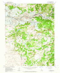
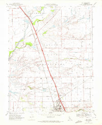
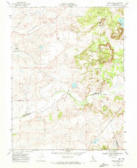
 1962 San Jose1962 Print · USGSCentral California in the early sixties showcases the expansion of the San Joaquin and Santa Clara valleys. Researchers can trace the rail-to-road transition along the Southern Pacific RR or locate landmarks like Castle USAF Base and Loma Prieta.4 unique versions available
 - 1962 Map of Wallace, 1963 Print
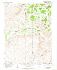
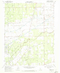
 1962 Wallace1963 Print · USGSCalaveras County is captured here just before the waters rose to create the Camanche Reservoir in the early sixties. Genealogists and local historians can trace the original locations of Lancha Plana and Camanche before they were inundated, alongside the tracks of the Southern Pacific.3 unique versions available
 - 1962 Map of Valley Springs SW, 1963 Print
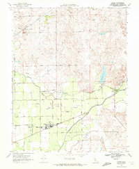
 1962 Valley Springs SW1963 Print · USGSIn the early 1960s, this portion of San Joaquin and Calaveras Counties reveals a landscape shaped by both ranching and the remnants of the gold era. Researchers can trace the riverfront Tailings, locate family-named sites like Ospital Ranch, and find early rural developments like Mother Lode Acres.3 unique versions available
 - 1962 Map of Valley Springs, 1964 Print
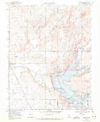
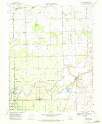
 1962 Valley Springs1964 Print · USGSWestern Calaveras County is seen here just as new water projects were poised to transform the landscape. Researchers can trace historic settlements like Camanche and Lancha Plana or locate old mining sites such as Penn Mine and McCarty Mine.2 unique versions available
 - 1966 Map of San Jose
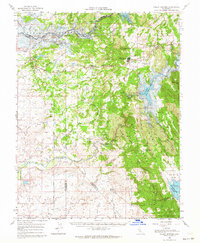
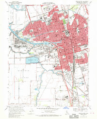
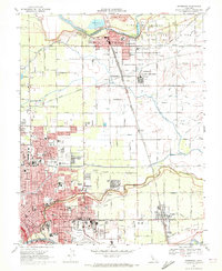
 1966 San Jose1966 Print · USGSCentral California in the mid-1960s reveals a landscape of massive irrigation projects and expanding Cold War military footprints. Researchers can trace the rail-and-river network of the San Joaquin Valley or locate specialized sites like Castle Air Force Base and the Sharp General Depot (Military).
 - 1968 Map of Stockton East, 1969 Print
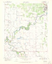
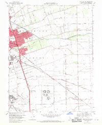 1968 Stockton East1969 Print · USGSStockton and its eastern agricultural fringes are captured here in the late sixties, showing a landscape defined by heavy rail and water engineering. Researchers can trace the mid-century footprint of Sharpe Army Depot and local landmarks like Garden Acres and the Northern California Youth Center.4 unique versions available
 - 1968 Map of Stockton West, 1970 Print
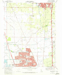
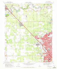
 1968 Stockton West1970 Print · USGSMid-century Stockton emerges as a bustling hub of river commerce and rail traffic at the height of its post-war growth. Genealogists and local historians can trace family locations near the Rural Cemetery, the The Homestead settlement, and numerous historic schools like Fairchild Sch.3 unique versions available
 - 1968 Map of Farmington, 1971 Print
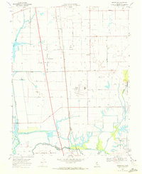
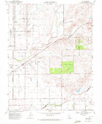
 1968 Farmington1971 Print · USGSThe San Joaquin Valley landscape near Farmington is seen here during the late sixties as water management redefined the terrain. Local historians can trace the Farmington Flood Control Basin, the Southern Pacific rail line, and the Highland View Memorial Gardens.2 unique versions available
 - 1968 Map of Escalon, 1971 Print
 1968 Escalon1971 Print · USGSThe Escalon area in the late sixties shows a thriving agricultural hub at the convergence of three major railroads. Genealogists can trace family names at Valley Home Cem, Burwood Sch, and along the banks of the Stanislaus River.4 unique versions available
 - 1968 Map of Lodi North, 1972 Print
 1968 Lodi North1972 Print · USGSSan Joaquin County agriculture and the city of Lodi thrive in the late sixties as the region's rail and irrigation networks reach full maturity. Researchers can locate vanished rural landmarks and family sites like Houston School, Liberty Cemetery, and Linds Airport.2 unique versions available
 - 1968 Map of Galt, 1972 Print
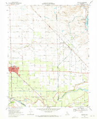
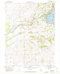
 1968 Galt1972 Print · USGSThe Sacramento and San Joaquin county border country comes alive in the late sixties as the town of Galt expands along the Southern Pacific line. Genealogists can trace family landmarks like the Hicksville Cemetery or the community at Twin Cities.3 unique versions available
 - 1968 Map of Bruceville, 1972 Print
 1968 Bruceville1972 Print · USGSSacramento County's delta wetlands and agricultural tracts are captured here in the late sixties at the meeting of two major rivers. Researchers can trace the legacy of family holdings like Kuhn Ranch and the operations at Franklin Field or Mokelumne City.8 unique versions available
 - 1968 Map of Clements, 1972 Print
 1968 Clements1972 Print · USGSClements and Dogtown are shown in the late sixties as the Mokelumne River's role in California's water system expands with new infrastructure. Genealogists and historians can locate the Clements Glen View Cemetery, trace the Southern Pacific rail line, and see the Camanche Dam at the edge of the reservoir.3 unique versions available
 - 1968 Map of Lodi South, 1972 Print
 1968 Lodi South1972 Print · USGSThe agricultural heart of San Joaquin County is captured here in the late sixties as suburban expansion reaches northward from Stockton. Trace family roots and local history through features like Lodi Academy, Henderson Village, and the Micke Grove County Park.3 unique versions available
 - 1968 Map of Waterloo, 1972 Print
 1968 Waterloo1972 Print · USGSSan Joaquin County agriculture and water infrastructure are in focus here during the late sixties. Researchers can trace rural school locations like Waterloo Sch and the Jack Tone Homestead Historical Marker near the Mokelumne Aqueduct.3 unique versions available
 - 1968 Map of Linden, 1972 Print
 1968 Linden1972 Print · USGSLinden and the surrounding San Joaquin County orchards are captured here in the late sixties as the region's agricultural and transit networks expanded. Genealogists and researchers can locate the Stockton Terminal and Eastern RR, the Cemetery, and local schools in Linden.3 unique versions available
 - 1968 Map of Lockeford, 1972 Print
 1968 Lockeford1972 Print · USGSSan Joaquin County agriculture is in full bloom in the late sixties, centered on the vital corridor of the Mokelumne River. Researchers can trace the rail-and-river economy through the streets of Lockeford, locating Locke Cem and old school sites like Bruella Sch.3 unique versions available
 - 1968 Map of Clay, 1972 Print
 1968 Clay1972 Print · USGSThe rural borderlands of Sacramento and San Joaquin counties come to life in the late sixties, showcasing a landscape of rail-dependent settlements and ranching. Genealogists can locate family landmarks like Bottimore Ranch and trace school districts around Colony Sch or the village of Herald.7 unique versions available
 - 1968 Map of Goose Creek, 1972 Print
 1968 Goose Creek1972 Print · USGSThe rural Sacramento County foothills come into focus in the late sixties at the intersection of three counties. Genealogists and local historians can trace the Pacific Southern rail line, the settlement at Hadselville, and the extensive Dredge Tailings left by earlier mining operations.4 unique versions available
 - 1969 Map of Ripon, 1971 Print
 1969 Ripon1971 Print · USGSThe fertile San Joaquin Valley floor comes to life in the late sixties as the Stanislaus River snakes through a landscape of family ranches and orchards. Genealogists and historians can trace property lines and water features from Ripon down to Mapes Ranch and the San Joaquin Sch.6 unique versions available
 - 1969 Map of Salida, 1972 Print
 1969 Salida1972 Print · USGSThe Stanislaus River valley in the late sixties reveals a landscape balancing vast orchards with the rising institutional and suburban footprint of Modesto and Salida. Researchers can trace the legacy of the Modesto State Hospital, the route of the Hetch Hetchy Aqueduct, and numerous local landmarks like Woodcolony Cem.4 unique versions available
 - 1969 Map of Vernalis, 1972 Print
 1969 Vernalis1972 Print · USGSThe San Joaquin River valley was a hub of massive water engineering and ranching in the late sixties. Trace the routes of the California Aqueduct and Hetch Hetchy Aqueduct or find historic locales like the San Joaquin City (Site).2 unique versions available
 - 1969 Map of Riverbank, 1972 Print
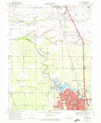
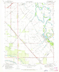
 1969 Riverbank1972 Print · USGSMid-century Stanislaus County comes to life as a bustling hub of rail transport, military industry, and irrigation. Genealogists and historians can trace family locations near Empire, Claus, and neighborhood landmarks like Cardoza Sch and the City County Airport.3 unique versions available
End of results
Showing maps 1-23 of 23
Top cities of San Joaquin County
- Stockton historical maps
- Tracy historical maps
- Manteca historical maps
- Lodi historical maps
- Mountain House historical maps
- Lathrop historical maps
See more
Frequently asked questions
- What are the different types of historical maps available for San Joaquin County?
- What is the oldest map of San Joaquin County?
- Where can I purchase historical maps of San Joaquin County for my home or office?
- Where can I download high-res historical maps of San Joaquin County?
- Are there historical topographic maps available for San Joaquin County?
- Is there historical aerial imagery available for San Joaquin County?
- Where are historical maps of San Joaquin County sourced from?