1910s Maps of San Joaquin County, California
Explore 29 historic maps of San Joaquin County from the 1910s. These maps offer a rare glimpse into what life looked like during the 1910s — showing old roads, neighborhoods, homes, and landmarks that have changed or disappeared over time.
Whether you're researching your family's past, planning a metal detecting trip, or studying how San Joaquin County's landscape evolved across the 1910s, these high-resolution maps are a powerful tool for exploring the history of this region.
- Focus on a specific era: All maps on this page are from the 1910s, giving you a focused view of this time period.
- See what’s changed: Compare century-old streets, trails, and buildings to today's modern landscape using overlays and satellite layers.
- Research with precision: Use these maps for genealogy, historical research, land use analysis, or educational projects.
- View, download, or print: Maps are fully viewable online in high resolution, and can be downloaded or printed for your own records.
Start exploring San Joaquin County's history through authentic maps from the 1910s. This is your window into the past.
San Joaquin County, CA maps
(29)- 1910 Map of New Hope
 1910 New Hope1910 Print · USGSThe California Delta at the start of the twentieth century was a complex network of reclaimed islands and vital waterways. Genealogists and local historians can trace the early community at New Hope and its New Hope School, or locate landings along the Mokelumne River.2 unique versions available
 - 1910 Map of Castle
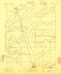
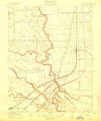
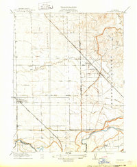
 1910 Castle1910 Print · USGSThe northern San Joaquin Valley was a landscape of transit and territory during the first decade of the twentieth century. Genealogists and historians can trace the exact routes of Cherokee Lane and the legacy of the Campo De Los Franceses land grant.2 unique versions available
 - 1910 Map of Bouldin
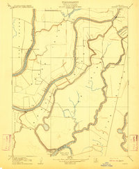
 1910 Bouldin1910 Print · USGSThe Sacramento-San Joaquin Delta at the turn of the century is a labyrinth of reclaimed island tracts and sloughs. Trace the early river landings at Central Landing and Blakes Landing, or locate the Old Cannery along the South Fork Mokelumne River.3 unique versions available
 - 1910 Map of Woodbridge
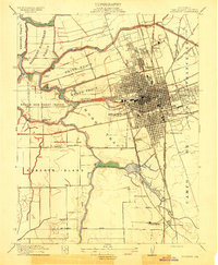
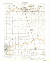
 1910 Woodbridge1910 Print · USGSSan Joaquin and Sacramento counties are captured here at the height of their early rail-and-river era. Genealogists and historians can trace the early streets of Lodi, the riverside blocks of Woodbridge, and rural landmarks like North School and Tracy Lake.2 unique versions available
 - 1910 Map of Bruceville
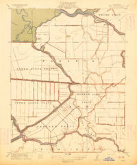
 1910 Bruceville1910 Print · USGSThe Sacramento County delta country is captured here in the early twentieth century as a landscape of new railways and traditional wineries. Trace the early days of Bruceville and Bradford Winery, or locate rural landmarks like the Point Pleasant School and Bear Lake.2 unique versions available
 - 1910 Map of Headreach
 1910 Headreach1910 Print · USGSThe California Delta's intricate waterway network is revealed in this 1910 survey, showcasing the early landscape of San Joaquin County. Trace the river economy through landings like Terminous and Headreach Landing or the winding paths of Potato Slough and White Slough.2 unique versions available
 - 1910 Map of Galt
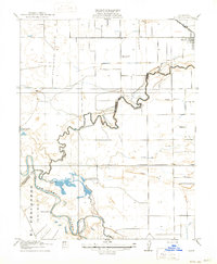
 1910 Galt1910 Print · USGSGalt and the surrounding Sacramento Valley are captured here in the early twentieth century as the railroad transformed rural life. Genealogists and local historians can trace the early rail stops at McConnell and Arno or locate the historic Arno School.2 unique versions available
 - 1910 Map of Isleton
 1910 Isleton1910 Print · USGSThe California Delta's intricate landscape of reclaimed islands and sloughs is captured here just after the turn of the century. You can trace early riverfront settlements like Isleton and Walnut Grove, or locate the waterfront Golden State Cannery.3 unique versions available
 - 1913 Map of Woodward Island
 1913 Woodward Island1913 Print · USGSThe reclaimed islands of the California Delta appear in this pre-war survey as a sophisticated network of levees and rail. Trace early commercial hubs like the Cannery at Woodward and the rural Middle River Moorland P O.
 - 1913 Map of Stockton
 1913 Stockton1913 Print · USGSThe river-port city of Stockton and its surrounding delta tracts come to life in this detailed pre-war survey. Researchers can trace the industrial waterfront and early landings like Crozier's Landing or locate landmarks such as the State Hospital.2 unique versions available
 - 1913 Map of Holt
 1913 Holt1913 Print · USGSThe San Joaquin Delta at the height of its reclamation era is captured here, showing the complex lattice of sloughs and leveed tracts. Researchers can locate vanished landings and schools like Blackslough Landing, Eldorado Landing, and Kingston School.2 unique versions available
 - 1913 Map of Romain
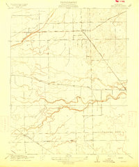
 1913 Romain1913 Print · USGSThe foothills of the Diablo Range meet the San Joaquin Valley floor in the early twentieth century. Researchers can trace early industrial infrastructure like the Southern Pacific R R and Rising Sun School near Romain.
 - 1914 Map of Burnham
 1914 Burnham1914 Print · USGSJust east of Stockton before the First World War, this region shows a landscape of land grants and growing rail junctions. Genealogists can locate family homesteads near Collegeville, Windsor, or rural schoolhouses like Elmwood School and Chartville School.2 unique versions available
 - 1914 Map of Manteca
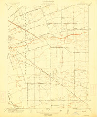
 1914 Manteca1914 Print · USGSSan Joaquin County agriculture is in full bloom during the early twentieth century as irrigation transforms the valley floor. Genealogists can locate family-named landmarks like Castle School and Atlanta Church or trace the early paths of the Tidewater Southern Road.2 unique versions available
 - 1914 Map of Avena
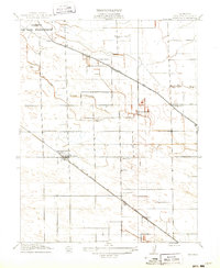
 1914 Avena1914 Print · USGSThe San Joaquin Valley comes into focus just before World War I as irrigation began to reshape the landscape. Genealogists and historians can trace old homesteads near Avena and Atlanta or locate rural school sites like Van Allen School and Four Tree School.
 - 1914 Map of Bethany
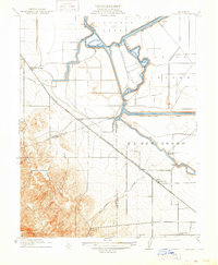 1914 Bethany1914 Print · USGSThe San Joaquin Delta was a maze of engineered waterways and rail lines just before the First World War. Researchers can trace the original routes of the Bethany Ferry and locate early landmarks like Mountain House and the Lammersville School.2 unique versions available
 - 1914 Map of Union Island
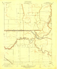 1914 Union Island1914 Print · USGSThe San Joaquin Delta was a maze of reclaiming lands and new canals in the years before the Great War. Researchers can trace the early infrastructure of Union Island and find rural landmarks like the Naglee School and the Southern Pacific line.2 unique versions available
 - 1915 Map of Vernalis
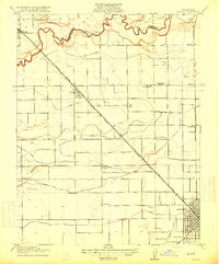
 1915 Vernalis1915 Print · USGSThe San Joaquin Valley at the onset of the Great War reveals a landscape transitioning from river-bound trade to a rail-centric economy. Trace the development of San Joaquin City and the rural New Jerusalem School along the tracks of the Southern Pacific.
 - 1915 Map of Lathrop
 1915 Lathrop1915 Print · USGSSan Joaquin County at the height of the railroad era reveals a complex delta landscape of river bends and major rail junctions. Researchers can trace the early footprints of Lathrop and Banta or locate vanished rural schoolhouses like Island School and Mossdale School.2 unique versions available
 - 1915 Map of Ripon
 1915 Ripon1915 Print · USGSRipon and the San Joaquin Valley river bottoms are captured here during the height of early twentieth-century agricultural development. Genealogists and researchers can trace local landmarks like Jackson School, the S. P. R. R. (Fresno Line), and the Owl Rod and Gun Club.2 unique versions available
 - 1915 Map of Trigo
 1915 Trigo1915 Print · USGSThe rural border of San Joaquin and Stanislaus counties comes to life in the early twentieth century as a network of creeks and rail lines. Trace family roots at Farmington or Trigo, and locate vanished sites like Wheatland School and Farm Cottage School.
 - 1915 Map of Peters
 1915 Peters1915 Print · USGSSan Joaquin County's agricultural heartland is captured here in the early twentieth century at a peak of rail expansion. Genealogists can trace early farm locations and rail stops like Peters, Holden, and Farmington along the Southern Pacific lines.
 - 1915 Map of Salida
 1915 Salida1915 Print · USGSThe fertile plains north of Modesto are captured here just before the First World War, showing a landscape transformed by complex irrigation. Genealogists can locate family homesteads near rural landmarks like Wood Colony School or along the Southern Pacific tracks in Salida.2 unique versions available
 - 1915 Map of Thalheim
 1915 Thalheim1915 Print · USGSThe Central Valley's burgeoning irrigation and rail networks are captured here during a period of rapid agricultural expansion. Researchers can trace the development of early settlements like Thalheim and Escalon alongside rural landmarks such as Burwood School and the Thompson Rancho.2 unique versions available
 - 1916 Map of Riverbank
 1916 Riverbank1916 Print · USGSThe Stanislaus and Tuolumne Rivers frame this early twentieth-century survey of the California Central Valley. Researchers can trace the development of agricultural irrigation and rail transport through features like Burneyville Ferry, Riverbank, and McHenry School.2 unique versions available
Showing maps 1-25 of 29
Top cities of San Joaquin County
- Stockton historical maps
- Tracy historical maps
- Manteca historical maps
- Lodi historical maps
- Mountain House historical maps
- Lathrop historical maps
See more
Frequently asked questions
- What are the different types of historical maps available for San Joaquin County?
- What is the oldest map of San Joaquin County?
- Where can I purchase historical maps of San Joaquin County for my home or office?
- Where can I download high-res historical maps of San Joaquin County?
- Are there historical topographic maps available for San Joaquin County?
- Is there historical aerial imagery available for San Joaquin County?
- Where are historical maps of San Joaquin County sourced from?