1990s Maps of San Joaquin County, California
Explore 13 historic maps of San Joaquin County from the 1990s. These maps offer a rare glimpse into what life looked like during the 1990s — showing old roads, neighborhoods, homes, and landmarks that have changed or disappeared over time.
Whether you're researching your family's past, planning a metal detecting trip, or studying how San Joaquin County's landscape evolved across the 1990s, these high-resolution maps are a powerful tool for exploring the history of this region.
- Focus on a specific era: All maps on this page are from the 1990s, giving you a focused view of this time period.
- See what’s changed: Compare century-old streets, trails, and buildings to today's modern landscape using overlays and satellite layers.
- Research with precision: Use these maps for genealogy, historical research, land use analysis, or educational projects.
- View, download, or print: Maps are fully viewable online in high resolution, and can be downloaded or printed for your own records.
Start exploring San Joaquin County's history through authentic maps from the 1990s. This is your window into the past.
San Joaquin County, CA maps
(13)- 1991 Map of Vernalis, 1995 Print
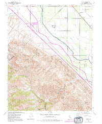
 1991 Vernalis1995 Print · USGSThe San Joaquin Valley landscape comes into focus here in the early nineties, showing a region defined by its massive water projects and river heritage. Researchers can trace the path of the California Aqueduct or locate rural landmarks like Vernalis and the New Jerusalem Sch.
 - 1991 Map of Solyo, 1995 Print
 1991 Solyo1995 Print · USGSThe Stanislaus and San Joaquin county line in the early 1990s shows a landscape dominated by major infrastructure. Trace the routes of the Hetch Hetchy Aqueduct and California Aqueduct past Rising Sun School and Solyo.
 - 1993 Map of San Andreas, 1994 Print
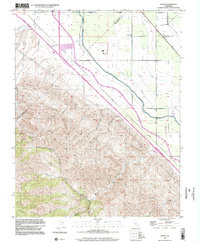
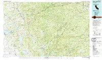 1993 San Andreas1994 Print · USGSThe Mother Lode and High Sierra foothills come alive in the 1990s, showcasing a region defined by historic gold mining and massive water projects. Genealogists and historians can locate old mining sites and rural settlements like Volcano, San Andreas, and Mokelumne Hill.
 - 1993 Map of Lodi, 1994 Print
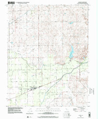
 1993 Lodi1994 Print · USGSNorthern California's delta country and the growing Central Valley corridors are captured here in the early nineties. Genealogists and historians can trace the intricate island tracts, old railroad lines like the Sacramento Northern RR, and established local landmarks including the Lodi Memorial Cemetery and University of the Pacific.2 unique versions available
 - 1994 Map of Oakdale, 1995 Print
 1994 Oakdale1995 Print · USGSThe San Joaquin Valley meets the Sierra foothills in the mid-1990s, where massive reservoirs and canal networks fueled California's agricultural heartland. Researchers can trace the Hetch Hetchy Aqueduct, find the Sierra RR, and locate the Riverbank Army Ammunition Plant.2 unique versions available
 - 1996 Map of Mount Boardman, 1999 Print
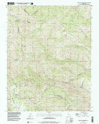 1996 Mount Boardman1999 Print · USGSThe Diablo Range backcountry comes into focus in the 1990s at the intersection of four California counties. Researchers can trace the footprint of the Naval Bombing Range, find the remote Harney School, and locate the Western Mines.
 - 1996 Map of Lathrop, 2000 Print
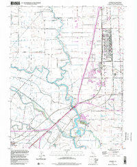 1996 Lathrop2000 Print · USGSThe San Joaquin River delta meets a massive rail and military logistical hub in the mid-1990s. Researchers can trace the sprawling Sharpe General Depot, the rail junction at Lathrop, and riverfront landmarks like Mossdale and Weatherbee Lake.
 - 1997 Map of Bouldin Island, 1998 Print
 1997 Bouldin Island1998 Print · USGSThe heart of the Sacramento-San Joaquin River Delta is captured in the late twentieth century as a complex maze of reclaimed islands and managed waterways. Trace the industrial reach of the Stockton Deep Water Channel or explore the recreational boundaries of Franks Tract.
 - 1997 Map of Linden, 2002 Print
 1997 Linden2002 Print · USGSThe San Joaquin Valley landscape near Linden and Bellota is captured here in the late twentieth century. Researchers can trace irrigation networks and property boundaries along Mormon Slough, the Linden Cem, and local schools.
 - 1997 Map of Terminous, 2002 Print
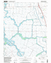 1997 Terminous2002 Print · USGSThe California Delta's intricate network of reclaimed lands and channels is captured here in the late nineties. Genealogists and researchers can trace local landmarks like Terminous, the Venice King Sch, and family-named lands such as the Rindge Tract.
 - 1997 Map of Goose Creek, 2002 Print
 1997 Goose Creek2002 Print · USGSSacramento and San Joaquin counties meet in this rural landscape during the late nineties, where hydraulic history is etched into the earth. Genealogists and historians can trace the old community of Hadselville and examine the extensive Dredge Tailings along the banks of Dry Creek.
 - 1998 Map of Valley Springs SW, 2002 Print
 1998 Valley Springs SW2002 Print · USGSAs the twentieth century closed, this San Joaquin valley borderland remained a site of ranching and mining heritage. Genealogists and researchers can trace the Old Railroad Grade and historic ranch sites like Stone Corral Ranch or the small Cemetery near Duck Creek.
 - 1999 Map of Solyo, 2002 Print
 1999 Solyo2002 Print · USGSThe border of Stanislaus and San Joaquin counties at the close of the millennium reveals a complex network of industrial water transport. Researchers can trace the massive California Aqueduct and Delta-Mendota Canal as they pass historical sites like Solyo and Rising Sun School.
End of results
Showing maps 1-13 of 13
Top cities of San Joaquin County
- Stockton historical maps
- Tracy historical maps
- Manteca historical maps
- Lodi historical maps
- Mountain House historical maps
- Lathrop historical maps
See more
Frequently asked questions
- What are the different types of historical maps available for San Joaquin County?
- What is the oldest map of San Joaquin County?
- Where can I purchase historical maps of San Joaquin County for my home or office?
- Where can I download high-res historical maps of San Joaquin County?
- Are there historical topographic maps available for San Joaquin County?
- Is there historical aerial imagery available for San Joaquin County?
- Where are historical maps of San Joaquin County sourced from?