Old Maps of Historic Ripon, Ripon for Hiking & Exploration
Hike through history with 13 historic maps of Historic Ripon. Explore old trails, ghost towns, and forgotten backroads — perfect for outdoor adventurers and local explorers.
- Rediscover forgotten places: Map out old mining camps, roads, and footpaths that no longer exist on modern maps.
- Layer with modern tools: Combine with LiDAR or satellite views to plan hikes through historical terrain.
- Made for exploration: Popular among hikers, overlanders, and local history lovers.
Use these maps to find adventure and explore the hidden past of Historic Ripon.
Historic Ripon, Ripon maps
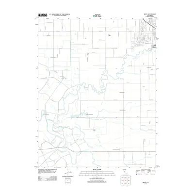
(13)- 1915 Map of Ripon
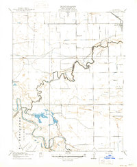 1915 Ripon1915 Print · USGSRipon and the San Joaquin Valley river bottoms are captured here during the height of early twentieth-century agricultural development. Genealogists and researchers can trace local landmarks like Jackson School, the S. P. R. R. (Fresno Line), and the Owl Rod and Gun Club.2 unique versions available
 - 1941 Map of Modesto West
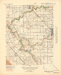 1941 Modesto West1941 Print · USGSThe Central Valley river system is captured here in the early 1940s, showing the complex web of irrigation canals and rural school districts. Genealogists can trace family footprints near Grayson or the Farm Security Administration Camp, and locate landmarks like Shiloh School or Tuolumne City.3 unique versions available
 - 1947 Map of San Jose, 1948 Print
 1947 San Jose1948 Print · USGSNorthern California's heartland is captured here just after the war, showing the rapid growth of the Santa Clara and Central Valleys. Researchers can trace the legacy of rail and water at Castle Air Force Base, Stockton, and the Hetch Hetchy Aqueduct.
 - 1952 Map of Ripon, 1954 Print
 1952 Ripon1954 Print · USGSThe San Joaquin and Stanislaus rivers meet in this early 1950s survey of California's agricultural heartland. Trace irrigation history through the Hetch Hetchy Aqueduct and find family sites at Mapes Ranch or the San Joaquin School.
 - 1956 Map of San Jose
 1956 San Jose1956 Print · USGSCentral California in the mid-fifties reveals the transition from sprawling orchards to growing urban hubs like San Jose and Stockton. Genealogists and historians can trace the rail-era landscape of the Mother Lode through Chinese Camp and Tuttletown, or follow the water through the Joaquin River and Calaveras Reservoir.
 - 1962 Map of San Jose
 1962 San Jose1962 Print · USGSCentral California in the early sixties showcases the expansion of the San Joaquin and Santa Clara valleys. Researchers can trace the rail-to-road transition along the Southern Pacific RR or locate landmarks like Castle USAF Base and Loma Prieta.4 unique versions available
 - 1966 Map of San Jose
 1966 San Jose1966 Print · USGSCentral California in the mid-1960s reveals a landscape of massive irrigation projects and expanding Cold War military footprints. Researchers can trace the rail-and-river network of the San Joaquin Valley or locate specialized sites like Castle Air Force Base and the Sharp General Depot (Military).
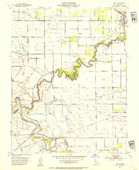
 - 1969 Map of Ripon, 1971 Print
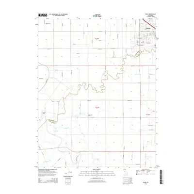
 1969 Ripon1971 Print · USGSThe fertile San Joaquin Valley floor comes to life in the late sixties as the Stanislaus River snakes through a landscape of family ranches and orchards. Genealogists and historians can trace property lines and water features from Ripon down to Mapes Ranch and the San Joaquin Sch.6 unique versions available
 - 1989 Map of Stockton
 1989 Stockton1989 Print · USGSDuring the late 1980s, the California Delta and San Joaquin Valley saw a massive convergence of water infrastructure and military logistics. Researchers can trace the sprawling Lawrence Livermore Laboratory (Univ of Calif) and Sharpe Army Depot alongside the complex waterways of Union Island and Victoria Island.2 unique versions available
 - 2012 Map of Ripon, 2012 Print
 2012 Ripon2012 Print · USGSCovers Historic Ripon, including Ripon, San Joaquin County, and other nearby areas
 - 2015 Map of Ripon, 2015 Print
 2015 Ripon2015 Print · USGSCovers Historic Ripon, including Ripon, San Joaquin County, and other nearby areas
 - 2018 Map of Ripon, 2018 Print
 2018 Ripon2018 Print · USGSCovers Historic Ripon, including Ripon, San Joaquin County, and other nearby areas
 - 2021 Map of Ripon, 2021 Print
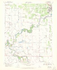
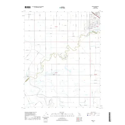
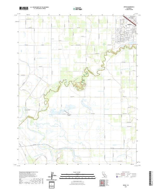 2021 Ripon2021 Print · USGSRipon and the fertile river lands of the northern San Joaquin Valley are shown in detail as they appeared in 2021. Researchers can trace the winding Stanislaus River past Sturgeon Bend, locate the Mapes Ranch Airport, and follow the critical path of the Hetch Hetchy Aqueduct.
End of results
Showing maps 1-13 of 13
Frequently asked questions
- What are the different types of historical maps available for Historic Ripon?
- What is the oldest map of Historic Ripon?
- Where can I purchase historical maps of Historic Ripon for my home or office?
- Where can I download high-res historical maps of Historic Ripon?
- Are there historical topographic maps available for Historic Ripon?
- Is there historical aerial imagery available for Historic Ripon?
- Where are historical maps of Historic Ripon sourced from?