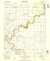
1952 Map of Ripon
USGS Topo · Published 1954About this map
The Stanislaus River and San Joaquin River converge in a complex network of meandering channels, sloughs, and levees. This 1952 study highlights the intensive irrigation infrastructure of the Central Valley, dominated by the Hetch Hetchy Aqueduct and a grid of canals including Lateral No 3 and Lateral No 6. The town of Ripon is the primary settlement, served by the Southern Pacific railroad and featuring local institutions like the High School and Sewage Disposal plant.
Find a feature on this map
73 named features on this map. Tap any name to fly to it.
Don’t see what you’re looking for? This feature index may not catch every label — zoom into the map to look around manually.
Map Details
Editions of this 1952 Ripon Map
This is the sole edition of this map. No revisions or reprints were ever made.
Other maps of this area

1913 · Romain
USGS Topo · 1:31,680

1914 · Manteca
USGS Topo · 1:31,680

1914 · Avena
USGS Topo · 1:31,680

1915 · Vernalis
USGS Topo · 1:31,680

1915 · Lathrop
USGS Topo · 1:31,680

1915 · Ripon
USGS Topo · 1:31,680

1915 · Westport
USGS Topo · 1:31,680

1915 · Westley
USGS Topo · 1:31,680

1915 · Salida
USGS Topo · 1:31,680

1916 · Romain
USGS Topo · 1:31,680