1950s Maps of San Carlos, California
Explore 8 historic maps of San Carlos from the 1950s. These maps offer a rare glimpse into what life looked like during the 1950s — showing old roads, neighborhoods, homes, and landmarks that have changed or disappeared over time.
Whether you're researching your family's past, planning a metal detecting trip, or studying how San Carlos's landscape evolved across the 1950s, these high-resolution maps are a powerful tool for exploring the history of this region.
- Focus on a specific era: All maps on this page are from the 1950s, giving you a focused view of this time period.
- See what’s changed: Compare century-old streets, trails, and buildings to today's modern landscape using overlays and satellite layers.
- Research with precision: Use these maps for genealogy, historical research, land use analysis, or educational projects.
- View, download, or print: Maps are fully viewable online in high resolution, and can be downloaded or printed for your own records.
Start exploring San Carlos's history through authentic maps from the 1950s. This is your window into the past.
San Carlos, CA maps
(8)- 1953 Map of Woodside, 1954 Print
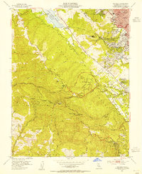 1953 Woodside1954 Print · USGSThe Woodside hills and San Mateo ridges come into sharp focus in the early 1950s, showing a landscape of mountain schools and deep gulches. Genealogists and hikers can trace the Old Woodside Store, the high-altitude Sky Londa, and the historic Pulgas Water Temple.2 unique versions available
 - 1953 Map of Palo Alto, 1955 Print
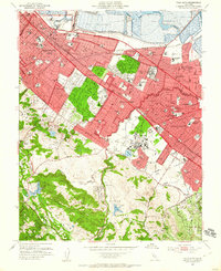 1953 Palo Alto1955 Print · USGSMid-century development spreads across the San Francisco Peninsula in the 1950s, bridging the gap between historic ranchos and suburban growth. Genealogists and local historians can trace the footprint of Stanford University, locate old neighborhood schools like Selby Lane Sch, or follow the Southern Pacific rail line.2 unique versions available
 - 1955 Map of San Francisco
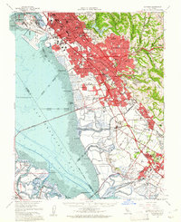
 1955 San Francisco1955 Print · USGSThe San Francisco Bay Area and central coast are captured during the postwar boom as suburbs and infrastructure expanded rapidly. Trace the development of local communities and military installations like the Presidio and Fort Mason, or follow the Southern Pacific rail lines.
 - 1956 Map of San Francisco
 1956 San Francisco1956 Print · USGSThe San Francisco Bay Area is captured in the mid-fifties, showing a landscape of rapid post-war growth and massive military installations. Researchers can trace the sprawling rail lines of the Southern Pacific and locate historic sites like Stanford University or the Hunters Point Naval Shipyard.4 unique versions available
 - 1956 Map of San Mateo, 1957 Print
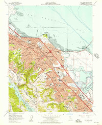 1956 San Mateo1957 Print · USGSThe San Mateo Peninsula is shown during a decade of remarkable suburban growth, stretching from the bayshore mudflats to the San Andreas foothills. Researchers can trace the mid-century layout of San Mateo and Burlingame, locating landmarks like the Bay Meadows Racetrack and the College of San Mateo.6 unique versions available
 - 1957 Map of San Francisco
 1957 San Francisco1957 Print · USGSThe Bay Area in the mid-fifties reveals a rapidly growing metropolitan landscape connected by its iconic spans and rail networks. Researchers can trace the layout of military sites like the Presidio and the extent of the Southern Pacific and Western Pacific railroads.
 - 1959 Map of Redwood Point, 1960 Print
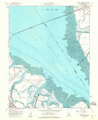 1959 Redwood Point1960 Print · USGSThe southern San Francisco Bay shoreline is defined by industrial salt works and complex slough systems in the late fifties. Trace the maritime history of the Port of Redwood City and the early footprints of the Belmont Salt Evaporators.7 unique versions available
 - 1959 Map of Hayward, 1961 Print
 1959 Hayward1961 Print · USGSThe East Bay shoreline in the late fifties reveals a period of massive suburban and industrial growth along the new Nimitz Freeway. Genealogists and historians can trace old neighborhoods and sites like Russell City, Mt Eden Cem, and the Oakland Naval Air Sta.2 unique versions available
End of results
Showing maps 1-8 of 8
Top cities near San Carlos
- San Jose historical maps
- San Francisco historical maps
- Oakland historical maps
- Fremont historical maps
- Hayward historical maps
- Sunnyvale historical maps
See more
Top neighborhoods of San Carlos
Frequently asked questions
- What are the different types of historical maps available for San Carlos?
- What is the oldest map of San Carlos?
- Where can I purchase historical maps of San Carlos for my home or office?
- Where can I download high-res historical maps of San Carlos?
- Are there historical topographic maps available for San Carlos?
- Is there historical aerial imagery available for San Carlos?
- Where are historical maps of San Carlos sourced from?